Bourneville, Ohio

Last updated

Bourneville, Ohio
CDP
BournevilleOH2.JPG
Looking east on Main Street (US Highway 50) in Bourneville
OHMap-doton-Bourneville.png
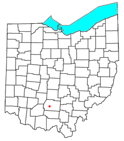
Location of Bourneville, Ohio
Coordinates: 39°16′58″N83°09′35″W / 39.28278°N 83.15972°W / 39.28278; -83.15972
Country United States
State Ohio
County Ross
Township Twin
Elevation
[1]
696 ft (212 m)
Population
 (2020) [2]
  Total241
Time zone UTC-5 (Eastern (EST))
  Summer (DST) UTC-4 (EDT)
ZIP
45617
GNIS feature ID2628867 [1]

Bourneville is a census-designated place in central Twin Township, Ross County, Ohio, United States. It has a post office with the ZIP code 45617. [3] It lies along U.S. Route 50. The population of the CPD was 241 at the 2020 census.

Contents

History

Bourneville community sign. BournevilleOH1.JPG
Bourneville community sign.

The first permanent settlement at Bourneville was made in the 1790s. [4] Bourneville was platted in 1832 by Colonel Bourne, and named for him. [5] A post office has been in operation at Bourneville since 1832. [6]

As of 1847, an Indian stone work was located near Bourneville. It was surveyed by Ephraim George Squier and Edwin Hamilton Davis and was featured in their book, Ancient Monuments of the Mississippi Valley , which was published in 1848. [7]

Notable person

Related Research Articles

<span class="mw-page-title-main">Ross County, Ohio</span> County in Ohio, United States

Ross County is a county in the Appalachian region of the U.S. state of Ohio. As of the 2020 United States Census, the population was 77,093. Its county seat is Chillicothe, the first and third capital of Ohio. Established on August 20, 1798, the county is named for Federalist Senator James Ross of Pennsylvania. Ross County comprises the Chillicothe, OH Micropolitan Statistical Area, which is also included in the Columbus-Marion-Zanesville, OH Combined Statistical Area.

<i>Ancient Monuments of the Mississippi Valley</i> Book by Ephraim George Squier

Ancient Monuments of the Mississippi Valley (1848) by the Americans Ephraim George Squier and Edwin Hamilton Davis is a landmark in American scientific research, the study of the prehistoric indigenous mound builders of North America, and the early development of archaeology as a scientific discipline. Published in 1848, it was the Smithsonian Institution's first publication and the first volume in its Contributions to Knowledge series. The book had 306 pages, 48 lithographed maps and plates, and 207 wood engravings. The book was reissued in 1998 in paperback, with an introduction by David J. Meltzer, professor of anthropology at Southern Methodist University.

<span class="mw-page-title-main">Derby, Ohio</span> CDP in Ohio, United States

Derby is a census-designated place in central Darby Township, Pickaway County, Ohio, United States. It is assigned the ZIP code 43117. The population was 355 at the 2020 census.

<span class="mw-page-title-main">Miamiville, Ohio</span> Unincorporated community in Ohio, United States

Miamiville is an unincorporated community and census-designated place (CDP) in western Miami Township, Clermont County, Ohio, United States, along the Little Miami River and the Loveland Bike Trail. It had a population of 205 at the 2020 census. It has a post office with the ZIP code 45147.

<span class="mw-page-title-main">Bannock, Ohio</span> Unincorporated community in Ohio, United States

Bannock is a census-designated place in northwestern Richland Township, Belmont County, Ohio, United States, along Wheeling Creek. As of the 2020 census it had a population of 159. It has a post office with the ZIP code 43972. It lies along State Route 331.

<span class="mw-page-title-main">Bentonville, Ohio</span> Unincorporated community and Census-designated place in Ohio, United States

Bentonville is a census-designated place in northern Sprigg Township, Adams County, Ohio, United States. The population was 253 at the 2020 census. It has a post office with the ZIP code 45105.

<span class="mw-page-title-main">Camp Dennison, Ohio</span> Census-designated place in Ohio, United States

Camp Dennison is a census-designated place (CDP) just outside Indian Hill in southern Symmes Township, Hamilton County, Ohio, United States. It has a post office with the ZIP code 45111. The population was 384 at the 2020 census.

<span class="mw-page-title-main">New Marshfield, Ohio</span> Census-designated place in Ohio, United States

New Marshfield is a census-designated place in central Waterloo Township, Athens County, Ohio, United States. The population was 316 at the 2020 census. It has a post office with the ZIP code 45766. It is located along State Route 56 west of the county seat of Athens.

<span class="mw-page-title-main">Millfield, Ohio</span> Census-designated place in Ohio, United States

Millfield is a census-designated place in northern Dover Township, Athens County, Ohio, United States. It had a population of 311 at the 2020 census. It has a post office with the ZIP code 45761. It is located near State Route 13 midway between Chauncey and Jacksonville. Route 13 formerly ran through the community, but a bypass relocated it close by.

<span class="mw-page-title-main">Hockingport, Ohio</span> Census-designated place in Ohio, United States

Hockingport is a census-designated place in southeastern Troy Township, Athens County, Ohio, United States. As of the 2020 census it had a population of 205. It has a post office with the ZIP code 45739. It is located at the intersection of State Routes 124 and 144.

<span class="mw-page-title-main">Dundee, Ohio</span> CDP in Ohio, United States

Dundee is a census-designated place in central Wayne Township, Tuscarawas County, Ohio, United States. It has a post office with the ZIP code 44624. It lies at the intersection of State Routes 93 and 516. The population was 269 at the 2020 census.

<span class="mw-page-title-main">Robertsville, Ohio</span> CDP in Ohio, United States

Robertsville is an unincorporated community and census-designated place in western Paris Township, Stark County, Ohio, United States. It has a post office with the ZIP code 44670. It lies along U.S. Route 30 between East Canton and Minerva and is in the Minerva Local School District. The community is part of the Canton–Massillon Metropolitan Statistical Area. The population was 293 at the 2020 census.

<span class="mw-page-title-main">McDermott, Ohio</span> CDP in Ohio, United States

McDermott is a census-designated place in western Rush Township, Scioto County, Ohio, United States. As of the 2020 census it had a population of 308. It has a post office with the ZIP code 45652.

<span class="mw-page-title-main">Newport, Washington County, Ohio</span> CDP in Ohio, United States

Newport is a census-designated place in eastern Newport Township, Washington County, Ohio, United States. It has a post office with the ZIP code 45768. Newport lies along the Ohio River several miles above the county seat of Marietta. Today its main street is designated as State Route 7. The population of the CPD was 895 at the 2020 census.

<span class="mw-page-title-main">Little Hocking, Ohio</span> Census-designated place in Ohio, US

Little Hocking is a census-designated place in southern Belpre Township, Washington County, Ohio, United States. It has a post office with the ZIP code 45742. The population of the CPD was 244 at the 2020 census.

<span class="mw-page-title-main">Richmond Dale, Ohio</span> CDP in Ohio, United States

Richmond Dale is a census-designated place in central Jefferson Township, Ross County, Ohio, United States. It has a post office with the ZIP code 45673. It is located along U.S. Route 35 southeast of the county seat of Chillicothe. The population of the CPD was 386 at the 2020 census.

<span class="mw-page-title-main">East Fultonham, Ohio</span> CDP in Ohio, United States

East Fultonham is a census-designated place in central Newton Township, Muskingum County, Ohio, United States. It has a post office with the ZIP code 43735. It is located along U.S. Route 22 a short distance east of the village of Fultonham. The population was 290 at the 2020 census.

<span class="mw-page-title-main">Duncan Falls, Ohio</span> CDP in Ohio, USA

Duncan Falls is a census-designated place in southeastern Wayne Township, Muskingum County, Ohio, United States, located on State Route 60 south of the city of Zanesville. It has a post office with the ZIP Code 43734. Duncan Falls has a public library, a branch of the Muskingum County Library System. The population was 898 at the 2020 census.

<span class="mw-page-title-main">Edwin Hamilton Davis</span>

Edwin Hamilton Davis was an American physician and self taught archaeologist who completed pioneering investigations of the mound builders in the Mississippi Valley. Davis gathered what, at that time, was the largest privately held collection of prehistoric Indian artifacts in the United States.

The Dunlap Works are a group of Hopewell tradition earthworks located in Ross County, Ohio in the United States. It is located approximately 6 miles (9.7 km) north of the city of Chillicothe, Ohio on the left bank of the Scioto River. The site should not be confused with the earthworks in Hamilton County on the Great Miami River near Dunlap's Station, the former site of a pioneer fort.

References

  1. 1 2 U.S. Geological Survey Geographic Names Information System: Bourneville, Ohio
  2. "Bourneville CPD, Ohio - Census Bureau Profile". United States Census Bureau. Retrieved August 12, 2023.
  3. USPS – Cities by ZIP Code Archived October 10, 2007, at the Wayback Machine
  4. Federal Writers' Project (1938). Chillicothe and Ross County. Works Progress Administration. p. 76.
  5. Bennett, Henry Holcomb (1902). The County of Ross: A History of Ross County, Ohio, from the Earliest Days. Selwyn A. Brant. p. 305.
  6. "Ross County". Jim Forte Postal History. Retrieved January 3, 2016.
  7. Squier, E.G. (1848). Ancient Monuments of the Mississippi Valley. Washington, D.C.: Smithsonian Institution. p. 67.
  8. 'Philip Caldwell is Dead at 93; First Nonfamily member to head Ford, New York Times, Patrick J. Lyons, July 11, 2013