Bainbridge, Ohio | |
---|---|
Coordinates: 39°13′35″N83°16′11″W / 39.22639°N 83.26972°W | |
Country | United States |
State | Ohio |
County | Ross |
Area | |
• Total | 0.51 sq mi (1.32 km2) |
• Land | 0.51 sq mi (1.32 km2) |
• Water | 0.00 sq mi (0.00 km2) |
Elevation | 735 ft (224 m) |
Population (2020) | |
• Total | 765 |
• Estimate (2023) [4] | 753 |
• Density | 1,502.95/sq mi (580.30/km2) |
Time zone | UTC-5 (Eastern (EST)) |
• Summer (DST) | UTC-4 (EDT) |
ZIP code | 45612 |
Area code | 740 |
FIPS code | 39-03604 [5] |
GNIS feature ID | 2398017 [3] |
Bainbridge is a village in Ross County, Ohio, United States, along Paint Creek. The population was 765 at the 2020 census.
Bainbridge is the location of Pike Lake State Park.
According to the United States Census Bureau, the village has a total area of 0.51 square miles (1.32 km2), all land. [6]
Census | Pop. | Note | %± |
---|---|---|---|
1820 | 146 | — | |
1830 | 279 | 91.1% | |
1840 | 300 | 7.5% | |
1850 | 626 | 108.7% | |
1860 | 679 | 8.5% | |
1870 | 647 | −4.7% | |
1880 | 825 | 27.5% | |
1900 | 954 | — | |
1910 | 883 | −7.4% | |
1920 | 862 | −2.4% | |
1930 | 735 | −14.7% | |
1940 | 913 | 24.2% | |
1950 | 964 | 5.6% | |
1960 | 1,001 | 3.8% | |
1970 | 1,057 | 5.6% | |
1980 | 1,042 | −1.4% | |
1990 | 968 | −7.1% | |
2000 | 1,012 | 4.5% | |
2010 | 860 | −15.0% | |
2020 | 765 | −11.0% | |
2023 (est.) | 753 | [4] | −1.6% |
U.S. Decennial Census [7] |
As of the census [8] of 2010, there were 860 people, 357 households, and 228 families living in the village. The population density was 1,686.3 inhabitants per square mile (651.1/km2). There were 394 housing units at an average density of 772.5 per square mile (298.3/km2). The racial makeup of the village was 96.4% White, 0.8% African American, 0.2% Native American, and 2.6% from two or more races. Hispanic or Latino of any race were 0.6% of the population.
There were 357 households, of which 31.1% had children under the age of 18 living with them, 43.7% were married couples living together, 15.7% had a female householder with no husband present, 4.5% had a male householder with no wife present, and 36.1% were non-families. 30.5% of all households were made up of individuals, and 16.3% had someone living alone who was 65 years of age or older. The average household size was 2.36 and the average family size was 2.91.
The median age in the village was 43.2 years. 22.6% of residents were under the age of 18; 6.5% were between the ages of 18 and 24; 23.5% were from 25 to 44; 26.5% were from 45 to 64; and 20.9% were 65 years of age or older. The gender makeup of the village was 45.9% male and 54.1% female.
As of the census [5] of 2000, there were 1,012 people, 397 households, and 277 families living in the village. The population density was 1,975.9 inhabitants per square mile (762.9/km2). There were 451 housing units at an average density of 880.5 per square mile (340.0/km2). The racial makeup of the village was 99.41% White, 0.20% African American, 0.10% Native American, 0.10% Asian, and 0.20% from two or more races. Hispanic or Latino of any race were 0.20% of the population. It is the hometown of medal of honor recipient Forrest E. Everhart
There were 397 households, out of which 35.0% had children under the age of 18 living with them, 48.6% were married couples living together, 17.4% had a female householder with no husband present, and 30.0% were non-families. 25.7% of all households were made up of individuals, and 13.6% had someone living alone who was 65 years of age or older. The average household size was 2.49 and the average family size was 2.95.
In the village, the population was spread out, with 26.8% under the age of 18, 8.6% from 18 to 24, 28.7% from 25 to 44, 19.2% from 45 to 64, and 16.8% who were 65 years of age or older. The median age was 36 years. For every 100 females there were 85.0 males. For every 100 females age 18 and over, there were 77.7 males.
The median income for a household in the village was $26,417, and the median income for a family was $31,645. Males had a median income of $32,000 versus $20,625 for females. The per capita income for the village was $14,905. About 17.0% of families and 19.9% of the population were below the poverty line, including 30.4% of those under age 18 and 16.0% of those age 65 or over.
Bainbridge students attend high school at Paint Valley High School, which contains students from Bainbridge and Bourneville. The school mascot is the bearcat, and the teams play in the Scioto Valley Conference.[ citation needed ]
Bainbridge is also home of the first dental school in the United States. Opened by Dr. John M. Harris in 1825, the school is now a museum.
Bainbridge has a public library, a branch of the Chillicothe & Ross County Public Library. [9]
Millville is a village in Butler County, Ohio, United States. The population was 634 at the 2020 census. Millville sits between Oxford, Ohio and Cincinnati, Ohio along U.S. Route 27.
Gordon is a village in Darke County, Ohio, United States. The population was 245 at the 2020 census.
Ithaca is a village in Darke County, Ohio, United States. The population was 81 at the 2020 census.
Rossburg is a village in Darke County, Ohio, United States. The population was 159 at the 2020 census.
Jamestown is a village in Greene County, Ohio, United States. The population was 2,052 at the 2020 census.
Addyston is a village in Miami Township, Hamilton County, Ohio, United States. Located along the Ohio River, it is a western suburb of the neighboring city of Cincinnati. The population was 927 at the 2020 census.
Cleves is a village in Miami Township, Hamilton County, Ohio, United States. Located along the Ohio River, it is a western suburb of Cincinnati. The population was 3,414 at the 2020 census.
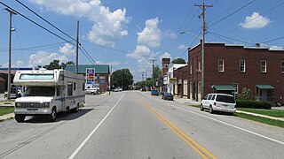
Mowrystown is a village in Highland County, Ohio, United States. The population was 385 at the 2020 census.
Hanover is a village in Licking County, Ohio, United States. The population was 1,270 at the 2020 census. The village lies along Ohio State Route 16.
Adelphi is a village in Ross County, Ohio, United States. The population was 322 at the 2020 census.
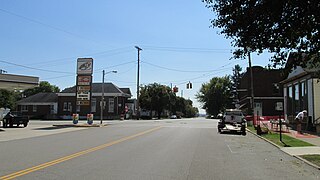
Clarksburg is a village in Ross County, Ohio, United States. The population was 409 at the 2020 census.
Frankfort is a village in Ross County, Ohio, United States, along the North Fork of Paint Creek. The village is located in Concord Township. The population was 1,084 at the 2020 census.
Kingston is a village in Ross County, Ohio, United States. The population was 1,262 at the 2020 census.
North Fork Village is an unincorporated community and former census-designated place (CDP) in Ross County, Ohio, United States. The population was 1,726 at the 2000 census. It was not delineated as a CDP for the 2010 census.
South Salem is a village in Ross County, Ohio, United States. The population was 219 at the 2020 census.
Port Jefferson is a village in Salem Township, Shelby County, Ohio, United States. The population was 308 at the 2020 census.
Limaville is a census-designated place (CDP) and former village in Stark County, Ohio, United States. The population was 151 at the 2020 census. It is part of the Canton–Massillon Metropolitan Statistical Area.
Wilson is a village in Belmont and Monroe counties in the U.S. state of Ohio. The population was 129 at the 2020 census. It is part of the Wheeling metropolitan area.
Gratiot is a village in Licking and Muskingum counties in the U.S. state of Ohio. The population was 215 at the 2020 census.
Bainbridge is a census-designated place (CDP) in Bainbridge Township, Geauga County, Ohio, United States. As of the 2020 census, the CDP had a population of 9,242.
book by Nancy Baum written in collaboration with the Bainbridge Historical Society