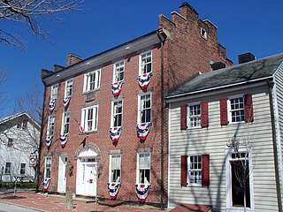
South Salem, Ohio

Last updated

South Salem, Ohio
SouthSalemOH7.JPG
OHMap-doton-South Salem.png
Location of South Salem, Ohio
Map of Ross County Ohio Highlighting South Salem Village.png
Location of South Salem in Ross County
Coordinates: 39°20′14″N83°18′26″W / 39.33722°N 83.30722°W / 39.33722; -83.30722
Country United States
State Ohio
County Ross
Government
  MayorDennis Crouse[ citation needed ]
Area
[1]
  Total0.18 sq mi (0.47 km2)
  Land0.18 sq mi (0.47 km2)
  Water0.00 sq mi (0.00 km2)
Elevation
[2]
925 ft (282 m)
Population
 (2020)
  Total219
  Density1,216.67/sq mi (469.94/km2)
Time zone UTC-5 (Eastern (EST))
  Summer (DST) UTC-4 (EDT)
ZIP code
45681
Area code 740
FIPS code 39-73698 [3]
GNIS feature ID2399858 [2]

South Salem is a village in Ross County, Ohio, United States. The population was 219 at the 2020 census.

Contents

History

In 1842, local Presbyterian minister Hugh Stewart Fullerton orchestrated the establishment of a school in southwestern Ross County. [4] Known as the "Salem Academy," this school became the foundation of the present village: landowner John Sample platted South Salem in 1846 in order better to serve the students and teachers of the school. After two years of rapid growth, the village reached the point that it could easily serve the needs of the school, and growth ceased. Although South Salem incorporated in the 1870s, few other changes occurred during the late years of the nineteenth century. In 1917, its population was deemed to be between 350 and 400 residents, a size that had remained consistent since the 1850s. [5] The Salem Academy (by then known as the "South Salem Academy") closed in 1907 due to competition from other schools, [6] and since that time, the village has declined in population. [3]

Geography

According to the United States Census Bureau, the village has a total area of 0.21 square miles (0.54 km2), all land. [7]

Demographics

Historical population
CensusPop.Note
1850 479
1860 318−33.6%
1880 299
1890 263−12.0%
1900 2640.4%
1910 211−20.1%
1920 193−8.5%
1930 2014.1%
1940 185−8.0%
1950 20611.4%
1960 180−12.6%
1970 20916.1%
1980 25220.6%
1990 227−9.9%
2000 213−6.2%
2010 204−4.2%
2020 2197.4%
U.S. Decennial Census [8]

2010 census

As of the census [9] of 2010, there were 204 people, 80 households, and 58 families residing in the village. The population density was 971.4 inhabitants per square mile (375.1/km2). There were 84 housing units at an average density of 400.0 per square mile (154.4/km2). The racial makeup of the village was 98.5% White, 1.0% African American, and 0.5% from two or more races.

There were 80 households, of which 35.0% had children under the age of 18 living with them, 55.0% were married couples living together, 13.8% had a female householder with no husband present, 3.8% had a male householder with no wife present, and 27.5% were non-families. 21.3% of all households were made up of individuals, and 7.6% had someone living alone who was 65 years of age or older. The average household size was 2.55 and the average family size was 2.90.

The median age in the village was 42 years. 23% of residents were under the age of 18; 5.8% were between the ages of 18 and 24; 27.5% were from 25 to 44; 31.3% were from 45 to 64; and 12.3% were 65 years of age or older. The gender makeup of the village was 49.0% male and 51.0% female.

2000 census

As of the census [3] of 2000, there were 213 people, 77 households, and 60 families residing in the village. The population density was 1,027.8 inhabitants per square mile (396.8/km2). There were 81 housing units at an average density of 390.8 per square mile (150.9/km2). The racial makeup of the village was 96.24% White, 0.94% African American, 0.47% Native American, 0.94% from other races, and 1.41% from two or more races. Hispanic or Latino of any race were 1.41% of the population.

There were 77 households, out of which 37.7% had children under the age of 18 living with them, 64.9% were married couples living together, 10.4% had a female householder with no husband present, and 20.8% were non-families. 16.9% of all households were made up of individuals, and 10.4% had someone living alone who was 65 years of age or older. The average household size was 2.77 and the average family size was 3.11.

In the village, the population was spread out, with 25.4% under the age of 18, 8.0% from 18 to 24, 33.8% from 25 to 44, 20.7% from 45 to 64, and 12.2% who were 65 years of age or older. The median age was 35 years. For every 100 females there were 113.0 males. For every 100 females age 18 and over, there were 93.9 males.

The median income for a household in the village was $32,500, and the median income for a family was $37,250. Males had a median income of $31,563 versus $22,500 for females. The per capita income for the village was $12,762. About 6.3% of families and 14.0% of the population were below the poverty line, including 17.7% of those under the age of eighteen and 17.4% of those 65 or over.

Related Research Articles

<span class="mw-page-title-main">Woodstock, Ohio</span> Village in Ohio, United States

Woodstock is a village in Champaign County, Ohio, United States. The population was 287 at the 2020 census.

<span class="mw-page-title-main">Salineville, Ohio</span> Village in Ohio, United States

Salineville is a village in southwestern Columbiana County, Ohio, United States. The population was 1,206 at the 2020 census. It is part of the Salem micropolitan area, about 20 miles (32 km) northwest of Steubenville and 34 miles (55 km) southwest of Youngstown.

<span class="mw-page-title-main">Plainfield, Ohio</span> Village in Ohio, United States

Plainfield is a village in Coshocton County, Ohio, United States, along Wills Creek. The population was 141 at the 2020 census.

<span class="mw-page-title-main">Walton Hills, Ohio</span> Village in Ohio, United States

Walton Hills is a village in Cuyahoga County, Ohio, United States. The population was 2,033 at the 2020 census. A suburb of Cleveland, it is a part of the Cleveland metropolitan area.

<span class="mw-page-title-main">Gordon, Ohio</span> Village in Ohio, United States

Gordon is a village in Darke County, Ohio, United States. The population was 245 at the 2020 census.

<span class="mw-page-title-main">Addyston, Ohio</span> Village in Ohio, United States

Addyston is a village in Miami Township, Hamilton County, Ohio, United States. Located along the Ohio River, it is a western suburb of the neighboring city of Cincinnati. The population was 927 at the 2020 census.

<span class="mw-page-title-main">North Bend, Ohio</span> Village in Ohio, United States

North Bend is a village in Miami Township, Hamilton County, Ohio, United States, along the Ohio River. It is a part of the Greater Cincinnati area. The population was 835 at the 2020 census.

<span class="mw-page-title-main">St. Bernard, Ohio</span> Village in Ohio, United States

St. Bernard or Saint Bernard is a village in Hamilton County, Ohio, United States. It is an enclave and suburb of Cincinnati. The population was 4,070 at the 2020 census.

<span class="mw-page-title-main">Arcadia, Ohio</span> Village in Ohio, United States

Arcadia is a village in Hancock County, Ohio, United States. The population was 564 at the 2020 census.

<span class="mw-page-title-main">Athalia, Ohio</span> Village in Ohio, United States

Athalia is a village in Lawrence County, Ohio, United States, along the Ohio River. The population was 279 at the 2020 census.

<span class="mw-page-title-main">Shiloh, Richland County, Ohio</span> Village in Ohio, United States

Shiloh is a village in Richland County in the U.S. state of Ohio. It is part of the Mansfield, Ohio Metropolitan Statistical Area. The population was 619 at the 2020 census.

<span class="mw-page-title-main">Clarksburg, Ohio</span> Village in Ohio, United States

Clarksburg is a village in Ross County, Ohio, United States. The population was 409 at the 2020 census.

<span class="mw-page-title-main">Kingston, Ohio</span> Village in Ohio, United States

Kingston is a village in Ross County, Ohio, United States. The population was 1,262 at the 2020 census.

<span class="mw-page-title-main">Port Jefferson, Ohio</span> Village in Ohio, United States

Port Jefferson is a village in Salem Township, Shelby County, Ohio, United States. The population was 308 at the 2020 census.
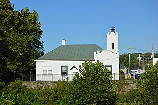
<span class="mw-page-title-main">Morrow, Ohio</span> Village in Ohio, United States

Morrow is a village in Salem Township, Warren County, Ohio, United States. The population was 2,049 at the 2020 census.

<span class="mw-page-title-main">Lower Salem, Ohio</span> Village in Ohio, United States

Lower Salem is a village in Washington County, Ohio, United States. The population was 75 at the 2020 census.

<span class="mw-page-title-main">West Salem, Ohio</span> Village in Ohio, United States

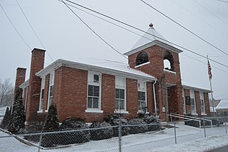
West Salem is a village in Wayne County, Ohio. The population was 1,430 at the time of the 2020 census. West Salem is served by a branch of the Wayne County Public Library.

<span class="mw-page-title-main">College Corner, Ohio</span> Village in Ohio, United States

College Corner is a village in Butler and Preble counties in the southwestern part of the U.S. state of Ohio, 5 miles (8 km) northwest of Oxford. The population was 387 at the 2020 census. The village lies on the state line with Indiana, where it borders the town of West College Corner. The public school, part of the Union County–College Corner Joint School District, is bisected by the state line and is operated jointly with Indiana authorities.

<span class="mw-page-title-main">Lynchburg, Ohio</span> Village in Ohio, United States

Lynchburg is a village in Clinton and Highland counties in the U.S. state of Ohio. The population was 1,510 at the 2020 census.

<span class="mw-page-title-main">Washingtonville, Ohio</span> Village in Ohio, United States

Washingtonville is a village in northern Columbiana and southern Mahoning counties in the U.S. state of Ohio. The population was 712 at the 2020 census. Southern Washingtonville is included in the Salem micropolitan area, while northern Washingtonville is part of the Youngstown–Warren metropolitan area.

References

  1. "ArcGIS REST Services Directory". United States Census Bureau. Retrieved September 20, 2022.
  2. 1 2 U.S. Geological Survey Geographic Names Information System: South Salem, Ohio
  3. 1 2 3 "U.S. Census website". United States Census Bureau . Retrieved January 31, 2008.
  4. Owen, Lorrie K., ed. Dictionary of Ohio Historic Places. Vol. 2. St. Clair Shores: Somerset, 1999, 1223-1224.
  5. Evans, Lyle S. A Standard History of Ross County, Ohio: An Authentic Narrative of the Past, with Particular Attention to the Modern Era in the Commercial, Industrial, Civic and Social Development . Vol. 1. Chicago and New York: Lewis, 1917, 473-474.
  6. Marker #4-71: Salem Academy, Ohio Channel and the Ohio Historical Society, 2006. Accessed 2010-09-02.
  7. "US Gazetteer files 2010". United States Census Bureau. Archived from the original on January 25, 2012. Retrieved January 6, 2013.
  8. "Census of Population and Housing". Census.gov. Retrieved June 4, 2015.
  9. "U.S. Census website". United States Census Bureau . Retrieved January 6, 2013.