| Bournheath | |
|---|---|
 Bournheath Location within Worcestershire | |
| Population | 454 |
| OS grid reference | SO946741 |
| • London | 103 miles (166 km) |
| Civil parish |
|
| District | |
| Shire county | |
| Region | |
| Country | England |
| Sovereign state | United Kingdom |
| Post town | BROMSGROVE |
| Postcode district | B61 |
| Dialling code | 01527 |
| Police | West Mercia |
| Fire | Hereford and Worcester |
| Ambulance | West Midlands |
Bournheath is a village and civil parish in the Bromsgrove District of Worcestershire, England, about three miles north of Bromsgrove. According to the 2001 census it had a population of 454. [1]
 The New Inn
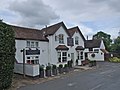 The Gate
 Bournheath Methodist Church
 Bournheath Village Hall
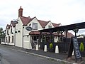 The Nailers Arms


Wikimedia Commons has media related to Bournheath .