
The Humber River is a river in Southern Ontario, Canada. It is in the Great Lakes Basin, is a tributary of Lake Ontario and is one of two major rivers on either side of the city of Toronto, the other being the Don River to the east. It was designated a Canadian Heritage River on September 24, 1999.
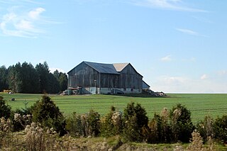
The Town of Mono is situated in south-central Ontario, Canada, at the south-east corner of Dufferin County. It stretches from Highway 9 along its southern border to Highway 89 along its northern border. Its border to the west is with the Township of Amaranth and in the east, it is bordered by the Township of Adjala-Tosorontio. It was previously known as the Township of Mono.
Adjala–Tosorontio is a township in south-central Ontario, Canada, in the County of Simcoe.
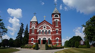
Alliston is a settlement in Simcoe County in the Canadian province of Ontario. It has been part of the Town of New Tecumseth since the 1991 amalgamation of Alliston and nearby villages of Beeton, Tottenham, and the Township of Tecumseth. The primary downtown area is located along Highway 89, known as Victoria Street.

Simcoe County is located in the central portion of Southern Ontario, Canada. The county is just north of the Greater Toronto Area, stretching from the shores of Lake Simcoe in the east to Georgian Bay in the west. Simcoe County forms part of the Greater Golden Horseshoe area, a densely populated and industrialized region, centred on the Greater Toronto Area.
The Indian River is a river in Lanark County in Eastern Ontario, Canada. It is in the Saint Lawrence River drainage basin and is a left tributary of the Mississippi River.

The York River is a river in Renfrew County, Hastings County and Haliburton County in Ontario, Canada. The river is in the Saint Lawrence River drainage basin, and flows from the southern extension of Algonquin Provincial Park to the Madawaska River.

The Nottawasaga River is a river in Simcoe County and Dufferin County in Central Ontario, Canada. It is part of the Great Lakes Basin, and is a tributary of Lake Huron. The river flows from the Orangeville Reservoir in the town of Orangeville, Dufferin County, through the Niagara Escarpment and the Minesing Wetlands, the latter a wetland of international significance, and empties into Nottawasaga Bay, an inlet of Georgian Bay on Lake Huron, at the town of Wasaga Beach, Simcoe County.

Clearview is a rural incorporated township in Simcoe County in Central Ontario, Canada, west of Barrie and south of Collingwood and Wasaga Beach in Simcoe County.

The Maitland River is a river in Huron County, Perth County and Wellington County in Southwestern Ontario, Canada. The river is in the Great Lakes Basin and empties into Lake Huron at the town of Goderich. It is 150 kilometres (93 mi) long, and is named after Sir Peregrine Maitland, Lieutenant-Governor of Upper Canada from 1818 to 1828. It was formerly known as the Menesetung River.

The Crowe River is a river in the counties of Haliburton, Hastings, Northumberland and Peterborough in southern Ontario, Canada. It is in the Lake Ontario drainage basin and is a tributary of the Trent River.
King's Highway 89, commonly referred to as Highway 89, is an east–west provincially maintained highway in the south central portion of the Canadian province of Ontario, stretching 107 kilometres (66 mi) from the junction of Highway 9 and Highway 23 in Harriston in the west, to Highway 400 just east of Cookstown in the east. The principal urban centres along the highway include Alliston, Shelburne and Mount Forest. Outside these towns, the highway travels through rural farmland across a large part of southwestern Ontario.

Kemptville Creek is a stream in the municipalities of North Grenville and Augusta, in the United Counties of Leeds and Grenville, in Eastern Ontario, Canada. It is in the Ottawa River drainage basin, is a right tributary of the Rideau River, and is under the auspices of the Rideau Valley Conservation Authority.
Sixteen Mile Creek is a stream in the municipality of Lake of Bays, District Municipality of Muskoka in Central Ontario, Canada. It is part of the Great Lakes Basin and flows from Hickory Lake to its mouth at the Boyne River. The Boyne River flows to the Lake of Bays, then via the Muskoka River, and the Moon River and Musquash River to Georgian Bay on Lake Huron.

The Boyne River is a river in the municipality of Grey Highlands, Grey County in Southwestern Ontario, Canada. It is part of the Great Lakes Basin, and lies entirely within geographic Artemesia Township.

The Beaver River is a river in Grey County and Simcoe County in Southern Ontario, Canada. It is part of the Great Lakes Basin, and is a tributary of Lake Huron. The river's drainage basin is under the auspices of Grey Sauble Conservation.

The Beaver River is a river in Durham Region in Central Ontario, Canada. It is part of the Great Lakes Basin, and is a tributary of Lake Simcoe. The river's drainage basin is mostly in Durham Region with the remaining portion in the city of Kawartha Lakes; the entire watershed is under the auspices of the Lake Simcoe Region Conservation Authority.

The Black River is a river in the Regional Municipality of York and the Regional Municipality of Durham in Central Ontario, Canada. It is part of the Great Lakes Basin, and is a tributary of Lake Simcoe; the entire watershed is under the auspices of the Lake Simcoe Region Conservation Authority.
The Black River is a river in Simcoe County, the District Municipality of Muskoka, the City of Kawartha Lakes, and Haliburton County in Central Ontario, Canada. It is part of the Great Lakes Basin, and is a right tributary of the Severn River.
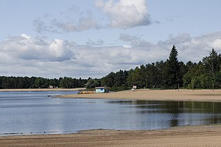
Earl Rowe Provincial Park is an Ontario Parks recreational park located in Adjala–Tosorontio near Alliston, Ontario.

