Brandywine Township | |
|---|---|
 | |
| Coordinates: 39°34′56″N85°50′20″W / 39.58222°N 85.83889°W | |
| Country | United States |
| State | Indiana |
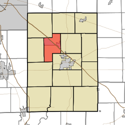
| County | Shelby |
| Government | |
| • Type | Indiana township |
| Area | |
• Total | 22.31 sq mi (57.8 km2) |
| • Land | 22.2 sq mi (57 km2) |
| • Water | 0.11 sq mi (0.3 km2) |
| Elevation | 761 ft (232 m) |
| Population | |
• Total | 1,898 |
| • Density | 90.8/sq mi (35.1/km2) |
| FIPS code | 18-07102 [3] |
| GNIS feature ID | 453134 |
Brandywine Township is one of fourteen townships in Shelby County, Indiana. According to the 2010 census, its population was 2,015 and had 843 housing units. [4]
Contents
Brandywine Township was founded in 1843. [5]
