This is a list of sites in Minnesota which are included in the National Register of Historic Places. There are more than 1,700 properties and historic districts listed on the NRHP; each of Minnesota's 87 counties has at least 2 listings. Twenty-two sites are also National Historic Landmarks.

The Sorlie Memorial Bridge, also known as the Red River Bridge, was constructed in 1929 by the Minneapolis Bridge Company to connect the cities of Grand Forks, North Dakota and East Grand Forks, Minnesota. It was placed on the National Register of Historic Places in 1999.

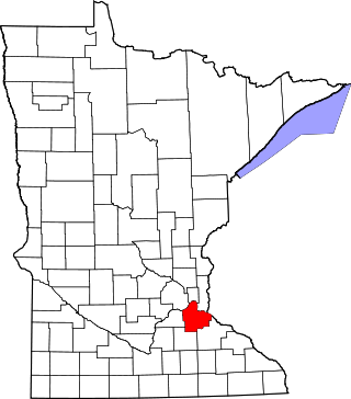
This is a list of the National Register of Historic Places listings in Dakota County, Minnesota. It is intended to be a complete list of the properties and districts on the National Register of Historic Places in Dakota County, Minnesota, United States. Dakota County is located in the southeastern part of the U.S. state of Minnesota, bounded on the northeast side by the Upper Mississippi River and on the northwest by the Minnesota River. The locations of National Register properties and districts for which the latitude and longitude coordinates are included below, may be seen in an online map.

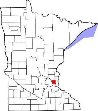
This is a complete list of National Register of Historic Places listings in Ramsey County, Minnesota. It is intended to be a complete list of the properties and districts on the National Register of Historic Places in Ramsey County, Minnesota, United States. The locations of National Register properties and districts for which the latitude and longitude coordinates are included below, may be seen in an online map.

This is a list of the National Register of Historic Places listings in Scott County, Minnesota. It is intended to be a complete list of the properties and districts on the National Register of Historic Places in Scott County, Minnesota, United States. The locations of National Register properties and districts for which the latitude and longitude coordinates are included below, may be seen in an online map.

This is a list of the National Register of Historic Places listings in Rice County, Minnesota. It is intended to be a complete list of the properties and districts on the National Register of Historic Places in Rice County, Minnesota, United States. The locations of National Register properties and districts for which the latitude and longitude coordinates are included below, may be seen in an online map.

The Stewart Creek Bridge or Bridge L6007 is a stone arch bridge in the Smithville neighborhood of Duluth, Minnesota, United States. It was built around 1925 as part of the scenic Skyline Parkway overlooking the city. The Stewart Creek Bridge was listed on the National Register of Historic Places in 1989 under the name Bridge No. L-6007 for its state-level significance in the theme of engineering. It was nominated for being the most picturesque stone arch road bridge in design and setting in Minnesota.

This is a list of the National Register of Historic Places listings in Carver County, Minnesota. It is intended to be a complete list of the properties and districts on the National Register of Historic Places in Carver County, Minnesota, United States. The locations of National Register properties and districts for which the latitude and longitude coordinates are included below, may be seen in an online map.

This is a list of the National Register of Historic Places listings in Goodhue County, Minnesota. It is intended to be a complete list of the properties and districts on the National Register of Historic Places in Goodhue County, Minnesota, United States. The locations of National Register properties and districts for which the latitude and longitude coordinates are included below, may be seen in an online map.

This is a list of the National Register of Historic Places listings in Saint Louis County, Minnesota. It is intended to be a complete list of the properties and districts on the National Register of Historic Places in Saint Louis County, Minnesota, United States. The locations of National Register properties and districts for which the latitude and longitude coordinates are included below, may be seen in an online map.

This is a list of the National Register of Historic Places listings in Blue Earth County, Minnesota. It is intended to be a complete list of the properties and districts on the National Register of Historic Places in Blue Earth County, Minnesota, United States. The locations of National Register properties and districts for which the latitude and longitude coordinates are included below, may be seen in an online map.

This is a list of the National Register of Historic Places listings in Pine County, Minnesota. It is intended to be a complete list of the properties and districts on the National Register of Historic Places in Pine County, Minnesota, United States. The locations of National Register properties and districts for which the latitude and longitude coordinates are included below, may be seen in an online map.

This is a list of the National Register of Historic Places listings in Le Sueur County, Minnesota. It is intended to be a complete list of the properties and districts on the National Register of Historic Places in Le Sueur County, Minnesota, United States. The locations of National Register properties and districts for which the latitude and longitude coordinates are included below, may be seen in an online map.

This is a list of the National Register of Historic Places listings in Washington County, Minnesota. It is intended to be a complete list of the properties and districts on the National Register of Historic Places in Washington County, Minnesota, United States. The locations of National Register properties and districts for which the latitude and longitude coordinates are included below, may be seen in an online map.

This is a list of the National Register of Historic Places listings in Cass County, Minnesota. It is intended to be a complete list of the properties and districts on the National Register of Historic Places in Cass County, Minnesota, United States. The locations of National Register properties and districts for which the latitude and longitude coordinates are included below, may be seen in an online map.

This is a list of the National Register of Historic Places listings in Pipestone County, Minnesota. It is intended to be a complete list of the properties and districts on the National Register of Historic Places in Pipestone County, Minnesota, United States. The locations of National Register properties and districts for which the latitude and longitude coordinates are included below, may be seen in an online map.

Bridge 5757 or the Fond du Lac Culvert is a historic bridge in the Fond du Lac neighborhood of Duluth, Minnesota, United States. It was built in 1937 to carry Minnesota State Highway 23 over Mission Creek. It is a double-span culvert built using a modular, corrugated iron product called "multi-plate", with granite headwalls. The creek flows through two 20-foot (6 m) metal culverts that are 115 feet (35 m) wide. The bridge was part of a 0.75-mile (1.2 km) section of Highway 23 built as a wide, shaded, parkway-like divided highway known as Veterans' Evergreen Memorial Highway.

This is a list of the National Register of Historic Places listings in Meeker County, Minnesota.

This is a list of the National Register of Historic Places listings in Lac qui Parle County, Minnesota. It is intended to be a complete list of the properties and districts on the National Register of Historic Places in Lac qui Parle County, Minnesota, United States. The locations of National Register properties and districts for which the latitude and longitude coordinates are included below, may be seen in an online map.

Bridge L6113 is a historic bridge in Congdon Park in Duluth, Minnesota, United States. Built in 1925, it carries East 4th Street over Tischer Creek. Structurally it is a reinforced concrete arch bridge with a veneer of local gabbro masonry. Artistically it mixes rustic, uncoursed masonry with neoclassical details in its limestone belt courses and arch ring. Bridge L6113 was listed on the National Register of Historic Places in 2016 for its local significance in the theme of engineering. It was nominated for its high aesthetic value of mixed architectural styles complementing its park setting.


