This article needs additional citations for verification .(October 2019) |
Bridge of Orchy
| |
---|---|
Bridge of Orchy seen from Beinn Dòrain | |
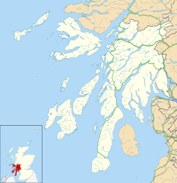
Location within Argyll and Bute | |
Population | 152 [1] |
OS grid reference | NN297396 |
• Edinburgh | 72 mi (116 km) |
• London | 394 mi (634 km) |
Community council | |
Council area | |
Lieutenancy area |
|
Country | Scotland |
Sovereign state | United Kingdom |
Post town | BRIDGE OF ORCHY |
Postcode district | PA36 |
Police | Scotland |
Fire | Scottish |
Ambulance | Scottish |
UK Parliament | |
Scottish Parliament | |
Bridge of Orchy (Scottish Gaelic : Drochaid Urchaidh) is a village in Glen Orchy in Argyll and Bute, Scotland. It is named after the crossing over the River Orchy, which was constructed by British Army during the pacification of the Highland Clans following the Battle of Culloden in 1746. Military roads were built between the Scottish Lowlands and Highlands of northern Scotland to facilitate the speedy movement of Crown forces.
The village, which is dated to 1751, is on the A82 road. The nearby Bridge of Orchy railway station opened on the West Highland Line in 1894.
The 96 mi (154 km) West Highland Way long-distance trail runs through the village. Nearby prominent peaks include the munros Beinn Dorain and Beinn an Dòthaidh. The River Orchy is one of the finest white-water rivers in the United Kingdom. [3]
The West Highland Way is a linear long-distance route in Scotland. It is 154 km long, running from Milngavie north of Glasgow to Fort William in the Scottish Highlands, with an element of hill walking in the route. The trail, which opened in 1980, was Scotland's first officially designated Long Distance Route, and is now designated by NatureScot as one of Scotland's Great Trails. It is primarily intended as a long distance walking route, and whilst many sections are suitable for mountain biking and horseriding there are obstacles and surfaces that will require these users to dismount in places.
Glenelg is a scattered community area and civil parish in the Lochalsh area of Highland in western Scotland.
Glen Orchy is a glen in Argyll and Bute, Scotland. It runs from Bridge of Orchy to Dalmally.
Rannoch railway station, on the West Highland Line, serves the area of Rannoch in Perth and Kinross, Scotland. In 2017, Simon Jenkins reported it to be one of the best 10 stations in Britain. It is situated between Corrour and Bridge of Orchy, 64 miles 36 chains (103.7 km) from Craigendoran Junction, near Helensburgh. ScotRail manage the station and operate most services, along with Caledonian Sleeper.
Bridge of Orchy railway station is a railway station in the village of Bridge of Orchy in the west of Scotland. The station is on the West Highland Line, between Rannoch and Upper Tyndrum, 48 miles 68 chains (78.6 km) from Craigendoran Junction, near Helensburgh. ScotRail manage the station and operate most services, with others provided by Caledonian Sleeper.
Beinn Dorain, is a mountain in the Breadalbane region of the Scottish Highlands. It overlooks Bridge of Orchy in Argyll. It is a Munro with a height of 1,076 metres (3,530 ft). The mountain is the subject of Duncan Ban MacIntyre's best known Gaelic poem, Moladh Beinn Dòbhrainn ; MacIntyre had spent his youth and had worked as a gamekeeper in these parts.
Loch Tulla is a small loch at grid reference NN293428 near Bridge of Orchy and Glen Coe in Scotland and in the central highlands. It contains salmon some of which are bred locally. The loch is 2.5 miles in length and an average 0.5 miles in width, with a mean depth of 33 feet and a maximum depth of 84 feet. The river River Orchy flows from the southeastern side of the loch.
Dalmally is a village in Argyll and Bute, Scotland. It is near the A85 road and is served by Dalmally railway station.
Beinn an Dòthaidh, is a mountain in the Bridge of Orchy hills of Argyll and Bute, Scotland. It is located beside the more popular Beinn Dòrain. The two hills are frequently climbed together from the bealach between them, which is easily accessed from the Bridge of Orchy railway station.
Beinn Achaladair is a Scottish mountain situated six kilometres north east of the hamlet of Bridge of Orchy. The mountain stands on the border of the Perth and Kinross and Argyll and Bute council areas.
Beinn Chùirn is a hill five kilometres west-south-west of Tyndrum, Scotland, standing on the border of Stirlingshire and Perthshire at the northern extremity of the Loch Lomond and The Trossachs National Park.
Stob a' Choire Odhair is a Scottish mountain situated eight kilometres north west of Bridge of Orchy on the border of the Argyll and Bute and Highland council areas.
Whitebridge is a small village on the southwest side of Loch Ness in northern Scotland.
Beinn Odhar is a Scottish mountain situated at the northern extremity of the Loch Lomond and the Trossachs National Park. It stands four km (2.5 mi) north of Tyndrum, a location with which it has strong ties, being well seen from the village. The mountain lies on the border between Argyll and Bute and Stirling council areas within the Auch and Invermeran estate.
Heasta, Heast, or the anglicised form Heaste, pron. /heɪst/, is a small settlement on the island of Skye, Scotland. It is located on the west coast of the island five miles south of Broadford extending down to the north shore of Loch Eiseort, facing out to the Atlantic to the south west and is in the Scottish council area of Highland.
The River Add is a river which runs through Argyll and Bute on the west coast of Scotland. Historically, it was known as the river Airigh but to avoid confusion with the Aray, it was renamed the River Add.
Beinn a' Chaisteil is a mountain in the southern Highlands of Scotland, it is located 6.25 km north of Tyndrum on the border of Perth and Kinross and Argyll and Bute council areas. This hill is not to be confused with another Beinn a' Chaisteil, above Loch Vaich in Highland Council area.
Beinn Mhanach, also anglicized Ben Vannoch, is a mountain in the Breadalbane region of the Scottish Highlands. It is east from Bridge of Orchy, overlooking Loch Lyon to the south and Gleann Cailliche to the north. It is a Munro with a height of 953 metres (3,127 ft). The mountain has two rounded summits; the western one is called Beinn a 'Chuirn and rises to 923 metres (3,028 ft). From the West Highland Line and the A82 road, the mountain can be seen clearly 8 km north-east up the Auch Gleann. On the southern side the slopes are grassy but the more remote northern side is craggier.
The River Orchy is a river that passes through the village of Dalmally, Argyll and Bute in the West Highlands of Scotland. It rises in the Black Mount Forest, and flows southerly, passing through Loch Tulla and Glen Orchy before reaching Loch Awe. The hills of Beinn Mhic-Mhonaidh, Beinn Udlaidh and Beinn Bhreac-liath are to the north and south; there are falls and islands within the river. Reachable by the A82 road, tourists partake in kayaking, whitewater rafting, and fishing. Recent gold mining exploration has occurred in one of the river's glens just outside the Loch Lomond and The Trossachs National Park.
Gorton railway station or Gortan railway station, named for the nearby Meall a Ghortain area of high ground, was a remote rural private railway station on Rannoch Moor, Argyll and Bute, Scotland. Opened in 1894 by the North British Railway, it was located at the present day Gorton Crossing engineer's siding where the ancient Rannoch Drove Road crossed the railway line.