North Ice was a research station of the British North Greenland Expedition on the inland ice of Greenland. The coordinates of the station were 78°04′N38°29′W, at an altitude of 2,341 metres (7,680 ft) above sea level. The British North Greenland Expedition had its main base camp in Britannia Lake, Queen Louise Land. It was led by Commander James Simpson RN. The station recorded a temperature of −66.1 °C (−87.0 °F) on 9 January 1954, which made it the lowest temperature ever recorded in North America up until that time. It was superseded by an observation of −69.6 °C (−93.3 °F) at the Greenland Ice Sheet on 22 December 1991. The name of the station contrasts to the former British South Ice station in Antarctica.

The British North Greenland expedition was a British scientific mission, led by Commander James Simpson RN, which lasted from July 1952 to August 1954. A total of 30 men took part, though not all stayed for both years.

Cortlandt James Woore Simpson was an English polar explorer and naval officer.

Storstrommen, is one of the major glaciers in northeastern Greenland. The North-East Greenland Ice Stream (NEGIS) discharges into 3 main marine-terminating outlets: 79N Glacier, Zachariae Isstrøm and Storstrommen - as arranged North to South.

Romer Lake is a land-locked freshwater fjord at the northern end of King Frederick VIII Land, near Greenland's northeastern coast. The Danish military base/weather station Nord —the only inhabited place in the area— lies 50 km (31 mi) to the northeast. The lake and its surroundings are part of the Northeast Greenland National Park zone.
Queen Margrethe II Land is a peninsula in the northern limit of King Christian X Land, northeastern Greenland. Administratively it belongs to the NE Greenland National Park area.
Queen Louise Land is a vast mountainous region located west of Dove Bay, King Frederik VIII Land, northeastern Greenland. Administratively it is part of the Northeast Greenland National Park zone.
Revaltoppe is one of the highest mountains in Queen Louise Land, NE Greenland. The peak is located in the King Frederick VIII Land area of northeastern Greenland. Administratively it is part of the Northeast Greenland National Park zone.
Gefiontinde is the highest mountain in Queen Louise Land, NE Greenland. The peak is located in the King Frederick VIII Land area of northeastern Greenland. Administratively it is part of the Northeast Greenland National Park zone.

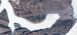
Britannia Lake, is a lake in King Frederik VIII Land, Northeastern Greenland. The lake and its surroundings are part of the Northeast Greenland National Park zone.

Ymer Nunatak is a nunatak in the Queen Louise Land area of northeastern Greenland. Administratively it is part of the Northeast Greenland National Park zone.

Admiralty Glacier is a glacier in Queen Louise Land, northeastern Greenland. Administratively it belongs to the Northeast Greenland National Park.

Ad Astra Ice Cap is an ice cap in Queen Louise Land, northeastern Greenland. Administratively it belongs to the Northeast Greenland National Park.

Eventyrfjelde is a group of nunataks in Queen Louise Land, NE Greenland. Administratively it is part of the Northeast Greenland National Park zone.
L. Bistrup Brae is a glacier in Northeastern Greenland. Administratively it belongs to the Northeast Greenland National Park.

Trefork Lake, is a lake in King Frederik VIII Land, Northeastern Greenland. The lake and its surroundings are part of the Northeast Greenland National Park zone.

Carlsbergfondet Land is a group of nunataks in Queen Louise Land, NE Greenland. Administratively it is part of the Northeast Greenland National Park zone.
Borgjokel is a glacier in Queen Louise Land, northeastern Greenland. Administratively it belongs to the Northeast Greenland National Park.
The Danish Expedition to Queen Louise Land, also known as the Danish expedition to Queen Louise Land and straight through Greenland’s ice sheet, as well as Danish North Greenland Expedition, was an expedition to northeastern Greenland and across the Greenland ice sheet in 1912–1913. It was the first such venture that went across the broad central part of Greenland. The expedition was led by Johan Peter Koch (1870–1928). Its purpose was to study the vast ice sheet, making glaciological and meteorological observations. Instead of sled dogs, sixteen Icelandic ponies were chosen for transporting 20 tons of materials, including 6 t of compressed hay to feed the ponies.