This page is based on this
Wikipedia article Text is available under the
CC BY-SA 4.0 license; additional terms may apply.
Images, videos and audio are available under their respective licenses.

Blackmoor Copse is a woodland in Wiltshire, managed as a nature reserve by the Wiltshire Wildlife Trust. A 31.3-hectare (77-acre) area of the wood was notified as a biological Site of Special Scientific Interest in 1971.
Winsley Mines is a 1.48 hectare biological Site of Special Scientific Interest, near the village of Winsley in Wiltshire, notified in 1989.
Steeple Langford Down is a 21.75 hectare biological Site of Special Scientific Interest at Steeple Langford in Wiltshire, notified in 1971.
Burderop Wood is a 48.5 hectare biological Site of Special Scientific Interest in Wiltshire, notified in 1971.
Distillery Farm Meadows is an 18.7 hectare biological Site of Special Scientific Interest in Wiltshire, notified in 1988.
Sutton Lane Meadows is a 3.44 hectare biological Site of Special Scientific Interest in Wiltshire, notified in 1988.
Chilton Foliat Meadows is a 54.6 hectare biological Site of Special Scientific Interest in the civil parish of Chilton Foliat in the English county of Wiltshire. It was notified in 1971 and is split across Berkshire and Wiltshire.

Clattinger Farm is a 60.3 hectare biological Site of Special Scientific Interest in Wiltshire, notified in 1971.
Clearbury Down is a 13.3 hectare biological Site of Special Scientific Interest in Wiltshire, England. It is above the village of Charlton-All-Saints in the parish of Downton, south of Salisbury.
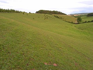
Cockey Down is a 15.2 hectare biological Site of Special Scientific Interest in Wiltshire, notified in 1971.

Clout's Wood is an 11.78 hectare biological Site of Special Scientific Interest in Wiltshire, notified in 1951.
Cloatley Manor Farm Meadows is a 12.1 hectare biological Site of Special Scientific Interest in Wiltshire, notified in 1997.
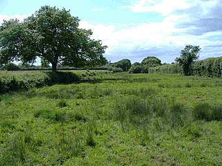
Emmett Hill Meadows is a 5.1 hectare biological Site of Special Scientific Interest in Wiltshire, notified in 1987.
Stoke Common Meadows is a 10.2 hectare biological Site of Special Scientific Interest in Wiltshire, notified in 1994.

Ravensroost Wood is a 43.7 hectare biological Site of Special Scientific Interest between Brinkworth and Minety in north Wiltshire, England.

Jones's Mill is an 11.6 hectare biological Site of Special Scientific Interest near Pewsey in Wiltshire, notified in 1975.
Restrop Farm and Brockhurst Wood is a 56.5 hectare biological Site of Special Scientific Interest in Wiltshire, notified in 1992. The site contains the Iron Age hill fort of Ringsbury Camp.
The Kennet and Lambourn Floodplain is a 22.9 hectare biological Site of Special Scientific Interest in Berkshire and Wiltshire, England, notified in 1996. It comprises seven separate small areas, four in the Kennet Valley and three in the Lambourn Valley. The areas included in the site support particularly large populations of Desmoulin's whorl snail.
Homington and Coombe Bissett Downs is a 25.0 hectare biological Site of Special Scientific Interest in Wiltshire, notified in 1971.
Bryanston SSSI is a 0.3 hectare biological Site of Special Scientific Interest in Dorset, England notified in 1977.


