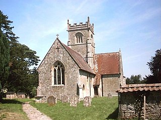
Berwick St John is a village and civil parish in south-west Wiltshire, England, about 5 miles (8 km) east of Shaftesbury in Dorset.
Gripwood Quarry is a 2.9 hectare geological Site of Special Scientific Interest at Bradford-on-Avon, Wiltshire, England, notified in 1951.
Seend Cleeve Quarry is a 7.5 acres (3.0 ha) Geological Site of Special Scientific Interest at Seend Cleeve, Wiltshire, England, notified in 1987. It is important for its strata from the Oxfordian stage of the Jurassic period, containing fossil ammonites and bivalves which aid stratigraphy.
Stanton St. Quintin Quarry & Motorway Cutting is a 2.2 hectare geological Site of Special Scientific Interest southeast of Stanton St Quintin in Wiltshire, England, notified in 1971.
Westbury Ironstone Quarry is a 5,600 square metre geological Site of Special Scientific Interest just west of Westbury in Wiltshire, England, notified in 1965. The quarry was once an important source of Upper Oxfordian Westbury Iron Ore.
Bencroft Hill Meadows is a 5.1 hectare biological Site of Special Scientific Interest some 3 miles (5 km) to the east of the town of Chippenham in Wiltshire, England, notified in 1988. The site is a flora-rich example of unimproved pasture on the Oxford Clay Vale of North Wiltshire which attracts butterflies such as the small copper, small heath and common blue.
Scratchbury & Cotley Hills SSSI is a 53.5 hectare biological Site of Special Scientific Interest at Norton Bavant in Wiltshire, England, notified in 1951. The Iron Age hillfort of Scratchbury Camp occupies the summit of the hill.

Upton Cow Down is a 16.4 hectare biological Site of Special Scientific Interest in Wiltshire. The down is an area of chalk grassland on the western edge of Salisbury Plain. It lies one mile south of the town of Westbury, above the village of Upton Scudamore.

West Yatton Down is a 14.4 hectare biological Site of Special Scientific Interest in Wiltshire, notified in 1971.

Tytherington Down is a 5.9 hectares biological Site of Special Scientific Interest in Wiltshire, England, notified in 1975. The site spans a dry valley some 1+1⁄2 miles (2.4 km) south of the village of Tytherington and 5 miles (8 km) southeast of Warminster.
Win Green Down at grid reference ST927209 in south-western Wiltshire, England is a 26.0 hectares biological Site of Special Scientific Interest, notified in 1971.
Brimsdown Hill is a 193.7 hectare biological Site of Special Scientific Interest in Wiltshire, notified in 1951. It is situated within the Cranborne Chase and West Wiltshire Downs Area of Outstanding Natural Beauty.j,
Sutton Lane Meadows is a 3.44 hectare biological Site of Special Scientific Interest in Wiltshire, notified in 1988.

Pincombe Down is a 23.8 hectare biological Site of Special Scientific Interest in southwest Wiltshire, England, notified in 1971. The site lies in Alvediston and Berwick St John parishes.

Prescombe Down is a biological Site of Special Scientific Interest in Wiltshire, notified in 1951.
Rotherley Downs is a 120.05 hectare biological Site of Special Scientific Interest in Wiltshire, England, notified in 1989.

Roundway Down and Covert is an 86 hectare biological Site of Special Scientific Interest near Devizes in Wiltshire, England. It was notified in 1971.

Stockton Wood and Down is a 61.5 hectare biological Site of Special Scientific Interest in the southwest of Stockton parish in Wiltshire, England, notified in 1951.
Rack Hill is a 10.6 hectare biological Site of Special Scientific Interest in Wiltshire, notified in 1975.

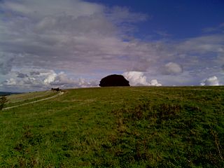
Cley Hill is a prominent hill to the west of Warminster in Wiltshire, England. Its summit has a commanding view of the Wiltshire / Somerset county boundary, at 244 metres (801 ft) elevation. The land is in Corsley parish and is owned by the National Trust.
This page is based on this
Wikipedia article Text is available under the
CC BY-SA 4.0 license; additional terms may apply.
Images, videos and audio are available under their respective licenses.
