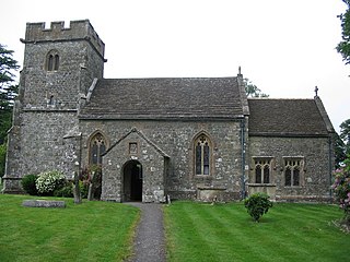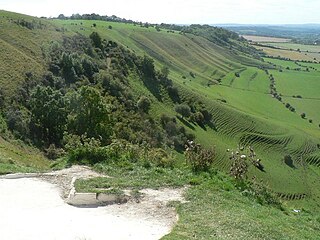
Cranborne Chase is a chalk plateau in central southern England, straddling the counties Dorset, Hampshire and Wiltshire. The plateau is part of the English Chalk Formation and is adjacent to Salisbury Plain and the West Wiltshire Downs in the north, and the Dorset Downs to the south west. The scarp slope of the hills faces the Blackmore Vale to the west, and to some extent the Vale of Wardour to the north. The chalk gently slopes south and dips under clays and gravels. The highest point is Win Green Down, in Wiltshire, at 910 feet (280 m).

Cuckmere Valley is a civil parish in the Wealden District of East Sussex, England. As its name suggests, the parish consists of a number of small settlements in the lower reaches of the River Cuckmere.

Long Man is a civil parish in the Wealden District of East Sussex, England which includes the villages of Wilmington, Milton Street and Folkington. The parish is named after the Long Man of Wilmington, a 69.2-metre (227 ft) chalk figure in the parish.

St Columb Major is a town and civil parish in Cornwall, England, United Kingdom. Often referred to locally as St Columb, it is approximately seven miles (11 km) southwest of Wadebridge and six miles (10 km) east of Newquay The designation Major distinguishes it from the nearby settlement and parish of St Columb Minor on the coast. An electoral ward simply named St Columb exists with a population at the 2011 census of 5,050. The town is named after the 6th-century AD Saint Columba of Cornwall, also known as Columb.

Ditchling is a village and civil parish in the Lewes District of East Sussex, England. The village is contained within the boundaries of the South Downs National Park; the order confirming the establishment of the park was signed in Ditchling.

Slapton is a village and civil parish in the South Hams district of Devon, England. It is located near the A379 road between Kingsbridge and Dartmouth, and lies within the South Devon Area of Outstanding Natural Beauty (AONB). The nearby beach is Slapton Sands.

Barlaston is a village and civil parish in the borough of Stafford in the county of Staffordshire, England. It is roughly halfway between the city of Stoke-on-Trent and the small town of Stone. According to the 2001 census the population of the parish was 2,659, rising at the 2011 Census to 2,858.

St Wenn is a civil parish and village in Cornwall, England, United Kingdom. The village is situated six miles (10 km) west of Bodmin and nine miles (14.5 km) east of Newquay. The parish population at the 2011 census was 369.

East Dean and Friston is a civil parish in the Wealden District of East Sussex, England.The two villages in the parish are in a dry valley on the South Downs – between Eastbourne three miles (4.8 km) to the east and Seaford an equal distance to the west. The main A259 road goes through both village centres. The coast and much of the land between it and the A259 from the east edge of Seaford to the west edge of Eastbourne is owned by the National Trust, and this has prevented further development to the area.

St John Without is a small civil parish in the Lewes District of East Sussex, England, covering an area to the north-west of the town of Lewes.

Penselwood is a village and civil parish in the English county of Somerset. It is located 4 miles (6.4 km) north east of Wincanton, 4 miles (6.4 km) south east of Bruton, 4 miles (6.4 km) west of Mere, and 5 miles (8.0 km) north west of Gillingham. The south-east of the parish borders Zeals and Stourhead in Wiltshire, and Bourton in Dorset. In 1991 the parish occupied 523 hectares.

Bratton Downs is a 395.8 hectare biological and geological Site of Special Scientific Interest in Wiltshire, England, near the villages of Bratton and Edington, and about 3 miles (5 km) east of the town of Westbury. It was notified in 1971. The designated area consists mainly of chalk grassland, as well as some ancient woodland, and supports a diverse range of native flora and fauna. It overlays notable geological features—principally landforms created by glaciation in the Pleistocene.

Aunt Mary's Bottom is an 8.62 hectare biological Site of Special Scientific Interest in Dorset, England notified in 1991.

Towan is found in many placenames in Cornwall. However, The Towans usually refers to the three-mile (5 km) stretch of coastal dunes which extends north-east from the estuary of the River Hayle to Gwithian beach with a midpoint near Upton.

Old Winchester Hill is a 66.2-hectare (164-acre) biological Site of Special Scientific Interest in Hampshire. It is a Nature Conservation Review site, Grade I, and a National Nature Reserve. Part of it is a Scheduled Monument.

Ranmore Common is an area of wooded former common land on the North Downs, immediately northwest of Dorking in the English county of Surrey. Its civil parish is Wotton, a geographically large village with a small population west of Dorking. Ranmore Commons — it is also seen in the plural — is within the Surrey Hills Area of Outstanding Natural Beauty, and part of it is Ranmore Common SSSI, a Site of Special Scientific Interest.

Week St Mary is a village and civil parish in northeast Cornwall, England, United Kingdom. It is situated south of Bude close to the River Tamar and the border between Cornwall and Devon in the Hundred of Stratton. The parish population at the 2011 census is 657.
Mulberry Downs Quarry is a disused opencast quarry, mining tin, in Cornwall, England, UK. The site is a Site of Special Scientific Interest (SSSI), noted for its geological characteristics.

Newlyn Downs is a Site of Special Scientific Interest (SSSI) in north Cornwall, England, UK, noted for its biological characteristics.


