
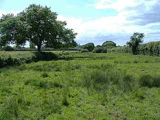
Steeple Langford Down (grid reference SU036387 ) is a 21.75 hectare biological Site of Special Scientific Interest at Steeple Langford in Wiltshire, notified in 1971.
Steeple Langford Down (grid reference SU036387 ) is a 21.75 hectare biological Site of Special Scientific Interest at Steeple Langford in Wiltshire, notified in 1971.
Coordinates: 51°08′51″N1°57′00″W / 51.14755°N 1.94991°W
| | This article about a Site of Special Scientific Interest in England is a stub. You can help Wikipedia by expanding it. |
| | This article about a location in Wiltshire is a stub. You can help Wikipedia by expanding it. |

The River Wylye is a chalk stream in the south of England, with clear water flowing over gravel. It is popular with anglers for fly fishing. A half-mile stretch of the river and three lakes in Warminster are a local nature reserve.

Stratford Toney Down is a 23.1 hectare biological Site of Special Scientific Interest in Wiltshire, notified in 1987.

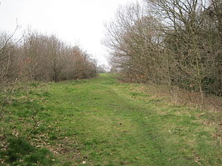
Tytherington Down is a 5.9 hectares biological Site of Special Scientific Interest in Wiltshire, England, notified in 1975. The site spans a dry valley some 1+1⁄2 miles (2.4 km) south of the village of Tytherington and 5 miles (8 km) southeast of Warminster.
Whiteparish Common is a 64.5 hectare biological Site of Special Scientific Interest near Whiteparish, Wiltshire, England, notified in 1965.
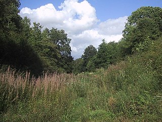
Wylye and Church Dean Downs is an 80.9 hectare biological Site of Special Scientific Interest in Wiltshire, England, notified in 1951.
Porton Meadows is a 17.6 hectare biological Site of Special Scientific Interest in Wiltshire, notified in 1988.
Stoke Common Meadows is a 10.2 hectare biological Site of Special Scientific Interest in Wiltshire, notified in 1994.

Ravensroost Wood is a 43.7 hectare biological Site of Special Scientific Interest between Brinkworth and Minety in north Wiltshire, England.

Great Yews is a 29.3 hectare biological Site of Special Scientific Interest in Wiltshire, notified in 1951.
Restrop Farm and Brockhurst Wood is a 56.5 hectare biological Site of Special Scientific Interest in Wiltshire, notified in 1992. The site contains the Iron Age hill fort of Ringsbury Camp.

Cannon Hill Common is a public park in the London Borough of Merton. It is situated near Raynes Park and Morden. It is also the location of a Local Nature Reserve and the Paddock Allotments.

Hackhurst and White Downs is a 185.1-hectare (457-acre) biological Site of Special Scientific Interest west of Dorking in Surrey. White Downs is a Nature Conservation Review site, Grade 2, and part of it is in the 200-hectare (490-acre) White Downs nature reserve, which is owned by the Wotton Estate and managed by the Surrey Wildlife Trust (SWT). Hackhurst Downs is a 29.9-hectare (74-acre) Local Nature Reserve, which part of the 40-hectare (99-acre) Hackhurst Downs nature reserve, which is owned by Surrey County Council and also managed by the SWT.

Totternhoe Chalk Quarry is a 13.4 hectare biological Site of Special Scientific Interest in Totternhoe in Bedfordshire. Part of it lies in Totternhoe nature reserve, which is managed by the Wildlife Trust for Bedfordshire, Cambridgeshire and Northamptonshire. The site is part of the Chilterns Area of Outstanding Natural Beauty.
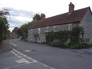
Steeple Langford is a village and civil parish in the English county of Wiltshire, 6 miles (10 km) northwest of Wilton. It has also been called Great Langford or Langford Magna. The village lies on the north bank of the River Wylye, and is bypassed to the north by the A36 Warminster-Salisbury trunk road which follows the river valley.
The Mill Field is a 3.4 hectare Site of Borough Importance for Nature Conservation, Grade II, in Mill Hill in the London Borough of Barnet. It is a public open space which slopes steeply down from the road called The Ridgeway. It may be the site of the windmill which gave the area its name. This was documented as early as 1321 and had disappeared by 1754.

Belsize Wood is a 0.7 hectare Local Nature Reserve and a Site of Borough Importance for Nature Conservation, Grade II, in Belsize Park in the London Borough of Camden. It is a steeply sloping site divided into a northern half, which is always open to the public and is of lesser ecological value, and a southern part which is in a better state of conservation, and which is only open at weekends. The two halves are separated by a public footpath between Lawn Road and Aspern Grove. The site is owned and managed by Camden Council.
Old Burghclere Lime Quarry SSSI is a 4.61 ha biological Site of Special Scientific Interest at Burghclere in Hampshire, notified in 1979. The Lime Quarry was actively worked until the beginning of the 20th century, and since then has been left to nature, resulting in a unique mix of flora and fauna becoming established at the site.

Duke's Hollow is a 0.27 hectare Local Nature Reserve and Site of Metropolitan Importance for Nature Conservation in Chiswick in the London Borough of Hounslow. It is owned and managed by Hounslow Council.

Yoesden, often known as Yoesden Bank, is a 13-hectare (32-acre) nature reserve in Bledlow Ridge in Buckinghamshire. It is managed by the Berkshire, Buckinghamshire and Oxfordshire Wildlife Trust. It is in the Chilterns Area of Outstanding Natural Beauty.
Hook Norton Cutting and Banks is a 6.7-hectare (17-acre) biological and geological Site of Special Scientific Interest south of Hook Norton in Oxfordshire. The site is in three areas, two of which are managed as a nature reserve called Hook Norton Cutting by Berkshire, Buckinghamshire and Oxfordshire Wildlife Trust. and are designated a Geological Conservation Review site.