
Brière is the marsh area to the north of the Loire estuary in France at its mouth on the Atlantic Ocean. The residents of Brière are called Briérons. The Brière marsh area includes a vast area of humid zones stretching from the Gulf of Morbihan and the estuary of the Vilaine to the north, to the salt marshes of Guérande to the west to the estuary of the Loire and the Lac de Grand-Lieu in the south. Peat used to be harvested here.

Saint-Malo-de-Guersac is a commune in the Loire-Atlantique department in western France. It was created in 1925 from part of the commune of Montoir-de-Bretagne.
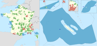
A regional nature park or regional natural park is a public establishment in France between local authorities and the French national government covering an inhabited rural area of outstanding beauty in order to protect the scenery and heritage as well as set up sustainable economic development in the area.

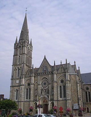
Sainte-Reine-de-Bretagne is a commune in the Loire-Atlantique department in western France.
Missillac is a commune located in the department of Loire-Atlantique in western France.

The Parc naturel régional d'Armorique, or Armorica Regional Natural Park, is a rural protected area located in Brittany. The park land reaches from the Atlantic Ocean to hilly inland countryside. There are sandy beaches, swamps, rock formations, fast-flowing rivers and the hills of Monts d'Arrée, all blended into one landscape. The park also includes three islands: Île de Sein, Molène and Ouessant.

Landes de Gascogne Regional Natural Park is a protected area of pine forest, wetland and oceanic coastline located in the Landes de Gascogne natural region of Nouvelle-Aquitaine in southwestern France.
La Presqu’île de Guérande is an Atlantic destination located in the North-West of France, between the Loire estuary and the mouth of the Vilaine. It encompasses about 20 towns split up into two departments: Morbihan and Loire-Atlantique. This area is often called Guérande Peninsula, partly because of Guérande, a scenic town that triggers off images of a medieval town and the salt marshes.

Morvan Regional Natural Park is a protected area of woodlands, lakes and traditional farmland in the Bourgogne-Franche-Comté region of central France. It covers a total area of 285,000 hectares and extends through four different departments with the majority being in Nièvre. The area was officially designated as a regional natural park in 1970.

The Vercors Regional Natural Park is a protected area of forested mountains in the Rhône-Alpes region of southeastern France.

Lorraine Regional Natural Park is a protected area of pastoral countryside in the Grand Est region of northeastern France, in the historic region of Lorraine. The park covers a total area of 205,000 hectares. The parkland is split in two non-contiguous parcels of land between the cities of Metz and Nancy, and spans the three departments of Meuse, Meurthe-et-Moselle, and Moselle. According to the World Database on Protected Areas, it is an IUCN category V area.

Pilat Regional Natural Park is a protected area of mountainous countryside in the Auvergne-Rhône-Alpes region of southeastern France. The park spans the departments of Loire and Rhône, and covers a total area of 65,000 hectares.

Livradois-Forez Regional Natural Park is a regional natural park located on three French department : Puy-de-Dôme, Haute-Loire and Loire. The two biggest urban areas are Thiers and Ambert. Courpière, Billom and Vic-le-Comte have a secondary place in the territory.
Normandie-Maine Regional Natural Park is a protected area of forest and bocage located in the French regions of Normandy and Pays de la Loire.

Orient Forest Regional Natural Park is a protected area of woodlands and lakes in the Champagne-Ardenne region of France. It covers a total area of 70,000 hectares The parkland encompasses the large Forêt d'Orient National Nature Reserve and three man-made lakes: Lac d'Orient, Lac du Temple and Lac Amance. The area was officially designated as a regional natural park in 1970.

Haute Vallée de Chevreuse Regional Natural Park is a protected area in the Île-de-France region of northern France. It is a verdant rural area outside Paris, designated as a regional natural park because it contains a wide variety of unique historical sites.

The Northern Vosges Regional Natural Park is a protected area of woodland, wetland, farmland and historical sites in the Grand Est region in northeastern France. The area was officially designated as a regional natural park in 1976.
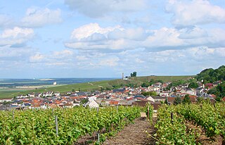
Montagne de Reims Regional Natural Park is a protected area in the Grand Est region of France. It is organized around the Montagne de Reims, a wooded range of hills covered by vineyards that produce the region's eponymous sparkling wine, Champagne.

The Ballons des Vosges Regional Nature Park is a protected area of woodland, pasture, wetland, farmland and historical sites in the regions of Grand Est and Bourgogne-Franche-Comté in northeastern France. The area was officially designated as a regional natural park in 1989. 187 communes belonging to the departments of Haut-Rhin, Vosges, Haute-Saône and Territoire de Belfort are members of the park, which hosts 238,000 inhabitants. It is one of the largest and most populated French regional parks. A wide range of habitats available in the park benefit a variety of wildlife such as boreal owl, lynx, peregrine falcon, western capercaillie, Dianthus superbus, cranberry and Drosera.

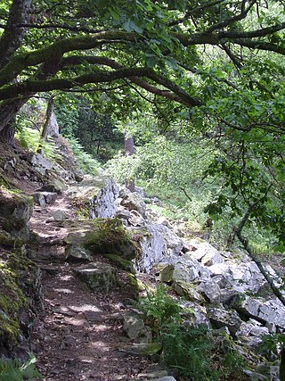
The long-distance hiking trail 34 is a French coastal path that starts from Mont-Saint-Michel (Manche) and ends in Saint-Nazaire (Loire-Atlantique). It runs along almost the entire coast of the Brittany region from Mont Saint-Michel and, beyond the limit between Morbihan and Loire-Atlantique, to the mouth of the Loire. It stretches over 1,700 kilometres (1,100 mi). It largely follows former customs paths. These paths, gradually abandoned during the first half of the 20th century, allowed customs officers to patrol the coast from their guardhouses, located at key observation points on the Brittany coast.

