The Kings River is a 132.9-mile (213.9 km) river draining the Sierra Nevada mountain range in central California in the United States. Its headwaters originate along the Sierra Crest in and around Kings Canyon National Park and form the eponymous Kings Canyon, one of the deepest river gorges in North America. The river is impounded in Pine Flat Lake before flowing into the San Joaquin Valley southeast of Fresno. With its upper and middle course in Fresno County, the Kings River diverges into multiple branches in Kings County, with some water flowing south to the old Tulare Lake bed and the rest flowing north to the San Joaquin River. However, most of the water is consumed for irrigation well upstream of either point.

A 1950s proposal to construct a dam near Tocks Island across the Delaware River was met with considerable controversy and protest. Tocks Island is located in the Delaware River a short distance north from the Delaware Water Gap. In order to control damaging flooding and provide clean water to supply New York City and Philadelphia, the U.S. Army Corps of Engineers proposed building a dam. When completed, the Tocks Island Dam would have created a 37-mile (60-km) long lake between Pennsylvania and New Jersey, with depths of up to 140 feet. This lake and the land surrounding were to be organized as the Tocks Island National Recreation Area. Although the dam was never built, 72,000 acres (291 km²) of land were acquired by condemnation and eminent domain. This incited environmental protesters and embittered local residents displaced by the project's preparations when their property was condemned. After the Tocks Island Dam project was withdrawn, the lands acquired were transferred to the oversight of the National Park Service which reorganized them to establish the Delaware Water Gap National Recreation Area.

Jennings Randolph Lake is a reservoir of 952 acres (3.85 km2) located on the North Branch Potomac River in Garrett County, Maryland and Mineral County, West Virginia. It is approximately eight miles upstream of Bloomington, Maryland, and approximately five miles north of Elk Garden, West Virginia.

Dworshak Dam is a concrete gravity dam in the western United States, on the North Fork Clearwater River in Clearwater County, Idaho. The dam is located approximately four miles (6 km) northwest of Orofino and impounds the Dworshak Reservoir for flood control and hydroelectricity generation. With a height of 717 feet (219 m), Dworshak is the third tallest dam in the United States and the tallest straight-axis concrete dam in the Western Hemisphere. Lacking fish ladders, Dworshak Dam blocks fish passage and completely extirpated anadromous fish migration into the upper reaches of the North Fork Clearwater River and its tributaries in Idaho. Construction of the dam by the U.S. Army Corps of Engineers (USACE) began in 1966 and was completed in 1973.

Flaming Gorge Dam is a concrete thin-arch dam on the Green River, a major tributary of the Colorado River, in northern Utah in the United States. Flaming Gorge Dam forms the Flaming Gorge Reservoir, which extends 91 miles (146 km) into southern Wyoming, submerging four distinct gorges of the Green River. The dam is a major component of the Colorado River Storage Project, which stores and distributes upper Colorado River Basin water.
Isabella Dam is an embankment dam located in the Kern River Valley, about halfway down the Kern River course, between the towns of Kernville and Lake Isabella in Kern County, California.
The Ware River is a 35.4-mile-long (57.0 km) river in central Massachusetts. It has two forks, both of which begin in Hubbardston, Massachusetts. The Ware River flows southwest through the middle of the state, joins the Quaboag River at Three Rivers, Massachusetts, to form the Chicopee River on its way to the Connecticut River.

Lavon Lake is a freshwater reservoir located in southeast Collin County, Texas, on the East Fork of the Trinity River near Wylie, off State Highway 78. It is commonly called Lake Lavon for commercial and recreational purposes, but Lavon Lake is its official name according to the U.S. Army Corps of Engineers. It was originally called Lavon Reservoir.

Auburn Dam was a proposed concrete arch dam on the North Fork of the American River east of the town of Auburn, California, in the United States, on the border of Placer and El Dorado Counties. Slated to be completed in the 1970s by the U.S. Bureau of Reclamation, it would have been the tallest concrete dam in California and one of the tallest in the United States, at a height of 680 feet (210 m) and storing 2,300,000 acre-feet (2.8 km3) of water. Straddling a gorge downstream of the confluence of the North and Middle Forks of the American River and upstream of Folsom Lake, it would have regulated water flow and provided flood control in the American River basin as part of Reclamation's immense Central Valley Project.

Cougar Dam is a 519-foot (158 m) tall rockfill hydroelectric dam in the U.S. state of Oregon. It has a gated concrete spillway and a powerhouse with two turbines totaling 25 megawatts of electric power.

Fontenelle Dam was built between 1961 and 1964 on the Green River in southwestern Wyoming. The 139-foot (42 m) high zoned earthfill dam impounds the 345,360-acre-foot (0.42600 km3) Fontenelle Reservoir. The dam and reservoir are the central features of the Seedskadee Project of the U.S. Bureau of Reclamation, which manages the Fontenelle impoundment primarily as a storage reservoir for the Colorado River Storage Project. The dam suffered a significant failure in 1965, when the dam's right abutment developed a leak. Emergency releases from the dam flooded downstream properties, but repairs to the dam were successful. However, in 1983 the dam was rated "poor" under Safety Evaluation of Existing Dams (SEED) criteria, due to continuing seepage, leading to an emergency drawdown. A concrete diaphragm wall was built through the core of the dam to stop leakage.
The Flood Control Act of 1946 was passed by the United States Congress on July 24, 1946; to authorize 123 projects including several dams and hydroelectric power plants like Old Hickory Lock and Dam in Tennessee and the Fort Randall Dam in South Dakota. It also allowed bank adjustments and re-directions for several rivers. The plan authorized the Secretary of War to regulate the surveillance of flood control and other improvements as well as the ability to call for a review of said surveys. The Secretary of Agriculture and the Department of Engineers were also charged with conducting surveys relating to their respective fields.

Success Dam is a dam across the Tule River in Tulare County, California in the United States. Serving mainly for flood control and irrigation, the dam is an earthen embankment structure 156 feet (48 m) high and 3,490 feet (1,060 m) long. The dam lies about 5 miles (8.0 km) east of Porterville and impounds Lake Success, which has a capacity of 82,300 acre-feet (0.1015 km3).

Fulks Run is an unincorporated community located in Rockingham County, Virginia, United States. It is located north of Harrisonburg and south of Bergton, just to the west of Broadway on route 259, near the border of West Virginia and the edge of George Washington National Forest. The North Fork Shenandoah River flows past the community. It includes Fulks Run Elementary School. The Fulks Run Ruritan Park is a popular get together spot with a baseball field.

Glacier View Dam was proposed in 1943 on the North Fork of the Flathead River, on the western border of Glacier National Park in Montana. The 416-foot (127 m) tall dam, to be designed and constructed by the U.S. Army Corps of Engineers in the canyon between Huckleberry Mountain and Glacier View Mountain, would have flooded in excess of 10,000 acres (4,000 ha) of the park. In the face of determined opposition from the National Park Service and conservation groups, the dam was never built.

The Mojave Forks Dam, most often known as the Mojave River Dam, is an earth-fill dry dam across the Mojave River in San Bernardino County, California in the United States. Completed in 1974 by the U.S. Army Corps of Engineers (USACE), the dam is located at the confluence of the West Fork Mojave River and Deep Creek, and can store approximately 179,400 acre⋅ft (221,300,000 m3) of water.

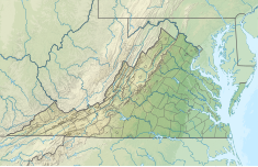
Brocks Gap is a water gap in Rockingham County, Virginia, where the North Fork of the Shenandoah River flows through Little North Mountain. The gap was the proposed site of the never-built Brocks Gap Dam and is traversed by Virginia Route 259.

Seneca Dam was the last in a series of dams proposed on the Potomac River in the area of the Great Falls of the Potomac. Apart from small-scale dams intended to divert water for municipal use in the District of Columbia and into the Chesapeake and Ohio Canal, no version of any scheme was ever built. In most cases the proposed reservoir would have extended upriver to Harpers Ferry, West Virginia. The project was part of a program of as many as sixteen major dams in the Potomac watershed, most of which were never built.
The Potomac River basin reservoir projects were U.S. Army Corps of Engineers programs that sought to regulate the flow of the Potomac River to control flooding, to assure a reliable water supply for Washington, D.C., and to provide recreational opportunities. Beginning in 1921 the Corps studied a variety of proposals for an ambitious program of dam construction on the Potomac and its tributaries, which proposed as many as sixteen major dam and reservoir projects. The most ambitious proposals would have created a nearly continuous chain of reservoirs from tidewater to Cumberland, Maryland. The 1938 program was focused on flood control, on the heels of a major flood in 1936. The reformulated 1963 program focused on water supply and quality, mitigating upstream pollution from sewage and coal mine waste.

Little Stony Creek is a 6.8 mile long river in the George Washington and Jefferson National Forests in the Commonwealth of Virginia. It is a first-order tributary of the North Fork Shenandoah River and the Potomac River.