Brzan

Last updated • 2 min readFrom Wikipedia, The Free Encyclopedia
Brzan
Брзан
Crkva brvnara u Brzanu.jpg
Wooden church in Brzan built in 1822
Serbia adm location map.svg
Red pog.svg
Brzan
Location of Brzan in Serbia
Coordinates: 44°06′55″N21°08′00″E / 44.11528°N 21.13333°E / 44.11528; 21.13333
CountryFlag of Serbia.svg  Serbia
District Šumadija
Municipality Batočina
Elevation
344 ft (105 m)
Population
 (2011) [1]
  Total1,754
Time zone UTC+1 (CET)
  Summer (DST) UTC+2 (CEST)
Postal code
34228
Area code 034
Geocode 702854
Car plates KG

Brzan (Serbian : Брзан) is a village in the municipality of Batočina in the Šumadija District of Serbia. The population was 1,754 in the 2011 census. [1]

Contents

Geography

The village of Brzan is located in the central part of Serbia, on the eastern edge of Šumadija District. It lies 6.09 kilometres (3.78 mi) to the south of the town of Batočina, the seat of the municipality. The nearest cities are Jagodina 18.48 kilometres (11.48 mi) to the southeast and Kragujevac 22 kilometres (14 mi) to the southwest. Belgrade is 95.27 kilometres (59.20 mi) to the northeast. [2] Brzan lies along the Great Morava River.

Demographics

As of the 2011 census, there were 1,754 people, 602 households and 514 families residing in the village. The average household size was 2.91 and the average family size was 2.83.

Of the total families, 45.9% were couples living together with children, 41.1% were couples living together without children, 8.6% had a female householder with no husband present, and 4.5% had a male householder with no wife present. 26.4% of total households were made up of individuals; 40.4% had 2 or 3 members; 21.6% had 4 or 5 members; and 11.6% had 6 or more members.

The median age in the village was 46.4 years. 14.4% of residents were under the age of 18; 14.6% were between the ages of 18 and 29; 21.9% were from 30 to 49; 31.1% were from 50 to 69; and 18.0% were 70 years of age or older. The gender makeup of the village was 50.5% male and 49.5% female. [3] [1]

According to the 2002 census, the village had a population of 2,073 people. [4] The ethnic composition of the village was 99.3% Serbian, with 0.7% identifying as other groups. [5] The population has declined over the past 5 censuses since 1961.

Transportation

The village has a railway station along the main line between Belgrade and Niš. The nearest main road is State Road 158, providing transport links north and south. The A1 Motorway, which is part of the European Route E75, runs by the village and is accessible at Batočina.

Related Research Articles

<span class="mw-page-title-main">Belgrade, Minnesota</span> City in Minnesota, United States

Belgrade is a city in Stearns County, Minnesota, United States. The population was 740 at the 2010 census. It is part of the St. Cloud Metropolitan Statistical Area. Belgrade is home to the world's largest black Crow.

<span class="mw-page-title-main">Šumadija District</span> District of Serbia

The Šumadija District is one of eight administrative districts of Šumadija and Western Serbia. It is located in the central parts of the country. According to the 2022 census results, it has a population of 269,728 inhabitants, and the administrative center is the city of Kragujevac. The district is named after the geographical region of Šumadija.

<span class="mw-page-title-main">Batočina</span> Town and municipality in Šumadija and Western Serbia, Serbia

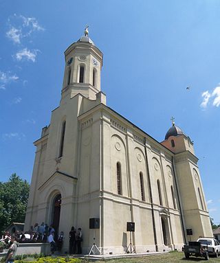
Batočina is a town and municipality located in the Šumadija District of central Serbia. According to 2011 census, the population of the town is 5,804, while population of the municipality is 11,760.

<span class="mw-page-title-main">Bečmen</span>

Bečmen is a suburban settlement of Belgrade, Serbia. It is located in Belgrade's municipality of Surčin.

<span class="mw-page-title-main">Azanja</span> Village in Serbia

Azanja is a village in Central Serbia, in the municipality of Smederevska Palanka. It lies in the region of Great Morava valley, on rivers of Jezava and Jasenica. Azanja is 160 meters above mean sea level. With 4,014 residents, it is one of largest villages in Central Serbia.

<span class="mw-page-title-main">Botunje</span> Village in Šumadija, Serbia

Botunje is a village in the Kragujevac city area in the Šumadija District of central Serbia. It is located north-east of the city. According to the 2011 census, the village has a population of 669 people.

Bayview is a census-designated place in Contra Costa County, California. Bayview sits at an elevation of 36 feet. The 2010 United States census reported Bayview's population was 1,754. Prior to 2010, Bayview was part of the Bayview-Montalvin CDP and then separated into the two individual communities of Bayview and Montalvin Manor for the census.

<span class="mw-page-title-main">Rogojevac, Kragujevac</span> Village in Šumadija District, Serbia

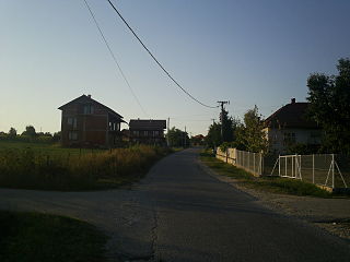
Rogojevac is a village in the Kragujevac city area in the Šumadija District, Serbia. According to the 2011 census there were 394 inhabitants. Bronze Age graves of nomads from the steppes of Russia were found in the village vicinity.

<span class="mw-page-title-main">Cvetojevac</span> Village in Šumadija, Serbia

Cvetojevac is a village in the Šumadija District, Serbia. According to the 2011 census, the village has a population of 841. It belonged to municipality of Aerodrom from 2002. to 2008. when municipality was abolished. Village was founded in the year 1789.

Šljivovac is a village in the Kragujevac city area in the Šumadija District, Serbia. According to the 2011 census there were 417 inhabitants.

<span class="mw-page-title-main">Badnjevac, Batočina</span> Village in Šumadija, Serbia

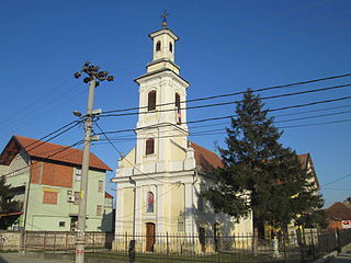
Badnjevac is a village in the municipality of Batočina in the Šumadija District of Serbia. The population was 1,084 in the 2011 census.

<span class="mw-page-title-main">Crni Kao, Batočina</span> Village in Šumadija, Serbia

Crni Kao is a village in the municipality of Batočina, Serbia. According to the 2011 census, the village has a population of 410 people.

<span class="mw-page-title-main">Dobrovodica</span> Village in Šumadija, Serbia

Dobrovodica is a village in the municipality of Batočina, Serbia. According to the 2011 census, the village has a population of 381 people.

<span class="mw-page-title-main">Gradac, Batočina</span> Village in Šumadija, Serbia

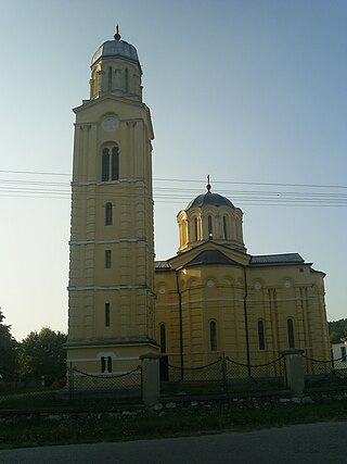
Gradac is a village in the municipality of Batočina, Serbia. According to the 2011 census, the village has a population of 206 people. The Gradac Cave located in the village is part of the Cultural Heritage of Serbia list, inscribed in 1979.

<span class="mw-page-title-main">Kijevo, Batočina</span> Village in Šumadija, Serbia

Kijevo is a village in the municipality of Batočina, Serbia. According to the 2011 census, the village has a population of 482 people.

<span class="mw-page-title-main">Nikšić, Batočina</span> Village in Šumadija, Serbia

Nikšić is a village in the municipality of Batočina, Serbia. According to the 2011 census, the village had a population of 176 people.

Prnjavor is a village in the municipality of Batočina, Serbia. According to the 2011 census, the village has a population of 166 people.

Kutlovo is a village in the Kragujevac city area in the Šumadija District, Serbia. According to the 2011 census there were 234 inhabitants.

Kotraža is a village in the Kragujevac city area in the Šumadija District, Serbia. According to the 2011 census there were 185 inhabitants.

Dimitrije Parezan was one of the leaders in the First Serbian Uprising. He died in the Battle of Mozgovo in 1813.

References

  1. 1 2 3 "Census 2011: Census Data - Excel Tables". Statistical Office of the Republic of Serbia. Retrieved 8 July 2019.
  2. "Distance calculator - Calculate the distance online!". www.distance.to. Retrieved 2019-07-09.
  3. "2011 Census of Population, Households and Dwellings in the Republic of Serbia: Comparative Overview of the Number of Population in 1948, 1953, 1961, 1971, 1981, 1991, 2002 and 2011, Data by settlements" (PDF). Statistical Office of Republic Of Serbia, Belgrade. 2014. ISBN   978-86-6161-109-4 . Retrieved 2014-06-27.
  4. Popis stanovništva, domaćinstava i Stanova 2002. Knjiga 1: Nacionalna ili etnička pripadnost po naseljima. Republika Srbija, Republički zavod za statistiku Beograd 2003. ISBN   86-84433-00-9
  5. "Ethnic Composition of Serbia - 2002" . Retrieved 9 July 2019.

44°06′55″N21°08′00″E / 44.11528°N 21.13333°E / 44.11528; 21.13333