The Portage Lakes are a group of glacial kettle lakes and reservoirs in Northeast Ohio. The name comes from an old Indian portage path that connected the Cuyahoga River flowing north to Lake Erie and the Tuscarawas River, a tributary of the Muskingum River, which flows south to the Ohio River. This proved advantageous for the Indians and early settlers as navigation from Lake Erie to the Ohio was possible with only an eight-mile portage. Portage Lakes State Park lies at one of the highest points of the state and on a major watershed divide in Ohio. Some water from the lakes reaches Lake Erie and some flows to the Ohio River.

Harbor Hills is a census-designated place (CDP) in southern Licking County, Ohio, United States. The population was 1,565 at the 2020 census.

Zoar is a village in Tuscarawas County, Ohio, United States. The population was 172 at the 2020 census. The community was founded in 1817 by Radical Pietists as a utopian Christian community, which survived until 1898.

The Ohio and Erie Canal was a canal constructed during the 1820s and early 1830s in Ohio. It connected Akron with the Cuyahoga River near its outlet on Lake Erie in Cleveland, and a few years later, with the Ohio River near Portsmouth. It also had connections to other canal systems in Pennsylvania.

The Warren County Canal was a branch of the Miami and Erie Canal in southwestern Ohio about 20 miles (32 km) in length that connected the Warren County seat of Lebanon to the main canal at Middletown in the mid-19th century. Lebanon was at the crossroads of two major roads, the highway from Cincinnati to Columbus and the road from Chillicothe to the College Township (Oxford), but Lebanon businessmen and civic leaders wanted better transportation facilities and successfully lobbied for their own canal, part of the canal fever of the first third of the 19th century. The Warren County Canal was never successful, operating less than a decade before the state abandoned it.

This is a list of high school athletic conferences in Ohio, separated by Ohio High School Athletic Association (OHSAA) region. Some conferences have schools in multiple regions, and will be listed in all applicable regions. However, the conference information is on the region page where the most schools are classified in.

The Licking River is a tributary of the Muskingum River, about 40 mi (65 km) long, in central Ohio in the United States. Via the Muskingum and Ohio Rivers, it is part of the watershed of the Mississippi River.
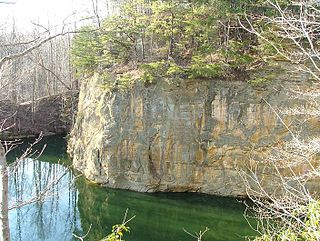
The Blackhand Gorge State Nature Preserve is a 4-mile-long (6.4 km) sandstone formation through which the Licking River flows in Licking County, Ohio, United States. Located 12 miles (19 km) east of Newark near the tiny town of Toboso, 957 acres (387 ha) along the gorge were designated an Ohio Nature Preserve in 1975. The gorge is a capsule of Ohio transportation history, having hosted canal boats, steam railroads, electric interurbans, and automobiles through the years. It is named for the black hand petroglyph that was found on the cliff face by the first settlers to the area. Black Hand Sandstone is a resistant rock that also forms the backbone of the Hocking Hills region.
The O'Shaughnessy Dam is located on the Scioto River near Dublin, Ohio, United States. The dam forms O'Shaughnessy Reservoir, which is a major source of drinking water for the city of Columbus. It was completed in 1925 following recommendations of then superintendent Jerry O'Shaughnessy. At the time, the reservoir was described as "the finest inland waterway in the United States." Located 10 miles (16 km) upstream of the smaller Griggs Dam, it provides a large area for various forms of recreation in addition to its water supply duties. The reservoir holds 6.3 billion US gallons (24,000,000 m3) over a surface area of 845 acres (3.42 km2). The Columbus Zoo and Aquarium is located on the east bank of the reservoir, near the dam.

Thorn Township is one of the fourteen townships of Perry County, Ohio, United States. The 2020 census found 4,555 people in the township.

The Beaver and Erie Canal, also known as the Erie Extension Canal, was part of the Pennsylvania Canal system and consisted of three sections: the Beaver Division, the Shenango Division, and the Conneaut Division. The canal ran 136 miles (219 km) north–south near the western edge of the state from the Ohio River to Lake Erie through Beaver County, Lawrence County, Mercer County, Crawford County, and Erie County, Pennsylvania.
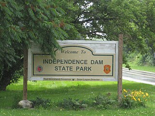
Independence Dam State Park is a 591-acre (239 ha) public recreation area located on the banks of the Maumee River three miles east of Defiance in Defiance County, Ohio, United States. The state park features ruins of the Miami and Erie Canal. Recreational features include boating, fishing, hiking, picnicking, and primitive camping.

Mary Jane Thurston State Park is a 105-acre (42 ha) public recreation area one mile west of Grand Rapids in Wood and Henry counties, Ohio, United States. The state park lies along the south bank of the Maumee River near remains of the historic Miami and Erie Canal. It is named for Mary Jane Thurston, a schoolteacher from Grand Rapids who bequeathed land for the establishment of a park. The park's year-round recreation includes hunting, fishing, boating, picnicking, and camping.

State Route 360 (SR 360) is a short east–west route in Buckeye Lake, Ohio. SR 360 starts and ends at SR 79, paralleled to the shore of Buckeye Lake. The route was designated in 1938, and has not changed significantly since.

Mosquito Creek Lake is a reservoir in Trumbull County, northeast Ohio, in the United States. It is approximately 6 miles (9.7 km) northeast of Warren. The lake is fed by Mosquito Creek and Walnut Creek. Construction was completed in 1944.
This is a list of high school athletic conferences in the Central Region of Ohio, as defined by the OHSAA. Because the names of localities and their corresponding high schools do not always match and because there is often a possibility of ambiguity with respect to either the name of a locality or the name of a high school, the following table gives both in every case, with the locality name first, in plain type, and the high school name second in boldface type. The school's team nickname is given last.
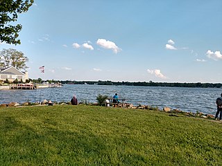
Buckeye Lake State Park is a public recreation area in Fairfield, Licking and Perry counties, Ohio in the United States. The park consists of a 3,349 acres (1,355 ha) of shore areas, islands, and water. Shore areas and islands include Brooks Park, Fairfield Beach, Liebs Island, Mud Island and North Shore. Activities include boating, fishing, swimming, picnicking, wildlife observation. and winter recreation. Wildlife visible in or from the park include cormorants, herons, bald eagles, osprey, and numerous waterfowl.
Thornport is a census-designated place in Perry County, in the U.S. state of Ohio. It is two miles north of Thornville and 22 miles north of the county seat of New Lexington. The population was 1,120 at the 2020 census.

Margerie Lake Reservoir is a 244 acre lake in Danbury and New Fairfield, Connecticut. It is a source of public drinking water, maintained by the Danbury Water Department. It has a watershed of 2,942 acres.

Cranberry Bog State Nature Preserve, which is located in Buckeye Lake in Licking County, Ohio, is the only floating island bog in the world. Once known as the “Big Swamp,” it is significant to Ohio, evidenced by its designation as one of the state's first National Natural Landmarks in October 1968 and its classification as a State Nature Preserve in 1977. This nature preserve is one of the remnants left behind by Ohio's glacial activity, and as its name suggests, large quantities of cranberries can still be found on the bog today. This island is also home to various other plant and animal species and serves as a tourist attraction that can be visited by the public.