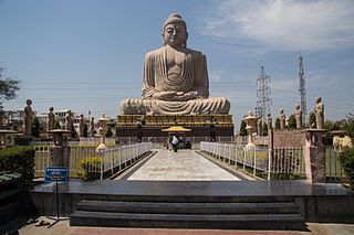
Gaya is of historical significance and is one of the major tourist attractions of the state of Bihar. Gaya is 100 kilometres (62 mi) south of Patna, the capital city of Bihar. It is the state's second-largest city, with a population of 470,839, and is the headquarters of Gaya district and Magadh division. The city is surrounded on three sides by small, rocky hills, with the Phalgu River on its fourth (eastern) side.

Hazaribagh is a city and a municipality in Hazaribagh district in the Indian state of Jharkhand. It is the divisional headquarters of North Chotanagpur division. It is famous as a health resort and for Hazaribag Wildlife Sanctuary. It is represented in the Indian Lok Sabha by its Member of Parliament Jayant Sinha.

Katihar is a city situated in the eastern part of the state of Bihar in India. It is the regional headquarter of Katihar district. It is one of the larger cities of Bihar and is known all over East India for its highly strategic railway junction.

Purnia is a city that serves as the administrative headquarters of both Purnia district and Purnia division in the Indian state of Bihar. It is the largest city in northeastern Bihar also known as Kosi- Seemanchal area. Total geographical area of Purnia municipal corporation is 92 sq.km. which is next only to Patna. Population density of the city is 3058 persons per km sq. making it the 5th largest city of Bihar. It is nearly 302 kilometres from Patna, as well as 171 km from Siliguri, 90 km from Bhagalpur.It is 640 km from Guwahati (Approx.) and 450 km from Kolkata, the capital of the adjacent state of West Bengal and the largest city in East India. Purnia district covers 3202.31 sq. km of the state of Bihar. The Indian Army, Indian Air Force, and three of five branches of India's Central Armed Police Forces – the Border Security Force (BSF), the Sashastra Seema Bal (SSB), and the Indo-Tibetan Border Police (ITBP) – have bases around the district.
Hajipur ( Hājīpur) is the largest city and headquarters of Vaishali district of Tirhut Division in the Indian state of Bihar. Hajipur is the 10th leading city and 17th most populous city of Bihar, making it the second-fastest developing city, next to Patna. It had a total population of 1.47 lakh as per census 2011. Vaishali district is ranked 8th on a list of 38 districts in Bihar in terms of growth.
Danapur is a satellite town of Patna in Bihar state of India. The population was 182,241 at the 2011 India Census. It is part of the Patna Metropolitan Region. It was constituted as a municipality in 1887. Danapur is also a shelter and hatchery for the migrating Siberian cranes, locally called Janhgil. They visit every year during the monsoon season for breeding and leave this place before the start of the winter season. The Sub-Area Headquarters of Bihar and Jharkhand is situated in the army cantonment here. Danapur is part of Danapur and Pataliputra

Nawada district is one of the thirty-eight districts of the Indian state of Bihar. Nawada is its administrative headquarters. The district is the easternmost district of the Magadh division, one of the nine administrative divisions of Bihar. The area of the modern district was historically part of the Magadha, Shunga and Gupta empires. Koderma and Giridih districts of the state of Jharkhand lie on the southern border of the district; it also shares borders with the Gaya, Nalanda, Sheikhpura, and Jamui districts of Bihar.

Bakhtiyarpur is a block and a notified area in Patna district in the state of Bihar, India. Bakhtiyarpur is under the Patna Sahib, and is a Vidhan Sabha constituency of Bihar in Patna District under the Barh sub-division of Bihar. It is a major railway junction in Danapur railway division, ECR. The incumbent Chief Minister of Bihar, Nitish Kumar belongs to Bakhtiyarpur.

Ramgarh district is one of the 24 districts in the Indian state of Jharkhand. It was also a military district during the British Regime, referred to then as Ramghur district.

Shivpuri is a neighbourhood in Patna, capital of Bihar, India.
Dayalpur Sapha is a village in Hajipur, Vaishali, in the state of Bihar. It has existed since around 1500 AD.
Bailey Road is a road and neighbourhood in Patna, India. It connects Patna with Danapur. It roughly starts from Income Tax Golambar and ends in Danapur, running through the heart of the city. It is one of the most important roads in the city. Many important landmarks like Patna High Court, Patna Women's College, Patna Secretariat, Patna Zoo, Patna Airport, Bihar Museum etc. are situated beside or near to this road. Bailey Road was officially renamed as Jawahar Lal Nehru Marg, but this road is still widely known as Bailey Road. This area is served by Shastrinagar Police Station of Patna Police.

Patliputra Junction, station code PPTA, is a railway station in the Rukanpura area in the West End of Patna, Bihar. The station, which is governed by East Central Railway and managed by Danapur railway division, lies on the Patna-Sonepur-Hajipur Section. Located 12 kilometres north-west of Patna Junction, it has primarily been developed to ease pressure on the city's other two railway stations, through which roughly 350 trains pass daily. It is located near Bailey Road, an important western thoroughfare in Patna.

Digha is a residential neighbourhood in Patna. The area is served by Digha PS under Patna Police. Digha is mostly known for the "Ghats" mean place near ganga river. Digha is also known for Rnet Software's, ITI college and WITI college. It comes under Digha .There is a colony named haripur colony. its very old colony but still not anyone knows about it. The JP Setu or Digha Rail-Road Bridge is started from Digha to Sonpur which is connecting Patna to Sonpur. Digha is now become the first destination for peoples who entered in Patna from other district of Bihar from Sonpur route.
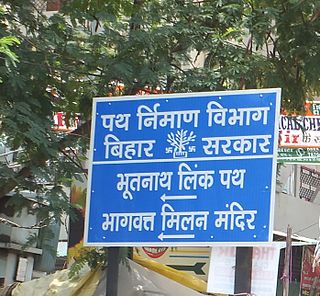
Bhootnath Road area is a neighbourhood and residential area in Patna. The area is served by Agamkuan Police Station under Patna Police and Bahadurpur Housing Colony Post Office. This road is a State Highway and also act as a linking road between Patna Main Road and Bypass Road. So this make this road one of the busiest road of Patna. TV Tower of Patna is located near this Road.
Kidwaipuri also known as P&T colony, is a neighbourhood of Patna. It is centrally located residential colony of Patna, adjacent to Nageshwar Colony. Sri Krishna Nagar, Buddha colony and Patna Women's College mark other boundaries of Kidwaipuri. This area is under the jurisdiction of Kotwali police station of Patna Police.
Exhibition Road is one of the most important thoroughfare in Patna, Bihar, India. It is a commercial center located in the heart of the city. It connects Gandhi Maidan Marg with the Chiraiyatand Flyover. It runs in parallel to the Frazer Road, east to the New Dak Bungalow.
Patliputra colony is a housing cooperative society in Patna, the capital city of Bihar. The Society was formed in 1954 and was meant to be a housing society for Government Officials only, consisting of both residential and business settlements. It is surrounded by the Kurji- Rajapur road on one side and the Bailey Road and Gosain Tola on the other and by New Patliputra colony and Rajeev Nagar on one side. The area is served by Patliputra colony police station under Patna Police. Patliputra Colony is managed by a housing cooperative society, known as Patliputra Cooperative Society and is not a part of Patna Municipal Corporation.
Serpentine Road, officially Daroga Prasad Rai Path, is major thoroughfare, which runs through the upscale part of Western Patna in India. Serpentine Road is a residential street, which connects Hartali Mor and Beer Chand Patel Marg. The area is served by Shastrinagar Police Station under Patna Police.