Buffalo Township, Illinois

Last updated

Buffalo Township
Map highlighting Buffalo Township, Ogle County, Illinois.svg
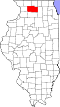
Location in Ogle County
Coordinates: 41°59′08″N89°34′12″W / 41.98556°N 89.57000°W / 41.98556; -89.57000
Country Flag of the United States (23px).png  United States
State Flag of Illinois.svg Illinois
County Ogle
EstablishedNovember 6, 1849
Government
  SupervisorPhillip Fossler
Area
  Total
33.67 sq mi (87.2 km2)
  Land33.67 sq mi (87.2 km2)
  Water0 sq mi (0 km2)  0%
Elevation
863 ft (263 m)
Population
 (2010)
  Estimate 
(2016) [1]
2,668
  Density83.5/sq mi (32.2/km2)
Time zone UTC-6 (CST)
  Summer (DST) UTC-5 (CDT)
ZIP code
61064
FIPS code 17-141-09421

Buffalo Township is one of twenty-four townships in Ogle County, Illinois, USA. As of the 2010 census, its population was 2,813 and it contained 1,284 housing units. [2]

Contents

Geography

According to the 2010 census, the township has a total area of 33.67 square miles (87.2 km2), all land. [2] It contains the city of Polo and the unincorporated town of Buffalo Grove.

Cemeteries

The township contains these four cemeteries: Buffalo Grove, Fairmount, Reed and Saint Mary's.

Demographics

Historical population
CensusPop.Note
2016 (est.)2,668 [1]
U.S. Decennial Census [3]

School districts

Political districts

References

  1. 1 2 "Population and Housing Unit Estimates" . Retrieved June 9, 2017.
  2. 1 2 "Population, Housing Units, Area, and Density: 2010 - County -- County Subdivision and Place -- 2010 Census Summary File 1". United States Census. Archived from the original on February 12, 2020. Retrieved May 28, 2013.
  3. "Census of Population and Housing". Census.gov. Retrieved June 4, 2016.