
Santa Monica is a beachfront city in western Los Angeles County, California, United States. Situated on Santa Monica Bay, it is bordered on three sides by the city of Los Angeles – Pacific Palisades to the north, Brentwood on the northeast, West Los Angeles on the east, Mar Vista on the southeast, and Venice on the south. The 2010 U.S. Census population was 89,736. Due in part to an agreeable climate, Santa Monica became a famed resort town by the early 20th century. The city has experienced a boom since the late 1980s through the revitalization of its downtown core, significant job growth and increased tourism. The Santa Monica Pier and Pacific Park remain popular destinations.

The Scooby Gang, or the "Scoobies", are a group of characters in the cult television series and comic book Buffy the Vampire Slayer who battle the supernatural forces of evil. The team consists of Buffy Summers and her friends and colleagues who assist her in her duties as the Slayer. First forming in the Season One episode "The Harvest" to prevent The Master from opening a portal to hell, the line-up of the group varied from year to year, but the core that remained intact throughout the series' run was Buffy herself and her best friends, Xander Harris and Willow Rosenberg, as well as her Watcher, Rupert Giles. This group was also called the "slayerettes".

Buffy the Vampire Slayer is an American supernatural drama television series based on the 1992 film of the same name. It was created by Joss Whedon under his production tag, Mutant Enemy Productions, with later co-executive producers being Jane Espenson, David Fury, David Greenwalt, Doug Petrie, Marti Noxon, and David Solomon.

Sunnydale is the fictional setting for the U.S. television drama Buffy the Vampire Slayer (1997-2003). Series creator Joss Whedon conceived the town as a representation of a generic California city, as well as a narrative parody of the all-too-serene towns typical in traditional horror films.
State Route 2 (SR 2) is a state highway in the U.S. state of California that runs from the Los Angeles Basin and through the San Gabriel Mountains to the edge of the Victor Valley in the Mojave Desert. Officially, it begins at the intersection of Centinela Avenue in the City of Los Angeles limits adjacent to the city of Santa Monica and extends all the way to SR 138 east of Wrightwood. The highway currently is divided into three segments, and it briefly runs concurrently with U.S. Route 101 (US 101) and Interstate 210 (I-210) to connect the segments. The western section of the highway is an old routing of US 66; the eastern portion is known as the Angeles Crest Highway, while the middle section is known as the Glendale Freeway along with multiple surface streets around US 101.

Santa Monica College (SMC) is a public, community college in Santa Monica, California. Founded as a junior college in 1929, SMC enrolls over 30,000 students in more than 90 fields of study. Although initially serving primarily pre-college, high school students, the College quickly expanded its enrollment to educate college-age students and non-traditional students with the primary intention to transfer to a four-year university. It is one of the few schools which has high transfer rates to 4-year universities such as UCs or CSUs. Today, two-thirds of students at Santa Monica College are enrolled part-time. With over 2,000 employees, SMC is a major employer in the Greater Los Angeles Area and has a significant impact in the region's economy.

Little Armenia is a neighborhood in Central Los Angeles, California. It is named after the Armenians who escaped genocide and made their way to Los Angeles during the early part of the 20th century.

Wilshire Boulevard is one of the principal east-west arterial roads in the Los Angeles area of Southern California, extending 15.83 miles (25.48 km) from Ocean Avenue in the city of Santa Monica east to Grand Avenue in the Financial District of downtown Los Angeles. It is also one of the major city streets through the city of Beverly Hills. Wilshire Boulevard runs roughly parallel with Santa Monica Boulevard from Santa Monica to the west boundary of Beverly Hills. From the east boundary it runs a block south of Sixth Street to its terminus.
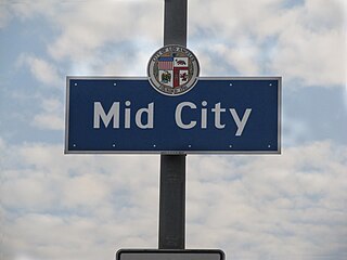
Mid-City is a neighborhood in Central Los Angeles, California.

Sepulveda Boulevard is a major street and transportation corridor in the City of Los Angeles and several other cities in western Los Angeles County, California. It is around 42.8 miles (68.9 km) in length, making it the longest street in the city and county of Los Angeles. Parts of the boulevard are known as areas of prostitution.

The Los Angeles Railway was a system of streetcars that operated in Central Los Angeles and surrounding neighborhoods between 1901 and 1963. It operated on 3 ft 6 in narrow gauge tracks. The company carried many more passengers than the Pacific Electric Railway's Red Cars, which served a larger area of Los Angeles.

Olympic Boulevard is a major arterial road in Los Angeles, California. It stretches from Ocean Avenue on the western end of Santa Monica to East Los Angeles—farther than Wilshire Boulevard and most other streets.
Pico Boulevard is a major Los Angeles street that runs from the Pacific Ocean at Appian Way in Santa Monica to Central Avenue in Downtown Los Angeles, California, USA. It is named after Pío Pico, the last Mexican governor of Alta California.

Highland Avenue is a north/south road in Los Angeles. It is a major thoroughfare that runs from Cahuenga Boulevard and the US 101 Freeway in Hollywood from the north end to Olympic Boulevard in Mid-City Los Angeles on the south end. Highland then is a small residential street from Olympic Boulevard south to Adams Boulevard. For through access, Highland swerves west into Edgewood Place which accesses La Brea Avenue.

Western Avenue is a major four-lane street in the city of Los Angeles and through the center portion of Los Angeles County, California. It is one of the longest north–south streets in Los Angeles city and county, apart from Sepulveda Boulevard. It is about 29 miles (47 km) long. The avenue is known for prostitution, primarily between Melrose Avenue and 2nd Street.
Centinela Avenue is a major street in the Westside region of Los Angeles County, California.
The western border of Santa Monica, California is the 3-mile (4.8 km) stretch of Santa Monica Bay. On its other sides, the city is bordered by various districts of Los Angeles: the northwestern border is Pacific Palisades, the eastern border is Brentwood north of Wilshire Boulevard and West Los Angeles south of Wilshire, the northeastern border is generally San Vicente Boulevard up to the Riviera Country Club, the southwestern border is Venice Beach and the southern border is with West Los Angeles and Mar Vista.

Temple Street is a street in the City of Los Angeles, California. The street is an east-west thoroughfare that runs through Downtown Los Angeles parallel to the Hollywood Freeway between Virgil Avenue past Alameda Street to the banks of the Los Angeles River. It was developed as a simple one-block long lane by Jonathan Temple, a mid-19th Century Los Angeles cattle rancher and merchant.
Abraham Wesley Eager (1864–1930) was a Canadian-American architect. He designed many houses in Los Angeles, California.

