Steelville is a city in Crawford County, Missouri, United States. The population was 1,472 at the 2020 census. It is the county seat of Crawford County. Steelville is the hometown of Congressman Albert Reeves and Missouri State Representative Jason Chipman. The town was named after the landowner James Steel.

Ironton is a city in Iron County, Missouri, United States. The population was 1,475 at the 2020 census. It is the county seat of Iron County, and is located 12 miles south of Belgrade.

Fredericktown is a city in and the county seat of Madison County, Missouri, United States, in the northeastern foothills of the St. Francois Mountains. The population was 4,429 at the 2020 census. The city is surrounded on three sides by the easternmost parcel of the Mark Twain National Forest.
Bixby is an unincorporated community in western Iron County, Missouri, United States. It is located at the western intersection of Routes 32 and 49, approximately 22 miles east of Salem.

Valles Mines is an unincorporated community in southern Jefferson County, Missouri, United States. It is located approximately seven miles south of De Soto. It is located on Missouri Route V less than one mile west of U.S. Route 67. Joachim Creek flows past the north side of the community. The ZIP Code for Valles Mines is 63087.
Belleview is an unincorporated community in northern Iron County, Missouri, United States. It is located about eight miles northwest of Ironton on Route 21 and is approximately three miles south of Belgrade and Caledonia. Belleview is located near Elephant Rocks State Park and is near the Mark Twain National Forest.

Middlebrook is an unincorporated community on the Iron County/St. Francois County line in the U.S. state of Missouri. It is located approximately six miles north of Ironton, four miles east of Belleview, and seven miles southeast of Belgrade and Caledonia.

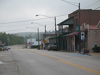
Cadet is an unincorporated community in Union Township in eastern Washington County, Missouri, United States. Cadet is located on Missouri Route 47 between Old Mines to the west and Bonne Terre to the southeast. The village is approximately 6 miles (10 km) northeast of Potosi.

Florence is a census-designated place in and the county seat of Florence County, Wisconsin, United States. Florence is located in northern Florence County, in the town of Florence. Florence has a post office with ZIP code 54121. The community was named a census-designated place in 2010. As of the 2010 census, its population was 592.
Leadmine is an unincorporated community in northern Dallas County, in the U.S. state of Missouri. The community is located about 3.5 miles east of Tunas on Missouri Route E. The Lead Mines Conservation Area lies one-half mile to the east. It is approximately 50 miles north-northeast of Springfield.
Banner is an unincorporated community in northern Iron County, in the U.S. state of Missouri.
Chloride is an unincorporated community in Iron County, in the U.S. state of Missouri. Chloride is located on Big Creek along Missouri Route 49. The community is approximately 1.5 miles south of the lead smelter at Glover.
Ghermanville is an unincorporated community in northeastern Iron County, in the U.S. state of Missouri. The community was located approximately one-half mile east of Graniteville adjacent to Missouri Route 21.
Good Water is an unincorporated community in northwest Iron County, in the U.S. state of Missouri.
Graniteville is an unincorporated community in northeast Iron County, in the U.S. state of Missouri. The community is located on Missouri Route 21 approximately three-quarters of a mile east of Elephant Rocks State Park. Pilot Knob is about three miles to the southeast.
Hogan is an unincorporated community in Iron County, in the U.S. state of Missouri.
Minimum is an unincorporated community in southeastern Iron County, in the U.S. state of Missouri.
Strother Creek is a stream in southwest Iron and northern Reynolds counties in the U.S. state of Missouri. It is a tributary to the Middle Fork of the Black River.
Silver Mine is an unincorporated community in northwest Madison County, in the U.S. state of Missouri.
Oates is an unincorporated community in northern Reynolds County, in the U.S. state of Missouri. The community is located on Brushy Creek st the intersection of Missouri Route J and county road 836. Nearby communities include Black, approximately seven miles to the east-southeast on the Middle Fork of the Black River and Buick, about six miles to the northwest in Iron County.


