Glover, Missouri | |
|---|---|
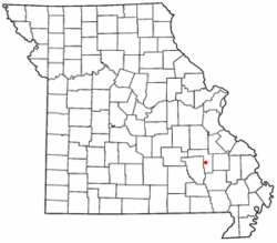 Location of Glover within Missouri | |
| Coordinates: 37°29′11″N90°41′28″W / 37.48639°N 90.69111°W | |
| Country | United States |
| State | Missouri |
| County | Iron |
| Elevation | 850 ft (260 m) |
| Time zone | UTC-6 (Central (CST)) |
| • Summer (DST) | UTC-5 (CDT) |
| Area code | 573 |
| GNIS feature ID | 750053 [1] |
Glover is an unincorporated community in southern Iron County, Missouri, United States. [1] It is located on Route 49, approximately eight miles south of Ironton. [2]
A post office called Glover was established in 1888, and remained in operation until 1991. [3] The community has the name of John Milton Glover, a state legislator. [4]
The lead smelter at Glover was operated by Doe Run Company and was a major local employer until operations were indefinitely suspended in 2003. [5]
