Gimhae International Airport is located on the western end of Busan, South Korea. Opened in 1976, the airport is named after the nearby city of Gimhae. A new international terminal opened on October 31, 2007. Gimhae International Airport is the main hub for Air Busan, and a focus city for Jeju Air, Jin Air and Korean Air. Runway 18L/36R is used for military purposes only for Gimhae Air Base, but due to increasing traffic, there are plans to open the runway for airliners. In 2018, 17,064,613 passengers used the airport.

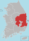
North Gyeongsang Province is a province in eastern South Korea, and with an area of 19,030 km2 (7,350 sq mi), it is the largest province in the Korean peninsula. The province was formed in 1896 from the northern half of the former Gyeongsang province, and remained a province of Korea until the country's division in 1945, then became part of South Korea.
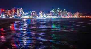
Pohang, formerly spelled Po-Hang, is the largest city in North Gyeongsang Province, South Korea, with a population of 499,363 as of 2022, bordering the Sea of Japan to the east, Yeongcheon to the west, Gyeongju to the south, and Cheongsong and Yeongdeok to the north.
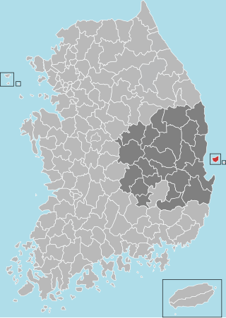
Ulleung County is a county in North Gyeongsang Province, South Korea.

Buk District is a gu, or district, in north central Ulsan, South Korea. Its name literally means "North Ward". It stretches roughly from the Ring Road to Mohwa into the north and out to the coast in the east.

Buk District (Buk-gu) is a district situated in the northern part of the city of Gwangju, South Korea. It is similar to a ward in the United States. The district is by far the most populated district in Gwangju, and elects two lawmakers for the South Korean National Assembly. Gwangju Station is here.

Buk District is a district in northwestern Daegu, South Korea. It adjoins Chilgok County on the north. The area is 93.99 km2. The population is about 444,923.
Buk-gu,, or "Northern District", is the name of a gu in several South Korean cities:
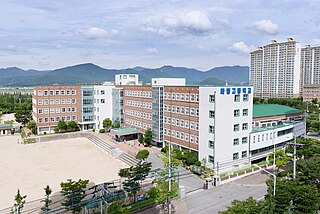
Buk District is a gu, or district, in north central Busan, South Korea. Buk-gu covers a surface of 38.30 km2 is home to about 335,000 people. It attained the status of gu in 1978.

Bupyeong District is one of the 10 administrative divisions that comprise Incheon, South Korea. Bupyeong-gu comprises an area of 12.35 square miles, and has a population of 508,587. It is located north of Namdong-gu, east of Seo-gu, and south of Gyeyang-gu. The city of Bucheon, in neighboring Gyeonggi Province, comprises its eastern limit.
Cheongha or Chungha may refer to:
Korea Polytechnics (Korean: 한국폴리텍대학) mean two or three-years public vocational school in South Korea. It has 11 colleges in 34 cities.

Ulju County is a county occupying much of western Ulsan, South Korea.

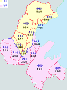
Nam-gu is a non-autonomous district in the City of Pohang in North Gyeongsang Province, South Korea. Its name literally means "South District" as it is one of two districts in the city, the other being Buk-gu or "North District".

Geumseong is a dong, or precinct, in Geumjeong-gu, Busan, South Korea. A lightly populated district, it is situated entirely within the mountain range of Geumjeongsan. It is bounded to the west by Hwamyeong-dong and Geumgok-dong in Buk District, to the northwest by Dong-myeon of Yangsan City, to the east by Cheongnyong-dong, Namsan-dong, Guseo-dong, and Jangjeon-dong of Geumjeong-gu, and to the south by Oncheon-dong in Dongnae-gu. The northernmost point in Geumseong-dong is at Godang-bong, the highest peak in Geumjeongsan.

Guryongpo is a town, or eup in Nam-gu, Pohang, North Gyeongsang Province, South Korea. The township Changju-myeon was upgraded to the town Guryongpo-eup in 1942. Guryongpo Town Office is located in Hudong-ri.
Yeonil is a town, or eup in Nam-gu, Pohang, North Gyeongsang Province, South Korea. The township Yeonil-myeon had been upgraded to the town Yeonil-eup in 1980. Yeonil Town Office is located in Geojeong-ri.
Heunghae is a town, or eup in Buk-gu, Pohang, North Gyeongsang Province, South Korea. The township Uichang-myeon was upgraded to the town Uichang-eup in 1980, and it was renamed Heunghae-eup in 1983. Heunghae Town Office is located in Okseong-ri.
National Route 31 is a national highway in South Korea connects Gijang, Busan to Singosan, Anbyeon. Due to the separation of Korean peninsula, it de facto ends in Yanggu It established on 31 August 1971.

ROKS Pohang (PCC-756) was a Pohang-class corvette of the Republic of Korea Navy. She was decommissioned and now serves as a museum ship in Pohang, South Korea.


