Bukoba Urban District

Last updated
Bukoba Municipality
Manispaa ya Bukoba
Bukoba, Tanzania.png
Bukoba, Tanzania
Bukoba Municipal in Kagera 2022.svg
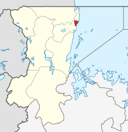
Bukoba municipality of Kagera Region
Coordinates: 1°20′00″S31°49′00″E / 1.333333°S 31.816667°E / -1.333333; 31.816667
CountryFlag of Tanzania.svg  Tanzania
Region Kagera Region
Established1960
Government
  TypeCouncil
  BodyBukoba Municipal Council
  MayorGodson Rwegasira
  DirectorHamid A. Njovu
  Deputy MayorMwajabu R.Galiatano
Area
  Total84.25 km2 (32.53 sq mi)
  Land61 km2 (24 sq mi)
  Water22 km2 (8 sq mi)
Elevation
1,150 m (3,770 ft)
Population
 (2022 census) [1]
  Total144,938
  Density1,700/km2 (4,500/sq mi)
Time zone EAT
Area code 028
Website Municipal Website

Bukoba Urban District is one of the eight districts of the Kagera Region of Tanzania. It is bordered to east by Lake Victoria and to the west by Bukoba Rural District. Its administrative seat is the town of Bukoba.

Contents

According to the 2012 Tanzania National Census, the population of Bukoba Urban District was 128,796, from 80,868 in 2002, and 46,503 in 1988. [2] [3] The district area is 83.25 square kilometres (32.14 sq mi), with a population density of 1,547 square kilometres (597 sq mi) [4] There are 14 wards and 66 neighborhoods within the municipality. [5]

Transport

Road

Paved trunk road T4 from Mwanza to the Ugandan border passes through Bukoba Urban District. [6]

Administrative subdivisions

As of 2022, Bukoba Urban District was administratively divided into 14 wards. [5]

Wards

  • Bakoba
  • Bilele
  • Buhemba
  • Hamugembe
  • Ijuganyondo
  • Kagondo
  • Kahororo
  • Kashai
  • Kibeta
  • Kitendaguroward
  • Miembeni
  • Nshambya
  • Nyanga
  • Rwamishenye

Related Research Articles

<span class="mw-page-title-main">Kagera Region</span> Region of Tanzania

Kagera Region is one of Tanzania's 31 administrative regions. The region covers an area of 35,686 km2 (13,778 sq mi). The region is comparable in size to the land area of the Netherlands. Kagera Region is bordered to the east by Lake Victoria, Mwanza Region and Mara Region. The region is bordered to the south by Geita Region and Kigoma Region. Lastly, Kagera borders Rwanda to the west, Uganda to the north and Burundi to the south west. The regional capital city is Bukoba. According to the 2022 national census, the region had 2,989,299, and 2012 the region had a population of 2,458,023.

<span class="mw-page-title-main">Kigoma Region</span> Region of Tanzania

Kigoma Region is one of Tanzania's 31 administrative regions. The regional capital is the city of Kigoma. Kigoma Region borders Kagera Region, Geita Region, Katavi Region, Tabora Region, DRC and Burundi According to the 2012 national census, the region had a population of 2,127,930, which was higher than the pre-census projection of 1,971,332. For 2002-2012, the region's 2.4 percent average annual population growth rate was tied for the fourteenth highest in the country. It was also the sixteenth most densely populated region with 57 people per square kilometer. With a size of 45,066 square kilometres (17,400 sq mi), the region is slightly smaller than Estonia.

<span class="mw-page-title-main">Muleba District</span> District of Kagera Region

Muleba is one of the six districts of the Kagera Region of Tanzania. It is bordered to the north by Bukoba Urban and Bukoba Rural districts, to the south by Biharamulo District, to the east by Lake Victoria and to the west by Ngara and Karagwe districts. The district covers area of 3,518 square kilometres (1,358 sq mi).

<span class="mw-page-title-main">Biharamulo District</span> District in Kagera Region, Tanzania

Biharamulo District is one of the eight districts of the Kagera Region of Tanzania. It is bordered to the north by Karagwe District and Muleba District, to the east and south by Geita Region, to the west by Ngara District, and to the southwest by the Kigoma Region. Its administrative seat is Biharamulo town. Biharamulo Game Reserve is located within the borders of the district.

<span class="mw-page-title-main">Ngara District</span> District of Kagera Region, Tanzania

Ngara District is one of the eight districts of the Kagera Region of Tanzania. It is bordered to the north by Karagwe District, to the east by Biharamulo District, to the south by the Kigoma Region, to the northeast by Muleba District and to the west by the countries of Rwanda and Burundi.

<span class="mw-page-title-main">Karagwe District</span> District of Kagera Region, Tanzania

Karagwe is one of the eight districts of the Kagera Region of Tanzania. It is bordered to the north by Uganda, to the east by the Bukoba Rural District, to the southeast by the Muleba District, to the south by the Ngara District and to the west by Republic of Rwanda, from which it is divided by the River Kagera. Small lakes such as the Ikimba, Burigi, Rushwa, and Rwakajunju provide fishing opportunities for residents of the Karagwe District. The district covers and area of 5,134 square kilometres (1,982 sq mi).

<span class="mw-page-title-main">Bagamoyo District, Pwani</span> District in Pwani Region, Tanzania

Bagamoyo is one of the six districts of the Pwani Region of Tanzania. It is bordered to the north by the Tanga Region, to the west by the Morogoro Region, to the east by the Indian Ocean and to the south by the Kibaha District. The district capital is at Bagamoyo.

Hazina is an administrative ward in the Dodoma Urban district of the Dodoma Region of Tanzania. The ward covers an area of 8.584 square kilometres (3.314 sq mi).

<span class="mw-page-title-main">Geita Region</span> Region of Tanzania

Geita Region is one of Tanzania's 31 administrative regions. The region covers an area of 20,054 km2 (7,743 sq mi)."Geita Region Size". The region is comparable in size to the combined land area of the nation state of Slovenia. Geita Region is bordered to the east by Lake Victoria, Mwanza Region and Shinyanga Region. The region is bordered by Tabora Region and Kigoma Region to the south and south west respectively. Lastly, Gieta is borders Kagera Region to the west.

<span class="mw-page-title-main">Bukoba Rural District</span> District in Kagera Region, Tanzania

Bukoba Rural District is one of the eight districts of the Kagera Region of Tanzania. It is bordered to the north by Missenyi District, to the east by Lake Victoria and Bukoba Urban District, to the south by Muleba District and to the west by Karagwe District. Its administrative seat is Bukoba town.

<span class="mw-page-title-main">Kyerwa District</span> District of Kagera Region, Tanzania

Kyerwa District is one of the eight districts of the Kagera Region of Tanzania. It is one of the 20 new districts that were formed in Tanzania since 2010; it was split off from Karagwe District. It is bordered to the north by Uganda, to the east by Missenyi District, to the south by Karagwe District and to the west by Rwanda, and has an area of 2,575 square kilometres (994 sq mi).

<span class="mw-page-title-main">Missenyi District</span> District of Kagera Region, Tanzania

Missenyi District is one of the eight districts of the Kagera Region of Tanzania. The district was created in 2007, separating from Bukoba District. It is bordered to the north by Uganda, to the east by Bukoba Rural District, to the south by Karagwe District and to the west by Kyerwa District.

Chang'ombe is an administrative ward in the Dodoma Urban district of the Dodoma Region of Tanzania. The ward covers an area of 3.04 km2 (1.17 sq mi) with an average elevation of 1,141 m (3,743 ft).

<span class="mw-page-title-main">Kigoma Rural District</span> District of Kigoma Region, Tanzania

Kigoma District is one of the eight administrative districts of Kigoma Region in Tanzania. The district lies north of the city of Kigoma-Ujiji. Uvinza District, to the west and south of Ujiji, was split off from the Kigoma District in 1 July, 2013.

<span class="mw-page-title-main">Mtwara-Mikindani District, Mtwara</span> District of Mtwara Region, Tanzania

Mtwara Mikindani Municipal District Council is one of eight regional councils of the Mtwara Region in Tanzania. It is bordered to the north by the Lindi Region, to the east by the Indian Ocean and to the south and west by the Mtwara District. In 2016, the municipality has a total population of 113,732.

<span class="mw-page-title-main">Mwanga Kaskazini</span> Ward in Kigoma-Ujiji District, Kigoma Region

Mwanga Kaskazini is an administrative ward in Kigoma-Ujiji District of Kigoma Region in Tanzania. The ward covers an area of 3.7 km2 (1.4 sq mi), and has an average elevation of 803 m (2,635 ft). In 2016 the Tanzania National Bureau of Statistics report there were 26,620 people in the ward, from 24,184 in 2012.

Kipampa is an administrative ward in Kigoma-Ujiji District of Kigoma Region in Tanzania. The ward covers an area of 1.8 km2 (0.69 sq mi), and has an average elevation of 777 m (2,549 ft). In 2016 the Tanzania National Bureau of Statistics report there were 8,714 people in the ward, from 7,917 in 2012.

<span class="mw-page-title-main">Simbo, Kigoma</span> Ward in Kigoma District, Kigoma Region

Simbo is an administrative ward in Kigoma Rural District of Kigoma Region in Tanzania. Prior to 2014 the ward was in the Uvinza District before moving to the Kigoma District.

<span class="mw-page-title-main">Msalala District</span> District in Shinyanga, Tanzania

Msalala District is a district council in the Shinyanga Region of Tanzania's lake zone established in 2012. The district lies in the middle of the region just north-east of the town of Kahama.

<span class="mw-page-title-main">Ushetu District</span> District in Shinyanga, Tanzania

Ushetu District is a district council in the Shinyanga Region of Tanzania's lake zone established in 2012. The district lies in west most portion of the region just south and west of the town of Kahama.

References

  1. Citypopulation.de Population of Bukoba municipality
  2. "2002 Census Analytical Report". Tanzania National Bureau of Statistics (in Swahili). Dodoma, Tanzania: National Bureau of Statistics (Tanzania). p. 17. Retrieved 2 July 2022.
  3. "Tanzania National Census 2012". National Bureau of Statistics. Dodoma, Tanzania. March 2013. p. 163. Retrieved 1 July 2022.
  4. "Kagera Region in Tanzania". City Population. Retrieved 2 July 2022.
  5. 1 2 "Halmashauri ya Manispaa ya Bukoba" [Bukoba Municipal Council]. Ofisi ya Rais, Tawala za Mikoa na Serikali za mitaa (in Swahili). Bukoba, Tanzania: Halmashauri ya Manispaa ya Bukoba. Retrieved 2 July 2022.
  6. "Kagera Roads Network" (PDF). Tanroads. Archived from the original (PDF) on 23 February 2016. Retrieved 16 February 2016.