
Slavošovce is a small village and municipality in the Rožňava District in the Košice Region of middle-eastern Slovakia.

Əcəxuroba is a village in the Qusar Rayon of Azerbaijan. The village forms part of the municipality of Əcəxur.
Zardoni is a village in the Lerik Rayon of Azerbaijan. The village forms part of the municipality of Tikəbənd.

Podoblin is a village in the administrative district of Gmina Maciejowice, within Garwolin County, Masovian Voivodeship, in east-central Poland. It lies approximately 4 kilometres (2 mi) north-west of Maciejowice, 22 km (14 mi) south of Garwolin, and 67 km (42 mi) south-east of Warsaw.

Stary Olsztyn is a village in the administrative district of Gmina Purda, within Olsztyn County, Warmian-Masurian Voivodeship, in northern Poland. It lies approximately 11 kilometres (7 mi) west of Purda and 8 km (5 mi) south of the regional capital Olsztyn. It is located within the historic region of Warmia.

Bogojevići is a village in the municipality of Arilje, Serbia. According to the 2011 census, the village has a population of 634 people.
Dragojevac is a village in the municipality of Arilje, Serbia. According to the 2011 census, the village has a population of 264 people.
Bozhan (village) is a village in Tervel Municipality, Dobrich Province, in northeastern Bulgaria.
Pšanik is a village in the municipality of Lučani, Serbia. According to the 2011 census, the village has a population of 179 people.
Borovo is a village in the municipality of Kraljevo, western-central Serbia. According to the 2002 census, the village has a population of 174 people.
Bresnik is a village in the municipality of Kraljevo, western-central Serbia. According to the 2002 census, the village has a population of 184 people.
Čibukovac is a suburban settlement in the municipality of Kraljevo, western-central Serbia. According to the 2002 census, the village has a population of 1114 people.
Dedevci is a village in the municipality of Kraljevo, western-central Serbia. According to the 2002 census, the village has a population of 341 people.
Dragosinjci is a village in the municipality of Kraljevo, western-central Serbia. According to the 2002 census, the village has a population of 672 people.
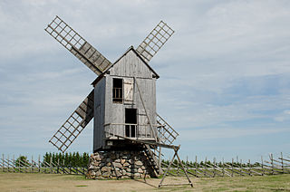
Angla is a village in Saaremaa Parish, Saare County in western Estonia.

Gradac is a village in the municipality of Raška, Serbia. According to the 2002 census, the village has a population of 368 people.
Vlakča is a village in the municipality of Stragari, Serbia. According to the 2002 census, the village has a population of 671 people.
Babayevo is the name of several inhabited localities in Russia.

The Loaita Bank10°45′N114°30′E is one of the significant maritime features in the Spratly Islands. It is about 20 nautical miles long on its NE-SW axis, and extends from Loaita Island to the NW of Dangerous Ground.
Abdita is a Syrian village located in Ihsim Nahiyah in Ariha District, Idlib. According to the Syria Central Bureau of Statistics (CBS), Abdita had a population of 1440 in the 2004 census.
