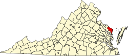
Bundick, Virginia

Last updated

Bundick is an unincorporated community in Northumberland County, in the U.S. state of Virginia.

Related Research Articles

<span class="mw-page-title-main">Jackson Township, Tioga County, Pennsylvania</span> Township in Pennsylvania, United States

Jackson Township is a township in Tioga County, Pennsylvania, United States. The population was 1,880 at the 2020 census.

<span class="mw-page-title-main">Onley, Virginia</span> Town in Virginia, United States

Onley is a town in Accomack County, Virginia, United States. The population was 516 at the 2010 census.

<span class="mw-page-title-main">Middle Peninsula</span> Region of Virginia

The Coan River is a 7.5-mile-long (12.1 km) river in Virginia's Northern Neck region. It is a tributary of the Potomac River. It flows from its source in Heathsville through Northumberland County and into the Potomac between Lewisetta and Walnut Point.

<span class="mw-page-title-main">Masonville, Colorado</span> Unincorporated community in Colorado, United States

Masonville is an unincorporated community and a U.S. Post Office in Larimer County, Colorado, United States. The Masonville Post Office has the ZIP Code 80541.

George J. Hatfield State Recreation Area is a state park unit on the Merced River Merced County, California. It is located in the San Joaquin Valley about 20 miles (32 km) south of Modesto.

Silver Beach is an unincorporated community in Northampton County, Virginia, United States.

<span class="mw-page-title-main">Yorktown Formation</span> Geological Formation in the United States

The Yorktown Formation is a mapped bedrock unit in the Coastal Plain of Maryland, Virginia, North Carolina and South Carolina. It is overconsolidated and highly fossiliferous.

Georgetown is an unincorporated community in Northumberland County, in the U.S. state of Virginia.

Hardings is an unincorporated community in Northumberland County, in the U.S. state of Virginia.

Lara is an unincorporated community in Northumberland and Richmond counties, in the U.S. state of Virginia.

<span class="mw-page-title-main">Lottsburg, Virginia</span>

Lottsburg is an unincorporated community in Northumberland County, in the U.S. state of Virginia.

Luttrellville is an unincorporated community in Northumberland and Richmond counties, in the U.S. state of Virginia.

Mila is an unincorporated community in Northumberland County, in the U.S. state of Virginia. Mila is located at 37°50′32″N76°19′39″W.

Rainswood is an unincorporated community in Northumberland and Richmond counties, in the U.S. state of Virginia.

<span class="mw-page-title-main">Eagle Village, Indiana</span> Unincorporated community in Indiana, United States

Eagle Village is an unincorporated community in Eagle Township, Boone County, in the U.S. state of Indiana.

Jarvisville is an unincorporated community in Harrison County, in the U.S. state of West Virginia.

Tilden is an unincorporated community in Dallas County, in the U.S. state of Missouri. The community was on Missouri Route MM approximately two miles west of Windyville. The Niangua River flows past just over one mile to the south of the location.

Oyer is an unincorporated community in St. Clair County, in the U.S. state of Missouri.

Border City is a hamlet on the border of the City of Geneva in Ontario County and the Town of Waterloo in Seneca County, New York, United States, near Seneca Lake. It dates back to 1788 when the Pre-Emption Line was drawn from the Pennsylvania border to Lake Ontario, thus creating Upstate New York. The "Border" referred to is the former Massachusetts and New York border. It is when Phelps & Gorham secured the purchase of 6+ million acres from the Commonwealth of Massachusetts that the State of New York that we now know was created. It is located just east of Geneva, at an elevation of 463 feet. The primary cross roads where the hamlet is located are East North Street, Border City Road and Pre-Emption Street. U.S. Route 20 and N.Y. Route 5 passes just south of Border City.

References

37°57′38″N76°29′14″W / 37.96056°N 76.48722°W / 37.96056; -76.48722