Burlington Township, Bradford County, Pennsylvania

Last updated

Burlington Township, Pennsylvania
Luther's Mill Covered Bridge - Pennsylvania.jpg
Luther's Mill Covered Bridge
Map of Burlington Township, Bradford County, Pennsylvania Highlighted.png
Map of Bradford County with Burlington Township highlighted
Map of Pennsylvania highlighting Bradford County.svg
Map of Bradford County, Pennsylvania
Country United States
State Pennsylvania
County Bradford
Settled1790
Incorporated1802
Area
[1]
  Total25.28 sq mi (65.48 km2)
  Land25.07 sq mi (64.92 km2)
  Water0.21 sq mi (0.55 km2)
Population
 (2010)
  Total791
  Estimate 
(2016) [2]
777
  Density31.00/sq mi (11.97/km2)
FIPS code 42-015-10248

Burlington Township is a township in Bradford County, Pennsylvania, United States. It is part of Northeastern Pennsylvania. The population was 791 at the 2010 census. [3] Children residing in the township are assigned to attend the Troy Area School District.

Contents

Geography

Burlington Township is located in central Bradford County and is bordered by Smithfield Township to the north, Ulster Township to the northeast, North Towanda and Towanda townships to the east, Monroe Township touching the southeastern corner, Franklin Township to the south and West Burlington Township to the west. The borough of Burlington is bordered on the north, east, and south by Burlington Township and by West Burlington Township to the west.

U.S. Route 6 passes through the center of the township, following the valley of Sugar Creek, a tributary of the Susquehanna River. US 6 leads east to Towanda and west through Burlington borough to Troy.

According to the United States Census Bureau, the township has a total area of 25.3 square miles (65.5 km2), of which 25.1 square miles (64.9 km2) is land and 0.23 square miles (0.6 km2), or 0.84%, is water. [3]

Demographics

Historical population
CensusPop.Note
2010 791
2016 (est.)777 [2] −1.8%
U.S. Decennial Census [4]

As of the census [5] of 2000, there were 799 people, 297 households, and 226 families residing in the township. The population density was 31.8 inhabitants per square mile (12.3/km2). There were 385 housing units at an average density of 15.3/sq mi (5.9/km2). The racial makeup of the township was 98.75% White, 0.13% African American, 0.13% Native American, 0.13% Asian, and 0.88% from two or more races. Hispanic or Latino of any race were 0.38% of the population.

There were 297 households, out of which 32.0% had children under the age of 18 living with them, 63.0% were married couples living together, 8.8% had a female householder with no husband present, and 23.9% were non-families. 19.5% of all households were made up of individuals, and 8.4% had someone living alone who was 65 years of age or older. The average household size was 2.69 and the average family size was 3.09.

In the township the population was spread out, with 26.3% under the age of 18, 6.8% from 18 to 24, 25.8% from 25 to 44, 28.7% from 45 to 64, and 12.5% who were 65 years of age or older. The median age was 39 years. For every 100 females, there were 104.3 males. For every 100 females age 18 and over, there were 99.0 males.

The median income for a household in the township was $35,724, and the median income for a family was $40,536. Males had a median income of $26,667 versus $20,882 for females. The per capita income for the township was $16,946. About 11.1% of families and 9.9% of the population were below the poverty line, including 11.9% of those under age 18 and 1.4% of those age 65 or over.

Related Research Articles

<span class="mw-page-title-main">Albany Township, Bradford County, Pennsylvania</span> Township in Pennsylvania, United States

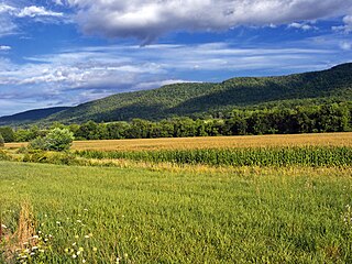
Albany Township is a township in Bradford County, Pennsylvania, United States. It is part of Northeastern Pennsylvania. The population was 860 at the 2020 census.

<span class="mw-page-title-main">Asylum Township, Pennsylvania</span> Township in Pennsylvania, United States

Asylum Township is a township in Bradford County, Pennsylvania, United States. It is part of Northeastern Pennsylvania. The population was 999 at the 2020 census. The town contains the historic site of French Azilum.

<span class="mw-page-title-main">Athens Township, Bradford County, Pennsylvania</span> Township in Pennsylvania, United States

Athens Township is a township in Bradford County, Pennsylvania, United States. It is part of Northeastern Pennsylvania. The population was 5,198 at the 2020 census.

<span class="mw-page-title-main">Burlington, Pennsylvania</span> Borough in Pennsylvania, United States

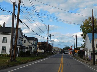
Burlington is a borough in Bradford County, Pennsylvania, United States. It is part of Northeastern Pennsylvania. The population was 145 at the 2020 census. Children residing in the township are assigned to attend the Troy Area School District.

<span class="mw-page-title-main">Franklin Township, Bradford County, Pennsylvania</span> Township in Pennsylvania, United States

Franklin Township is a township in Bradford County, Pennsylvania, United States. It is part of Northeastern Pennsylvania. The population was 723 at the 2010 census.

<span class="mw-page-title-main">Granville Township, Bradford County, Pennsylvania</span> Township in Pennsylvania, United States

Granville Township is a township in Bradford County, Pennsylvania, United States. It is part of Northeastern Pennsylvania. The population was 899 at the 2020 census. Children residing in the township are assigned to attend the Troy Area School District.

<span class="mw-page-title-main">Leroy Township, Bradford County, Pennsylvania</span> Township in Pennsylvania, United States

LeRoy Township is a township in Bradford County, Pennsylvania, United States. It is part of Northeastern Pennsylvania. The population was 718 at the 2010 census.

<span class="mw-page-title-main">Monroe, Pennsylvania</span> Borough in Pennsylvania, United States

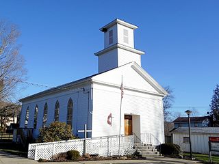
Monroe is a borough in Bradford County, Pennsylvania, United States. It is part of Northeastern Pennsylvania. The population was 482 at the 2020 census.

<span class="mw-page-title-main">Monroe Township, Bradford County, Pennsylvania</span> Township in Pennsylvania, United States

Monroe Township is a township in Bradford County, Pennsylvania, United States. It is part of Northeastern Pennsylvania. The population was 1,250 at the 2010 census.

<span class="mw-page-title-main">North Towanda Township, Pennsylvania</span> Township in Pennsylvania, United States

North Towanda Township is a township in Bradford County, Pennsylvania, United States. It is part of Northeastern Pennsylvania. The population was 1,132 at the 2010 census.

<span class="mw-page-title-main">Sheshequin Township, Pennsylvania</span> Township in Pennsylvania, United States

Sheshequin Township is a township in Bradford County, Pennsylvania, United States. It is part of Northeastern Pennsylvania. The population was 1,348 at the 2010 census.

<span class="mw-page-title-main">Smithfield Township, Bradford County, Pennsylvania</span> Township in Pennsylvania, United States

Smithfield Township is a township in Bradford County, Pennsylvania, United States. It is part of Northeastern Pennsylvania. The population was 1,498 at the 2010 census.

<span class="mw-page-title-main">Springfield Township, Bradford County, Pennsylvania</span> Township in Pennsylvania, United States

Springfield Township is a township in Bradford County, Pennsylvania, United States. The population was 1,124 at the 2010 census. Children residing in the township are assigned to attend the Troy Area School District.

<span class="mw-page-title-main">Standing Stone Township, Pennsylvania</span> Township in Pennsylvania, United States

Standing Stone Township is a township in Bradford County, Pennsylvania, United States. The population was 642 at the 2010 census.

<span class="mw-page-title-main">Towanda, Pennsylvania</span> Borough in Pennsylvania, United States

Towanda is a borough and the county seat of Bradford County in the U.S. state of Pennsylvania. It is part of Northeastern Pennsylvania and is located 66 miles (106 km) northwest of Wilkes-Barre, on the Susquehanna River. The name means "burial ground" in the Algonquian language. As of the 2020 census, the population of Towanda was 2,833.

<span class="mw-page-title-main">Towanda Township, Pennsylvania</span> Township in Pennsylvania, United States

Towanda Township is a township in Bradford County, Pennsylvania, United States. It is part of Northeastern Pennsylvania. The population was 1,149 at the 2010 census.

<span class="mw-page-title-main">Troy Township, Bradford County, Pennsylvania</span> Township in Pennsylvania, United States

Troy Township is a township in Bradford County, Pennsylvania. It is part of Northeastern Pennsylvania. The population was 1,645 at the 2010 census. Children residing in the township are assigned to attend the Troy Area School District.

<span class="mw-page-title-main">Ulster Township, Pennsylvania</span> Township in Pennsylvania, United States

Ulster Township is a township in Bradford County, Pennsylvania. It is part of Northeastern Pennsylvania. The population was 1,337 at the 2010 census.

<span class="mw-page-title-main">West Burlington Township, Pennsylvania</span> Township in Pennsylvania, United States

West Burlington Township is a township in Bradford County, Pennsylvania. It is part of Northeastern Pennsylvania. The population was 696 at the 2010 census. Children residing in the township are assigned to attend the Troy Area School District.

<span class="mw-page-title-main">Wysox Township, Pennsylvania</span> Township in Pennsylvania, United States

Wysox Township is a township in Bradford County, Pennsylvania. It is part of Northeastern Pennsylvania. The population was 1,721 at the 2010 census.

References

  1. "2016 U.S. Gazetteer Files". United States Census Bureau. Retrieved August 13, 2017.
  2. 1 2 "Population and Housing Unit Estimates" . Retrieved June 9, 2017.
  3. 1 2 "Geographic Identifiers: 2010 Demographic Profile Data (G001): Burlington township, Bradford County, Pennsylvania". U.S. Census Bureau, American Factfinder. Archived from the original on February 12, 2020. Retrieved March 17, 2014.
  4. "Census of Population and Housing". Census.gov. Retrieved June 4, 2016.
  5. "U.S. Census website". United States Census Bureau . Retrieved January 31, 2008.

41°45′52″N76°34′29″W / 41.76444°N 76.57472°W / 41.76444; -76.57472