Burna, Kentucky | |
|---|---|
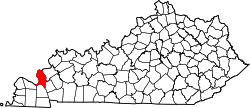
 Burna Location in Kentucky  Burna Location in the United States | |
| Coordinates: 37°14′44″N88°21′32″W / 37.24556°N 88.35889°W | |
| Country | United States |
| State | Kentucky |
| County | Livingston |
| Area | |
• Total | 1.35 sq mi (3.49 km2) |
| • Land | 1.34 sq mi (3.48 km2) |
| • Water | 0.01 sq mi (0.01 km2) |
| Elevation | 551 ft (168 m) |
| Population (2020) | |
• Total | 219 |
| • Density | 162.95/sq mi (62.91/km2) |
| Time zone | UTC-6 (Central (CST)) |
| • Summer (DST) | UTC-5 (CST) |
| ZIP code | 42028 |
| FIPS code | 21-11188 |
| GNIS feature ID | 2629581 [2] |
Burna is an unincorporated community and census-designated place (CDP) in central Livingston County, Kentucky, United States. As of the 2010 census the population was 257. [3] It is home to the North Livingston Elementary School and Livingston County Middle School.
Contents
The name was decided upon by a contest. A young girl named Burna was selected as the winner, and so the town was named after her.[ citation needed ]