Salem, Kentucky | |
---|---|
Coordinates: 37°15′53″N88°14′28″W / 37.26472°N 88.24111°W | |
Country | United States |
State | Kentucky |
County | Livingston |
Established | before 1816 [1] |
Incorporated | 1869 [1] |
Named for | the Carolinian hometown of the original settlers |
Area | |
• Total | 0.85 sq mi (2.21 km2) |
• Land | 0.85 sq mi (2.21 km2) |
• Water | 0.00 sq mi (0.01 km2) |
Elevation | 463 ft (141 m) |
Population (2020) | |
• Total | 722 |
• Density | 847.42/sq mi (327.33/km2) |
Time zone | UTC-6 (Central (CST)) |
• Summer (DST) | UTC-5 (CDT) |
ZIP code | 42078 |
Area code(s) | 270 & 364 |
FIPS code | 21-68052 |
GNIS feature ID | 2405405 [3] |
Salem is a home rule-class city in Livingston County, Kentucky, in the United States. Salem is part of the Paducah, KY-IL metropolitan statistical area. The population was 752 during the 2010 census, [4] down from 769 in 2000. It the second-largest community and largest village in Livingston County, but the census-designated place of Ledbetter has more than two times the population of Salem.
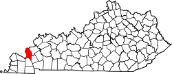
The city is believed to have been settled c. 1800 by immigrants from Salem, North Carolina, who named their new community after their former home. It replaced Centerville as Livingston County's seat in 1809, but it was replaced in turn by Smithland in 1842, after the removal of Crittenden County left it more centrally-located. [5]
Salem is located at 37°15′53″N88°14′28″W / 37.26472°N 88.24111°W (37.264694, -88.241221). [6] According to the United States Census Bureau, the city has a total area of 0.8 square miles (2.1 km2), all land.
Census | Pop. | Note | %± |
---|---|---|---|
1830 | 281 | — | |
1840 | 233 | −17.1% | |
1860 | 192 | — | |
1870 | 50 | −74.0% | |
1880 | 132 | 164.0% | |
1900 | 208 | — | |
1910 | 320 | 53.8% | |
1920 | 252 | −21.2% | |
1970 | 593 | — | |
1980 | 833 | 40.5% | |
1990 | 770 | −7.6% | |
2000 | 769 | −0.1% | |
2010 | 752 | −2.2% | |
2020 | 722 | −4.0% | |
U.S. Decennial Census [7] |
At the 2000 census there were 769 people in 322 households, including 202 families, in the city. The population density was 987.6 inhabitants per square mile (381.3/km2). There were 370 housing units at an average density of 475.2 per square mile (183.5/km2). The racial makup of the city was 99.22% White, 0.26% African American, 0.13% from other races, and 0.39% from two or more races. Hispanic or Latino of any race were 0.65%. [8]
Of the 322 households 20.8% had children under the age of 18 living with them, 51.9% were married couples living together, 8.1% had a female householder with no husband present, and 37.0% were non-families. 34.2% of households were one person and 23.0% were one person aged 65 or older. The average household size was 2.14 and the average family size was 2.72.
The age distribution was 16.9% under the age of 18, 6.6% from 18 to 24, 19.9% from 25 to 44, 25.1% from 45 to 64, and 31.5% 65 or older. The median age was 51 years. For every 100 females, there were 80.9 males. For every 100 females age 18 and over, there were 80.5 males.
The median household income was $29,196 and the median family income was $37,857. Males had a median income of $29,375 versus $20,000 for females. The per capita income for the city was $16,156. About 7.1% of families and 10.7% of the population were below the poverty line, including 14.8% of those under age 18 and 12.3% of those age 65 or over.
Lyon County is a county located in the U.S. state of Kentucky. As of the 2020 census, the population was 8,680. Its county seat is Eddyville. The county was formed from Caldwell County, Kentucky in 1854 and named for former Congressman Chittenden Lyon.
Livingston County is a county located in the U.S. state of Kentucky. As of the 2020 census, the population was 8,888. Its county seat is Smithland and its largest community is Ledbetter. The county was established in 1798 from land taken from Christian County and is named for Robert R. Livingston, a member of the Committee of Five that drafted the U.S. Declaration of Independence. The county was strongly pro-Confederate during the American Civil War and many men volunteered for the Confederate Army. Livingston County is part of the Paducah, KY-IL Metropolitan Statistical Area. It is a prohibition or dry county with the exception of Grand Rivers which voted to allow alcohol sales in 2016.
Fertile is a city in Worth County, Iowa, United States. The population was 305 at the time of the 2020 census. It is part of the Mason City Micropolitan Statistical Area.
Fredonia is a home rule-class city in Caldwell County, Kentucky, in the United States. The population was 401 at the 2010 census.
Marion is a home rule-class city in Crittenden County, Kentucky, in the United States. It is the seat of its county. As of the 2010 census, the city population was 3,039.
Water Valley is a census-designated place and former home rule-class city in Graves County, Kentucky, United States. The population was 235 as of the 2020 census. It was incorporated on April 19, 1884, and had its charter dissolved via court order effective June 20, 2016.
Broad Fields is a neighborhood of St. Matthews, Kentucky. Broad Fields was a Sixth Class city in Jefferson County, Kentucky, United States. Broad Fields was incorporated on May 24, 1957. Broad Fields was dissolved on July 1, 2000, and annexed by St. Matthews on January 8, 2001. The population was 250 at the 2000 census.
Brownsboro Farm is a home rule-class city in Jefferson County, Kentucky, United States. The population was 648 at the 2010 census.
Springlee is a neighborhood of St. Matthews, Kentucky, an area of Louisville. The population was 426 at the 2000 census. Until 2000 Springlee was an independent Sixth Class city in Jefferson County, Kentucky, United States. Springlee was incorporated on April 25, 1950. Springlee was dissolved on December 5, 2000, and annexed by the City of St. Matthews on January 8, 2001
Whipps Millgate is a former city in Jefferson County, Kentucky, United States. The population was 415 at the 2000 census. The City of Whipps Millgate was incorporated on April 26, 1969, it was dissolved and annexed by the City of Lyndon, Kentucky on July 1, 2001.
Carrsville is a home rule-class city beside the Ohio River in Livingston County, Kentucky, in the United States. The population was 50 at the 2010 census, declining from 64 as of 2000. It is part of the Paducah, KY-IL Metropolitan Statistical Area. It is situated just west of the junction of where Buck Creek empties into the Ohio River.
Grand Rivers is a home rule-class city in Livingston County, Kentucky, in the United States. The population was 382 at the 2010 census, up from 343 in 2000. It is part of the Paducah, KY-IL Metropolitan Statistical Area.
Ledbetter is a census-designated place (CDP) in Livingston County, Kentucky, United States. The population was 1,683 at the 2010 census, down slightly from 1,700 in 2000, thus making it the largest and most populous community in Livingston County. It is part of the Paducah, KY-IL Metropolitan Statistical Area, laying directly across the Tennessee River from Paducah. It is the largest community in Livingston County, but the village of Salem is less than two times the population of Ledbetter.
Hardin is a home rule-class city in Marshall County, Kentucky, United States. The population was 580 at the 2020 census.
Ekron is a home rule-class city in Meade County, Kentucky, United States. The population was 175 at the 2020 census.
Livingston is a home rule-class city in Rockcastle County, Kentucky, in the United States. The population was 226 during the 2010 U.S. census. It is part of the Richmond-Berea micropolitan area.
Sturgis is a home rule-class city in Union County, Kentucky, United States. The population was 1,898 at the 2010 census. Located in northwest Kentucky, the city was founded in 1890 and named for Samuel Sturgis, who owned the land now occupied by the city.
Oakland is a home rule-class city in Warren County, Kentucky, in the United States. The population was 198 during the 2020 Census. It is included in the Bowling Green metropolitan area.
Campton is a home rule-class city in and the county seat of Wolfe County, Kentucky, United States. The population was 441 at the 2010 census.
West Salem Township is a township in Mercer County, Pennsylvania, United States. The population was 3,220 at the 2020 census, a decrease from 3,538 in 2010.