Business routes of Interstate 55

Last updated

Business Loop 55.svg

Interstate 55 Business

Location
Country United States
Highway system

Interstate business routes are roads connecting a central or commercial district of a city or town with an Interstate bypass. These roads typically follow along local streets often along a former U.S. Route or state highway that had been replaced by an Interstate. Interstate business route reassurance markers are signed as either loops or spurs using a green shield shaped sign and numbered like the shield of the parent Interstate highway.

Contents

Along Interstate 55 (I-55), there are a total of six business routes, three in both Missouri and Illinois, all which are business loops.
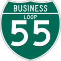
New Madrid business loop

Business Loop 55.svg

Interstate 55 Business

Location New Madrid

Interstate 55 Business (I-55 Bus.) is a major arterial surface street that serves downtown New Madrid, Missouri. It runs north from I-55 at exit 44 and the overlap of U.S. Route 61 (US 61)/US 62 through downtown to exit 49 on I-55.

Cape Girardeau business loop

Business Loop 55.svg

Interstate 55 Business

Location Cape Girardeau-Fruitland

Interstate 55 Business (I-55 Bus.) begins at US 61/Route 74 in Cape Girardeau at exit 93 and ends at US 61 at exit 105 in Fruitland. However, it also crosses its parent Interstate at exit 99

Crystal City business loop

Business Loop 55.svg

Interstate 55 Business

Location Crystal City-Herculaneum

Interstate 55 Business (I-55 Bus.) spans from US 67/US 61 at exit 174 in Crystal City to McNutt Street at exit 178 in Herculaneum.

Springfield business loop

Business Loop 55.svg

Interstate 55 Business

Location Springfield

Interstate 55 Business (I-55 Bus.) is to a major arterial surface street that serves downtown Springfield, Illinois. It runs north from the intersection of I-55 and I-72 through downtown to Illinois Route 4 (IL 4, Veterans' Parkway). It then runs northeast to Sherman. [1]

All of I-55 Bus. was part of US 66 at some point.

Major junctions
The entire route is in Sangamon County.

Locationmi [2] kmDestinationsNotes
Springfield 0.0–
0.7
0.0–
1.1
I-55.svgI-72.svgUS 36.svg I-55 / I-72  / US 36  Jacksonville, Decatur, Chicago, St. Louis Exit 92A (I-55), Exit 97B (I-72)
4.97.9North plate.svg
Illinois 97.svg
IL 97 north (Jefferson Street)
5.08.0South plate.svg
Illinois 97.svg
IL 97 south (Madison Street)
7.011.3Illinois 29.svg IL 29 (Sangamon Avenue)Southern end of IL 29 concurrency
8.012.9South plate.svg
Illinois 4.svg
North plate.svg
Illinois 29.svg
Airport Sign.svg IL 4 south / IL 29 north (Veterans Parkway) Abraham Lincoln Capital Airport
Northern end of IL 29 concurrency, northern terminus of IL 4
Sherman 12.119.5West plate.svg
Illinois 124.svg
IL 124 west (Andrew Road) Andrew, Athens
Eastern terminus of IL 124
12.720.4South plate blue.svg
I-55.svg
I-55 south Springfield
Exit 105 (I-55), no access to I-55 northbound from this point
Williams Township 13.922.4North plate blue.svg
I-55.svg
I-55 north Chicago
Only access to I-55 northbound
1.000 mi = 1.609 km; 1.000 km = 0.621 mi

Lincoln business loop

Business Loop 55.svg

Interstate 55 Business

Location Lincoln

Interstate 55 Business (I-55 Bus.) services the downtown of Lincoln, Illinois. It begins southwest of Lincoln and follows the former US 66 to Fifth Street. It then turns east on Fifth Street, southeast on Clinton Street, and northeast on Kickapoo Street at the city's center. The route continues northeast to rejoin the former routing of US 66 northeast of town near the Logan County Airport, at which point it continues along that route to end at I-55 further northeast of Lincoln.

Bloomington–Normal business loop

Business Loop 55.svg

Interstate 55 Business

Location BloomingtonNormal

Interstate 55 Business (I-55 Bus.) in BloomingtonNormal is known for its entire length as Veterans Parkway. It is a divided, limited-access highway bypassing the Bloomington–Normal area to the south and east. The route's north–south portion largely passes through a retail core, including Eastland Mall and The Shoppes at College Hills. The highway is also the recommended route from I-39, I-55, and I-74 to Central Illinois Regional Airport via IL 9.

Major junctions
The entire route is in McLean County.

LocationmikmDestinationsNotes
Bloomington South plate blue.svg
I-55.svg
I-55 south Springfield
East plate blue.svg
I-74.svg
South plate.svg
US 51.svg
I-74 east / US 51 south Champaign, Decatur
North plate blue.svg
I-55.svg
West plate blue.svg
I-74.svg
North plate.svg
US 51.svg
I-55 north / I-74 west / US 51 north Joliet, Peoria, Rockford
Exit 157 on I-55; exit 134 on westbound I-74
West plate brown.svg
US 66 (IL historic).svg
Historic US 66 west (Hamilton Road)
Western end of Historic Route 66 concurrency
Business plate.svg
US 51.svg
East plate brown.svg
US 66 (IL historic).svg
US 51 Bus.  / Historic US 66 east (Main Street)
Diamond interchange, eastern end of Historic US 66 concurrency
US 150.svg US 150 (Morrisey Drive)
Illinois 9.svgAirport Sign.svg IL 9 (Empire Street) Pekin, Gibson City Central Illinois Regional Airport
Normal US 66 (IL historic).svg Historic US 66 (Shelbourne Drive) Normal Southbound exit only
I-55.svg I-55 Joliet, Springfield I-55 exit 167; road continues to the north as Pipeline Road
1.000 mi = 1.609 km; 1.000 km = 0.621 mi

Related Research Articles

<span class="mw-page-title-main">Interstate 39</span> Interstate Highway in Illinois and Wisconsin

Interstate 39 (I-39) is a highway in the Midwestern United States. I-39 runs from Normal, Illinois, at I-55 to State Trunk Highway 29 (WIS 29) in the town of Rib Mountain, Wisconsin, which is approximately six miles (9.7 km) south of Wausau. I-39 was designed to replace U.S. Route 51 (US 51), which, in the early 1980s, was one of the busiest two-lane highways in the United States. I-39 was built in the 1980s and 1990s.

<span class="mw-page-title-main">Interstate 55</span> North–south Interstate Highway in the central US

Interstate 55 (I-55) is a major Interstate Highway in the central United States. As with most primary Interstates that end in a five, it is a major cross-country, north–south route, connecting the Gulf of Mexico to the Great Lakes. The highway travels from LaPlace, Louisiana, at I-10 to Chicago, Illinois, at U.S. Route 41, at McCormick Place. The major cities that I-55 connects to are New Orleans, Louisiana; Jackson, Mississippi; Memphis, Tennessee; St. Louis, Missouri; and Chicago, Illinois.

<span class="mw-page-title-main">U.S. Route 150</span> Highway in the Midwestern United States

U.S. Route 150 is a 571-mile (919 km) long northwest–southeast United States highway, signed as east–west. It runs from U.S. Route 6 outside of Moline, Illinois to U.S. Route 25 in Mount Vernon, Kentucky.

<span class="mw-page-title-main">Indiana State Road 2</span> Highway in Indiana

State Road 2 (SR 2) in the U.S. State of Indiana is an east–west route running from the Illinois border at Illinois Route 17 east to the outskirts of South Bend, Indiana, at the U.S. Route 20/U.S. Route 31 freeway, also known as the St. Joseph Valley Parkway. This is a distance of 80.98 miles (130.32 km).

<span class="mw-page-title-main">Interstate 155 (Illinois)</span> Highway in Illinois

Interstate 155 (I-155) is a north–south spur of I-55 that provides an Interstate connection for the Illinois cities of Peoria and Lincoln. The northern terminus is just east of Peoria, at I-74 exit 101 in Morton. The southern terminus, which is northwest of Lincoln, is located on I-55 at exit 127. The highway is 32.13 miles (51.71 km) long.

<span class="mw-page-title-main">Business routes of Interstate 44</span>

Nine business routes of Interstate 44 (I-44) exist, all of them within the state of Missouri.

<span class="mw-page-title-main">U.S. Route 41 in Illinois</span> U.S. Highway in Illinois

U.S. Route 41 (US 41) in the U.S. state of Illinois runs north from the Indiana border beneath the Chicago Skyway on Indianapolis Boulevard to the Wisconsin border north of the northern terminus of the Tri-State Tollway with Interstate 94. It is the only north–south U.S. Route to travel through a significant portion of the city of Chicago, carrying Lake Shore Drive through the central portion of the city along the lakefront. US 41 in Illinois is 64.81 miles (104.30 km) in length.

<span class="mw-page-title-main">Interstate 55 in Illinois</span> Section of Interstate Highway in Illinois, United States

Interstate 55 (I-55) is a major north–south Interstate Highway in the US state of Illinois that connects St. Louis, Missouri, to the Chicago metropolitan area. It enters the state from Missouri near East St. Louis, Illinois, and runs to U.S. Route 41 near Downtown Chicago, where the highway ends, a distance of 294.38 miles (473.76 km). The road also runs through the Illinois cities of Springfield, Bloomington, and Joliet. The section in Cook County is officially named the Stevenson Expressway, and in DuPage County its officially named the Joliet Freeway or the Will Rogers Freeway. The section from the south suburbs of Chicago to the area near Pontiac is officially named the Barack Obama Presidential Expressway after the 44th President, Barack Obama, who launched his political career from Illinois.

<span class="mw-page-title-main">Special routes of U.S. Route 71</span>

A total of ten special routes of U.S. Route 71 exist, and another ten previously existed.

<span class="mw-page-title-main">Special routes of U.S. Route 66</span> Portions of U.S. Route 66 that are or have historically been designated special routes

There have been 22 special routes of U.S. Route 66.

<span class="mw-page-title-main">Business routes of Interstate 35</span>

Interstate business routes are roads connecting a central or commercial district of a city or town with an Interstate bypass. These roads typically follow along local streets often along a former U.S. Route or state highway that had been replaced by an Interstate. Interstate business route reassurance markers are signed as either loops or spurs using a green shield shaped sign and numbered like the shield of the parent Interstate highway.

<span class="mw-page-title-main">Business routes of Interstate 15</span>

Interstate 15 Business may refer to several business routes of the Interstate Highway System that connects Interstate 15 with the central business district of various cities bypassed by I-15. The business route in each community is considered a unique route. In many cases, these routes are a former section of a U.S. Route or state highway.

<span class="mw-page-title-main">Special routes of U.S. Route 40</span>

Several special routes of U.S. Route 40 exist. In order from west to east they are as follows.

<span class="mw-page-title-main">Business routes of Interstate 70 in Colorado</span>

There are 13 active business routes of Interstate 70 in Colorado. Interstate 70 (I-70) spans Colorado in an east–west fashion, holding many business loops and spurs along the way, varying from lengths of 0.22 miles (0.35 km) to 27.47 miles (44.21 km), with a total of 55.51 miles (89.33 km). Four other business routes also used to exist within the state.

<span class="mw-page-title-main">Business routes of Interstate 25</span> Route system

Interstate business routes are roads connecting a central or commercial district of a city or town with an Interstate bypass. These roads typically follow along local streets often along a former US or state highway that had been replaced by an Interstate. Interstate business route reassurance markers are signed as either loops or spurs using a green shield shaped sign and numbered like the shield of the parent Interstate Highway.

<span class="mw-page-title-main">Special routes of U.S. Route 20</span>

Several special routes of U.S. Route 20 (US 20) exist. In order from west to east, they are as follows.

<span class="mw-page-title-main">Business routes of Interstate 75</span>

Business routes of Interstate 75 exist in three states. Georgia has three existing Interstate 75 (I-75) business routes and one other that was deleted. Ohio has three business routes for I-75. Nine other I-75 business routes also exist, or have existed, in Michigan, and a 10th has been proposed.

<span class="mw-page-title-main">Tennessee State Route 55</span> Highway in Tennessee

State Route 55 is an east–west highway in Middle Tennessee. The road begins at SR 50 in Lynchburg and ends at U.S. Route 70S and SR 380 in McMinnville. The current length is 49.3 mi (79.3 km). SR 55 heads northeast from Lynchburg to Tullahoma as a two-lane road. In Tullahoma, the route runs concurrent with US 41A. From here, SR 55 heads northeast as a multilane highway to Manchester, where it intersects US 41 and Interstate 24 (I-24). The route continues northeast, serving Summitville and Morrison before it reaches McMinnville.

<span class="mw-page-title-main">Business routes of Interstate 40</span> Highway system

Interstate business routes are roads connecting a central or commercial district of a city or town with an Interstate bypass. These roads typically follow along local streets often along a former U.S. Route or state highway that had been replaced by an Interstate. Interstate business route reassurance markers are signed as either loops or spurs using a green shield shaped and numbered like the shield of the parent Interstate highway.

<span class="mw-page-title-main">U.S. Route 51 Business (Bloomington–Normal, Illinois)</span> Business route in Illinois, United States

U.S. Route 51 Business is a business route of US 51 in Bloomington–Normal. It provides service to downtown Bloomington and downtown Normal.

References

  1. Illinois Department of Transportation (February 20, 2009). General Highway Map: Sangamon County, Illinois (PDF) (Map). Illinois Department of Transportation. Retrieved June 9, 2021.
  2. Google (June 9, 2021). "Interstate 55 Business (Springfield)" (Map). Google Maps . Google. Retrieved June 9, 2021.