
The Darling River is the third-longest river in Australia, measuring 1,472 kilometres (915 mi) from its source in northern New South Wales to its confluence with the Murray River at Wentworth. Including its longest contiguous tributaries it is 2,844 km (1,767 mi) long, making it the longest river system in Australia. The Darling River is the outback's most famous waterway.

Cobar is a town in central western New South Wales, Australia whose economy is based mainly upon base metals and gold mining. The town is 712 km (442 mi) by road northwest of the state capital, Sydney. It is at the crossroads of the Kidman Way and Barrier Highway. The town and the local government area, the Cobar Shire, are on the eastern edge of the outback. At the 2016 census, the town of Cobar had a population of 3,990. The Shire has a population of approximately 4,700 and an area of 44,065 square kilometres (17,014 sq mi).

Nevertire is a rural village in New South Wales, Australia. It is located at the junction of the Mitchell Highway and the Oxley Highway, in Warren Shire. Nevertire is about 496 kilometres northwest of Sydney, 78 km north-west of Narromine and about 107 km from Dubbo. It is about 20 km south-west of Warren on the western end of the Oxley Highway. At the 2011 census, Nevertire had a population of 225 people.

Nyngan is a town in the centre of New South Wales, Australia, in the Bogan Shire local government area within the Orana Region of central New South Wales. At the 2016 census, Nyngan had a population of 1,988 people. Nyngan is situated on the Bogan River between Narromine and Bourke, on the junction of the Mitchell Highway and Barrier Highway, 656 km (408 mi) south of Charleville and 576 km (358 mi) north-west of Sydney by road. The Barrier Highway starts at Nyngan, and runs west to Cobar and on through Wilcannia and Broken Hill into South Australia.
Bogan River, a perennial river that is part of the Macquarie–Barwon catchment within the Murray–Darling basin, is located in the central west and Orana regions of New South Wales, Australia.

Bourke is a town in the north-west of New South Wales, Australia. The administrative centre and largest town in Bourke Shire, Bourke is approximately 800 kilometres (500 mi) north-west of the state capital, Sydney, on the south bank of the Darling River. it is also situated:
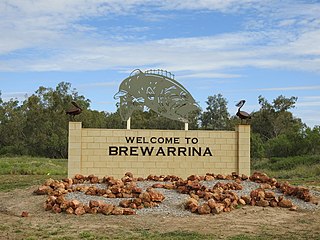
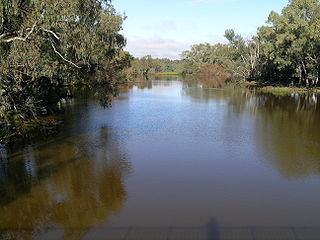
Brewarrina is a town in north-west New South Wales, Australia on the banks of the Barwon River in Brewarrina Shire. The name Brewarrina is derived from 'burru waranha', a Weilwan name for a species of Acacia, Cassia tree, "Acacia clumps", "a native standing" or "place where wild gooseberry grows". It is 96 kilometres (60 mi) east of Bourke and west of Walgett on the Kamilaroi Highway, and 787 km from Sydney. The population of Brewarrina in 2016 was 1,143. Other towns and villages in the Brewarrina district include: Goodooga, Gongolgon, Weilmoringle and Angledool.
The Main Western Railway is a major railway in New South Wales, Australia. It runs through the Blue Mountains, and Central West regions. It is 825 kilometres (513 mi) long, of which 484 kilometres (301 mi) is currently operational.

Brewarrina Shire is a local government area in the Orana region of New South Wales, Australia. The Shire is located adjacent to the Darling River, which is known as the Barwon River upstream from Bourke; and located adjacent to the Kamilaroi Highway. The northern boundary of the Shire is located adjacent to the border between New South Wales and Queensland. The Shire is a wool and cotton growing area.

Bourke Shire is a local government area in the Orana region of New South Wales, Australia. The Shire is located adjacent to the Darling River, which is known as the Barwon River upstream from Bourke; and located adjacent to the Mitchell Highway. The northern boundary of the Shire is located adjacent to the border between New South Wales and Queensland. The shire is a wool and beef producing area.
Cobar was an electoral district of the Legislative Assembly in the Australian state of New South Wales which was named after the town of Cobar. It was first created in 1894 and abolished in 1920. Cobar was recreated in 1930 and abolished in 1968.

The Cobar railway line is a railway line in New South Wales, Australia. It branches west towards Cobar from the Main West Line at Nyngan. The Main West once continued northwest to Bourke but is now closed beyond Nyngan. However, copper concentrates from mines near Hermidale and Cobar are still railed on this line to ports on the New South Wales coast.
The Brewarrina railway line is a closed branch railway line in far-western New South Wales, Australia. It joined the Main West Line at Byrock with the town of Brewarrina on the Darling River. It was 93.67 km long.
Coolabah is a small village in western New South Wales, Australia, 76 km north of Nyngan and 656 km north-west of Sydney. It lies on either side of the Mitchell Highway, with the area to the east of the highway in Brewarrina Shire and the westerly area in Bogan Shire.

Girilambone is a small village in western New South Wales, Australia. It is located north of Nyngan and 610 km north-west of Sydney. The name is also applied to the surrounding area, for postal and statistical purposes. At the 2016 census, the population of the village and its surrounding area was only 107, but it had fallen to just 86 in 2021. The village was originally associated with copper mining.
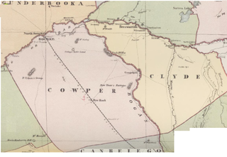
Bye, New South Wales is a Bounded locality of Bourke Shire and a civil Parish of Cowper County, New South Wales.
Loftus Parish is a civil parish of Cowper County, New South Wales; a Cadastral division of New South Wales. located at 30°13'05.0"S 146°27'57.0"E between Byrock, New South Wales and Bourke, New South Wales.

Bourke railway station is a heritage-listed disused railway station and present-day coach terminal in Bourke, in the Far West region of New South Wales.
Canonba is a locality in the Orana region of New South Wales, Australia. There was also a village of the same name, which is now a ghost town. It lay on Duck Creek, a tributary of the Bogan River, approximately 30 km north-east of Nyngan. Since 1983, the old village site has been known officially as Old Canonba.
Bobadah was a mining village, now a locality, in the Orana region of New South Wales, Australia. The village was also known as Carpina, its official name, although that name was rarely used. It is now a ghost town, with its community hall being its last remaining building. Its population in 2016, including the surrounding area, was 10. It was once a larger settlement associated with the nearby Overflow Mine.


