
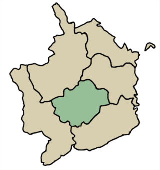
Monmouthshire is a county in the south east of Wales. It borders Powys to the north; the English counties of Herefordshire and Gloucestershire to the north and east; the Severn Estuary to the south, and Torfaen, Newport and Blaenau Gwent to the west. The largest town is Abergavenny, and the administrative centre is Usk.
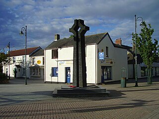
Caldicot is a market town and community in Monmouthshire, Wales. The town is located between Chepstow and the city of Newport. The site adjoins the Caldicot Levels, on the north side of the Severn Estuary. The population of the built-up area was around 11,000. It has a large school, Caldicot School, and is known for its medieval castle. The built-up area includes Portskewett. Caldicot had a population of 9,604 in 2011.
Caldicot is a town and community in Monmouthshire Wales.

Caldicot Castle is an extensive stone medieval castle in the town of Caldicot, Monmouthshire, in southeast Wales, built near the site of Harold Godwinson's former Saxon castle by the Norman earls of Hereford from about 1100. The castle became a Grade I listed building on 10 June 1953.

Rogiet is a small village and community in Monmouthshire, south east Wales, between Caldicot and Magor, 8 miles (13 km) west of Chepstow and 11 miles (18 km) east of Newport, which covers an area of 847 hectares (3.27 sq mi). It lies close to the M4 and M48 motorways, and the Second Severn Crossing. It has a railway station named Severn Tunnel Junction. Rogiet only has a population of 1,813 (2011).

Wentloog was an ancient hundred of Monmouthshire. It was also known as Newport hundred.
Usk was an ancient hundred of Monmouthshire.

St Brides Netherwent is a parish and largely deserted village in Monmouthshire, south-east Wales. It is centred 2 miles north of Magor, and 3 miles west of Caerwent. The A48 Newport to Chepstow road passes close by to the north.
Undy is a village in Monmouthshire, south east Wales, adjoining the village of Magor with which it forms the community and parish of Magor with Undy. It is located about 3 miles (4.8 km) west of Caldicot and 10 miles (16 km) east of Newport, close to the junction of the M4 and M48 motorways, and adjoins the Caldicot Levels on the north bank of the Bristol Channel.

Wilcrick is a hamlet within the administrative boundary of the city of Newport, South Wales, just to the west of Magor and approximately 7 miles (11 km) southeast of Newport city centre. It is within the historic county of Monmouthshire.

Redwick is a small village and community (parish) to the south east of the city of Newport, in Wales, United Kingdom. It lies within the Newport city boundaries, in the historic county of Monmouthshire and the preserved county of Gwent. In 2011 the population was 206.

Portskewett is a village and community (parish) in Monmouthshire, south east Wales. It is located four miles south west of Chepstow and one mile east of Caldicot, in an archaeologically sensitive part of the Caldicot Levels on the Welsh shore of the Severn Estuary. The Second Severn Crossing passes overhead carrying the M4 motorway. The community includes Sudbrook, Crick and Leechpool.

Sudbrook is a village in Monmouthshire, south east Wales. It is located 4 miles south west of Chepstow and 1 mile east of Caldicot. It lies close to the Second Severn Crossing on the Severn Estuary, and adjoins the village of Portskewett. It was largely built in the late 19th century for workers on the Severn railway tunnel. At that time it was also known as Southbrook.
Mounton is a hamlet in Monmouthshire, south east Wales, United Kingdom, located two miles west of Chepstow in a rural setting.

Penterry is a small rural parish of 479 acres (1.94 km2) in Monmouthshire, Wales. It is located between the villages of St. Arvans and Tintern, about 4 miles (6.4 km) north of Chepstow, within the Wye Valley Area of Outstanding Natural Beauty and about 2 miles (3.2 km) from the border with England. It now contains an isolated parish church adjoining the site of a deserted village, and a few farms.
Nash is a village and community to the south of the city of Newport, South Wales, in the Lliswerry ward.
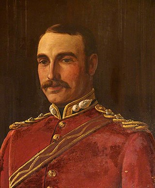
Colonel Sir Joseph Alfred Bradney, was a British soldier, historian and archaeologist, best known for his multivolume A History of Monmouthshire from the Coming of the Normans into Wales down to the Present Time.
Gwent Wildlife Trust (GWT) is a wildlife trust covering the area between the lower Wye and Rhymney rivers which forms the vice county of Monmouthshire in south-east Wales. It is a registered charity and a member of the Wildlife Trusts Partnership.
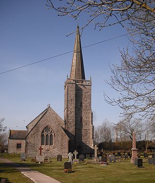
St Tewdric's Church is a Church in Wales parish church in Mathern, Monmouthshire, Wales. It is purportedly built over the resting place of Saint Tewdrig for whom it is named. A church has been located on the site since the 6th century. It was reconstructed by the Normans in the Early English style, and later was renovated by the Victorians. It is a Grade I listed building.

A History of Monmouthshire from the Coming of the Normans into Wales down to the Present Time is a study of the county of Monmouthshire written by Sir Joseph Bradney and published by Mitchell, Hughes and Clarke of London between 1904 and 1932. The history comprised twelve volumes, based on six of the seven historic hundreds of Monmouthshire; Skenfrith, Abergavenny, Raglan, Trellech, Usk and Caldicot.
