
Monmouthshire is a county in the south east of Wales. It borders Powys to the north; the English counties of Herefordshire and Gloucestershire to the north and east; the Severn Estuary to the south, and Torfaen, Newport and Blaenau Gwent to the west. The largest town is Abergavenny, and the administrative centre is Usk.

Tintern is a village in the community of Wye Valley, on the west bank of the River Wye in Monmouthshire, Wales, close to the border with England, about 5 miles (8 km) north of Chepstow. It is popular with tourists, in particular for the scenery and the ruined Tintern Abbey. Modern Tintern has been formed by the coalescence of two historic villages: Tintern Parva, forming the northern end of the village, and Chapel Hill, which forms the southern end. The village is designated as a Conservation Area.

Llanvaches or Llanfaches is a village and community parish within the boundaries of the city of Newport, Wales. It lies to the east of the urban area, in the historic county of Monmouthshire and the preserved county of Gwent. The population rose to 402 by the 2011 census.
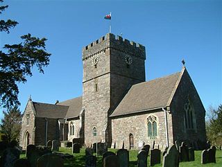
Shirenewton is a village and community in Monmouthshire, south east Wales. It is located 3 miles due west of Chepstow, 5 miles (8 km) by road. The village stands around 500 feet above sea level, and has extensive views of the Severn Estuary and Bristol Channel. The population of the village and the conjoined village of Mynydd-bach was 657 in 2011.
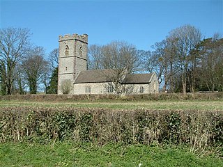
Bishton or Bishopston is a small rural community in the east of the city of Newport, South Wales. It lies in the Llanwern electoral district (ward) and contains the eastern end of Llanwern steelworks, the Underwood estate as well as Bishton itself. The population in the 2001 census was 2,181; dropping to 2,137 in 2011.
Southern Monmouthshire was a parliamentary constituency in Monmouthshire, Wales. It returned one Member of Parliament (MP) to the House of Commons of the Parliament of the United Kingdom.
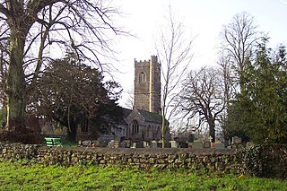
Mathern is a historic community (parish) and village in Monmouthshire, south east Wales, about 3 miles (4.8 km) south west of the town of Chepstow, close to the Severn estuary, the Bristol Channel and the M48 motorway. The village is designated as a Conservation Area. It is now bisected by the motorway, which passes over the road through the village, with the original village located to the south and the more recent development, known as Newton Green, to the north.

Llangwm is a small rural village and former community, now in the community of Llantrisant Fawr, in Monmouthshire, south east Wales. It is located 3 miles (4.8 km) east of Usk, on the B4235 Chepstow to Usk road. The main village is at Llangwm Uchaf, with a smaller and more dispersed settlement about 1 mile (1.6 km) to the north-east at Llangwm Isaf .The other settlement in the community is Llansoy. In 2022 the community was abolished and merged with Llantrisant Fawr.

Llantrisant is a village in Monmouthshire, south east Wales, United Kingdom. The community population at the 2011 census was 475.
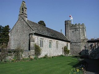
St Pierre is a former parish and hamlet in Monmouthshire, south east Wales, 3 miles (4.8 km) south west of Chepstow and adjacent to the Severn Estuary. It is now the site of a large golf and country club, the Marriott St Pierre Hotel & Country Club, which was previously a large manor house and deer park belonging to the Lewis family.

Henry Avray Tipping was a French-born British writer on country houses and gardens, a garden designer, and Architectural Editor of Country Life magazine for 17 years.

Bulwark is a predominantly residential area of Chepstow, Monmouthshire, Wales, largely developed during the twentieth century. The area is so named because of its Iron Age fort, which is now maintained as a public open space. Substantial development in the area began during the First World War, with housing being provided for the military and civilian workforce brought to the area for the National Shipyard no.1 at Chepstow.

The Church of St Peter, St Paul and St John, is the parish church of Llantrisant, Monmouthshire, Wales. Described by the architectural historian, John Newman as "a handsome church" in the Decorated style, it has been a Grade I listed building since 18 November 1980.

High Glanau is a country house and Grade II* listed building within the community of Cwmcarvan, Monmouthshire, Wales. It is located about 5 miles (8.0 km) south-west of Monmouth, and 1.5 miles (2.4 km) north of Trellech, adjoining the B4293 road and with views westwards over the Vale of Usk. Commissioned by Henry Avray Tipping and designed by Eric Francis, it is particularly noted for its gardens which are listed at Grade II* on the Cadw/ICOMOS Register of Parks and Gardens of Special Historic Interest in Wales.
Eric Carwardine Francis was a British architect and painter who designed a number of notable buildings, particularly in Monmouthshire, Gloucestershire and Somerset, in the early and mid-twentieth century, many in the Arts and Crafts style.

Monmouthshire is a county and principal area of Wales. It borders Torfaen and Newport to the west; Herefordshire and Gloucestershire to the east; and Powys to the north. The largest town is Abergavenny, with the other major towns being Chepstow, Monmouth, and Usk. The county is 850 km2 in extent, with a population of 95,200 as of 2020. The present county was formed under the Local Government (Wales) Act 1994, which came into effect in 1996, and comprises some sixty percent of the historic county. Between 1974 and 1996, the county was known by the ancient title of Gwent, recalling the medieval Welsh kingdom. In his essay on local government in the fifth and final volume of the Gwent County History, Robert McCloy suggests that the governance of "no county in the United Kingdom in the twentieth century was so transformed as that of Monmouthshire".
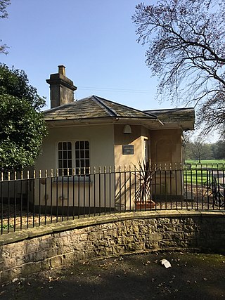
Wyelands, sometimes styled The Wyelands or Wyelands House, is a Grade II* listed building and estate located about 1 mile (1.6 km) north of the village of Mathern, Monmouthshire, Wales, United Kingdom and about 1 mile (1.6 km) west of the edge of Chepstow. It is a neoclassical villa designed by Robert Lugar in the late Regency period, and was completed around 1830. The park surrounding the house is listed on the Cadw/ICOMOS Register of Parks and Gardens of Special Historic Interest in Wales.

Mounton House, Mounton, Monmouthshire, Wales, is the last major country house built in the county, constructed between 1910 and 1912 by the architect and writer Henry Avray Tipping for himself. Formerly a school, which has now relocated to the grounds, the house has been divided into apartments. It is a Grade II* listed building. The surrounding park is on the Cadw/ICOMOS Register of Parks and Gardens of Special Historic Interest in Wales.
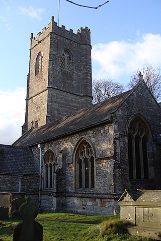
St Tewdric's Church is a Church in Wales parish church in Mathern, Monmouthshire, Wales. It is purportedly built over the resting place of Saint Tewdrig for whom it is named. A church has been located on the site since the 6th century. It was reconstructed by the Normans in the Early English style, and later was renovated by the Victorians. It is a Grade I listed building.

Monmouthshire is a county of Wales. It borders Torfaen and Newport to the west; Herefordshire and Gloucestershire to the east; and Powys to the north. The largest town is Abergavenny, with other large settlements being Chepstow, Monmouth, and Usk. The present county was formed under the Local Government (Wales) Act 1994, which came into effect in 1996. It has an area of 850 km2 (330 sq mi), with a population of 93,200 as of 2021. Monmouthshire comprises some sixty per cent of the historic county, and was known as Gwent between 1974 and 1996.


