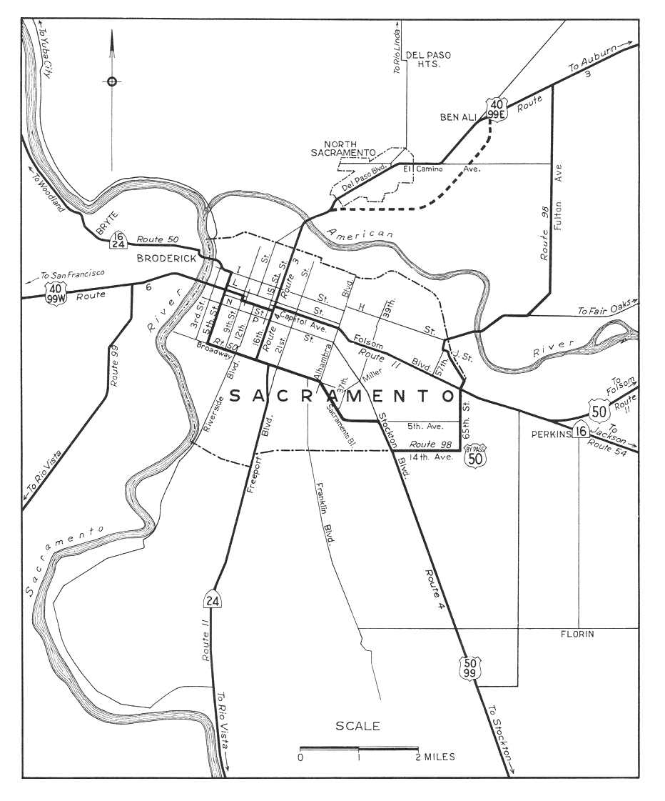
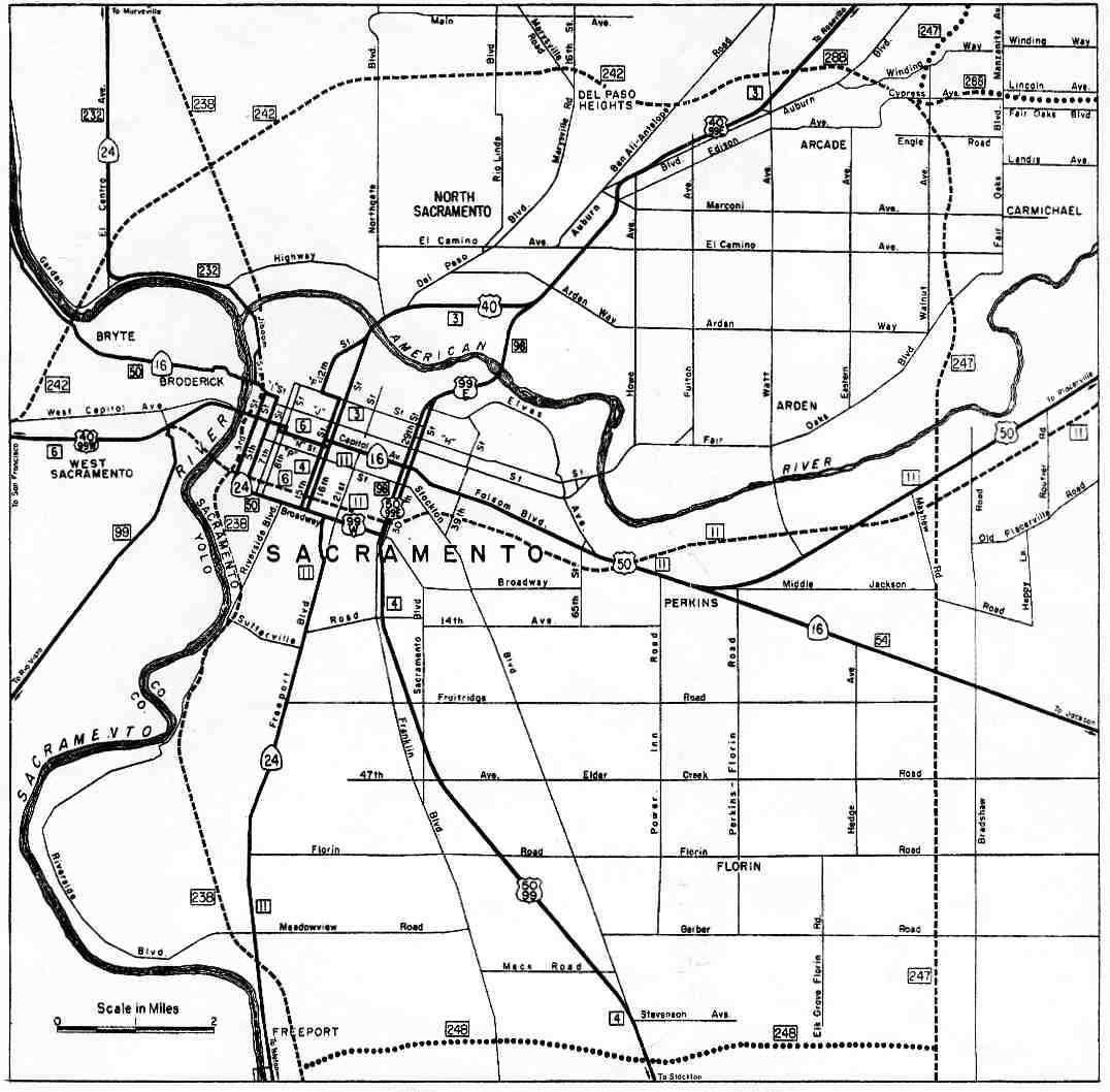
Prior to 1996, SR 275 was part of the West Sacramento Freeway. The West Sacramento Freeway designation begins on Interstate 80 at exit 81 (West Capitol Avenue), the east end of the Yolo Causeway. It soon splits, with I-80 exiting to bypass Sacramento to the north and Interstate 80 Business (legislatively U.S. Route 50) continuing east via exit 82 towards downtown. After one interchange, at Harbor Boulevard (exit 1/1B), the freeway splits again, with Bus. 80 turning abruptly southeast over the Pioneer Memorial Bridge to avoid downtown Sacramento. The original SR 275 designation then began here, at exit 3 of Bus. 80, with full access to and from the intersecting Jefferson Boulevard (State Route 84).[2]
Capitol Mall, with 9th Street — the former east end of SR 275 — behind the fountain
After the Jefferson Boulevard interchange, the road — now maintained by the city of West Sacramento as Cabaldon Parkway — crosses the new Grand Street at an at-grade intersection. This intersection replaced a partial trumpet interchange, oriented towards West Capitol Avenue with a missing westbound entrance, in 2007. After Cabaldon Parkway crosses under the Union Pacific Railroad line that used to cross the Tower Bridge, it approaches an intersection with 5th Street. It was formerly a ramp that entered the westbound lanes from the intersection of West Capitol Avenue and 5th Street, which completed the former interchange at Riske Lane. Two blocks to the east, Cabaldon Parkway approaches its final intersection in West Sacramento with 3rd and Riverfront Streets. A westbound offramp formerly led to West Capitol Avenue and 3rd Street, with eastbound access to Broderick to the north and the formerly industrial area to the south, now containing Sutter Health Park.[2]
State maintenance resumes once again as SR 275 as the road crosses the Sacramento River on the Tower Bridge. At the east end of the bridge, SR 275 ends and the roadway becomes Capitol Mall, maintained by the city of Sacramento, and crosses over Interstate 5. Seven blocks later, the main road ends at 9th Street; the last block of Capitol Mall to 10th Street, on which the State Capitol fronts, is a two-lane road with a mid-block traffic circle around a fountain.[2]
SR 275 began as part of Legislative Route 6, one of the shorter main routes of the initial system funded by the 1910 bond issue. This highway, which included the several-mile-long Yolo Causeway, connected Sacramento with the north–south Route 7 at Davis, thereby linking the capital city with the San Francisco Bay Area. Route 6 traffic initially left Sacramento on the 1911 I Street Bridge, heading southwest through the small settlement of Washington via D Street, 5th Street, and present Tower Court to West Capitol Avenue.[5][6] The state highway was moved to the M Street Bridge in 1926, as part of an improvement that also took it through a two-lane subway under the Sacramento Northern Railroad, still present on West Capitol Avenue.[7] The M Street Bridge was replaced by the Tower Bridge in 1935.[8]
U.S. Routes 40 and 99 (soon 99W) were marked along Route 6 in 1928.[9] These two routes remained on West Capitol Avenue[10] until 1954, when the new West Sacramento Freeway opened, connecting the west end of the Tower Bridge with the east end of the Yolo Causeway. Traveler-oriented businesses along the bypassed West Capitol Avenue were hit hard by the shifting of through traffic.[11]
The entire freeway was designated as part of Interstate 80 in the late 1950s. However, two bypasses were planned — a realignment of Route 6 that would take I-80 over a new bridge and around the south side of downtown, and a northern bypass of the entire city (I-880).[12] Since the southerly bypass had not been completed in time for the 1964 renumbering, the route over the Tower Bridge — and along downtown streets — became Route 80,[13] but US 99W signage remained (initially following Capitol Mall to near the State Capitol, later turning south onto 3rd and 5th Streets east of the bridge)[14][15] until the late 1960s,[16] before I-5 had finished replacing old US 99W north of Woodland.[17]
Normally, upon completion of the new I-80 south of downtown, the old alignment over the Tower Bridge and through downtown would be relinquished. The legislature recognized that it might be useful to keep a state highway to the Capitol, and so in 1966 it passed a concurrent resolution requesting that the California Highway Commission delay relinquishment west of 9th Street until the last day of the 1967 legislative session.[18] During that session, a new Route 275 was created from that portion of former Route 80. This consisted of the eastern part of the West Sacramento Freeway, the Tower Bridge, and Capitol Mall up to 9th Street, just west of the capitol building. The portion in Sacramento, east of the bridge, was not to be beautified with state highway funds.[19] Due to the cancellation of a replacement of the North Sacramento Freeway, I-80 was moved to former I-880 around the city in 1981, giving the West Sacramento Freeway three numbers: I-80, US 50, and SR 275.[20]
In 1993, the West Sacramento City Council approved the "Triangle Specific Plan" for a new downtown in the triangle bounded by the Sacramento River, SR 275, and US 50;[21] this plan included downgrading the freeway to a surface road.[22] The state legislature passed a law in 1994 that allowed Caltrans to come to an agreement with West Sacramento or Sacramento for the relinquishment of any part of SR 275.[23] Although no portions had yet been relinquished, the legislature deleted Route 275 from the Streets and Highways Code in 1996.[24]
The Triangle redevelopment happened slowly, with the first part — Raley Field (now Sutter Health Park) — opening in 2000.[22] Effective January 1, 2001, Caltrans relinquished SR 275 to West Sacramento between postmiles 12.4 (west of Riske Lane) and 13.0 (the west end of the Tower Bridge).[25][26] The city renamed the road Tower Bridge Gateway and demolished the Riske Lane overpass in early 2007, replacing it with a signalized intersection that now serves the new Garden Street (later renamed Grand Street).[27]
The city of Sacramento also wished to modify its section of SR 275, which, while not a freeway, was still designed for motor vehicle traffic. Capitol Mall east of postmile 0.11 (the east end of the Tower Bridge) was relinquished to the city effective January 1, 2006.[28][29] A ramp from the bridge to N Street was closed in July 2007, allowing the block it had cut diagonally through to be sold.[30] The ramp's counterpart, from L Street to the Tower Bridge, remained open, though the lot that includes it was sold to the Sacramento Housing and Redevelopment Agency in 2005.[31] The ramp finally closed to traffic in 2016 in conjunction with a project to connect 2nd Street in Old Sacramento to Capitol Mall.[32]
These 2001 and 2007 relinquishments left Caltrans maintaining only two pieces of SR 275 — the Tower Bridge and the west end through the Jefferson Boulevard (SR 84) interchange — for a total of about 0.9 miles (1.4km), under half of the 1967-2001 length. A joint project to widen the bridge sidewalks was carried out by Sacramento, West Sacramento, and Caltrans. The project was completed in May 2008.[33]
A second phase to convert the remaining section of freeway of Tower Bridge Gateway to a city street began in 2010. The 3rd Street underpass and subsequent interchange was removed and signalized intersections at 5th and 3rd Streets were constructed. The project was completed in November 2011.[34]
The legislature added Route 275 back to the Streets and Highways Code in 2010, but its definition now only includes "Tower Bridge from the west side of the Sacramento River near the City of West Sacramento to the east side of the Sacramento River near the City of Sacramento."[35]
On November 6, 2024, Tower Bridge Gateway was renamed Cabaldon Parkway in honor of former West Sacramento mayorChristopher Cabaldon.[1]
As of 2024, only two interchanges of the former SR 275 remain: a diamond interchange at Jefferson Boulevard (SR 84) and the split at Business Loop 80 / US 50.
Major intersections
Except where prefixed with a letter, postmiles were measured on the road as it was in 1964, based on the alignment of Route 80 as it existed at that time, and do not necessarily reflect current mileage.R reflects a realignment in the route since then, M indicates a second realignment, L refers to an overlap due to a correction or change, and T indicates postmiles classified as temporary (for a full list of prefixes, see California postmile §Official postmile definitions).[36] Segments that remain unconstructed or have been relinquished to local control may be omitted.The numbers reset at county lines; the start and end postmiles in each county are given in the county column.
The Santa Ana Freeway is one of the principal freeways in Southern California, connecting Los Angeles and its southeastern suburbs including the freeway's namesake, the city of Santa Ana. The freeway begins at its junction with the San Diego Freeway, called the El Toro Y, in Irvine, signed as I-5. From there, it generally goes southeast to northwest to the East Los Angeles Interchange, where it takes the designation of U.S. Route 101 (US 101). It then proceeds 2.95 miles (4.75 km) northwest to the Four Level Interchange in downtown Los Angeles. Formerly, the entirety of the route was marked as US 101 until the 1964 highway renumbering, which truncated US 101 to the East Los Angeles Interchange and designated the rest of the freeway as I-5.
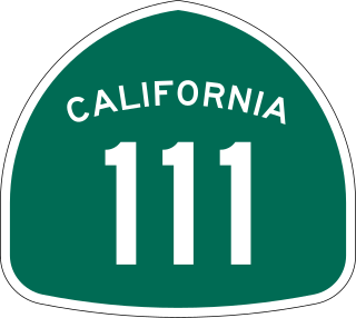
State Route 111 is a state highway in the southeastern part of U.S. state of California. It is a north-south route serving the Imperial Valley, the eastern shore of the Salton Sea, and the Coachella Valley. Its southern terminus is at Imperial Avenue and 1st Street in Calexico, at the former entrance to the Calexico West Port of Entry. SR 111's northern terminus is at Interstate 10 at the northwestern corner of the Palm Springs city limits, near the unincorporated community of Whitewater.
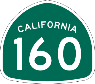
State Route 160 is a state highway in the U.S. state of California consisting of two sections. The longer, southern, section is a scenic highway through the alluvial plain of the Sacramento River, linking SR 4 in Antioch with Sacramento via the Antioch Bridge. The northern section, separated from the southern by Sacramento city streets, is the North Sacramento Freeway, running from the 16th Street Bridge over the American River to Interstate 80 Business towards Roseville.
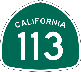
State Route 113 is a north–south state highway in the U.S. state of California that runs from around 10 miles (16 km) in the Sacramento Valley west of Rio Vista at State Route 12 to State Route 99 in Tudor. It serves as one of two important connecting routes between Interstate 80 and Interstate 5, bypassing Sacramento to the east; the other being Interstate 505 to the west. Past the southern terminus are Collinsville and Birds Landing around the Suisun Bay marshes. Cities along the route include Dixon, Davis, and Woodland. It also shares a stretch of Interstate 80 between just outside UC Davis and Dixon. The section running from Dixon to Woodland is a controlled-access freeway; the remainder is a standard road of two to four lanes. The freeway section spanning from the I-80 interchange in Davis to Woodland is called the Vic Fazio Highway, after the former U.S. House representative of the Davis area, who is credited with obtaining the funding for the freeway upgrade of that section.
State Route 84 is a state highway in the U.S. state of California that consists of two unconnected segments, one in the San Francisco Bay Area and the other primarily in the Sacramento–San Joaquin River Delta area.
State Route 19 is a state highway in the U.S. state of California, running along Lakewood Boulevard and Rosemead Boulevard in the Los Angeles area. An additional "hidden" state highway, State Route 164, is also signed as part of SR 19, despite having a legal description separate from Route 19. The combined route is a north–south four-to-six lane suburban roadway, lying east of the Long Beach Freeway and west of the San Gabriel River Freeway, and connecting the eastern parts of Long Beach and Pasadena via the Whittier Narrows. Under their legal descriptions, SR 19 runs north to Gallatin Road in Pico Rivera, then SR 164 goes from Gallatin Road to Pasadena. Since 1998, several pieces have been relinquished to local governments, and more transfers are authorized by state law.
State Route 66 is a state highway in the U.S. state of California that runs along a section of old U.S. Route 66 in Los Angeles and San Bernardino counties. It goes from State Route 210 in La Verne east to Interstate 215 in San Bernardino, passing through Claremont, Upland, Rancho Cucamonga, Fontana and Rialto along Foothill Boulevard. In San Bernardino, it is the part of Fifth Street west of H Street.
State Route 41 is a state highway in the U.S. State of California, connecting the Central Coast with the San Joaquin Valley and the Sierra Nevada. Its southern terminus is at the Cabrillo Highway in Morro Bay, and its northern terminus is at SR 140 in Yosemite National Park. It has been constructed as an expressway from near SR 198 in Lemoore north to the south part of Fresno, where the Yosemite Freeway begins, passing along the east side of downtown and extending north into Madera County.
Interstate 80 Business, called the Capital City Freeway in its entirety and also known as Business 80, is a business loop of Interstate 80 (I-80) through Sacramento, California, United States. The route is also colloquially referred to as "Cap City Freeway" and "Biz 80". The entire route is a freeway.
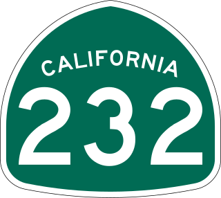
State Route 232 is a state highway in the U.S. state of California that runs along Vineyard Avenue in Ventura County, serving as a connector between US 101 in Oxnard and SR 118 near Saticoy.
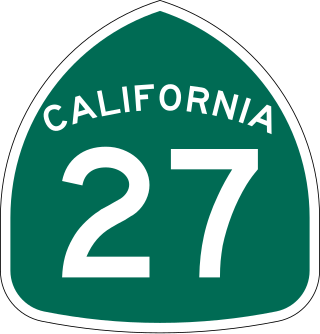
State Route 27, commonly known by its street name Topanga Canyon Boulevard, is a state highway in the U.S. state of California that runs from the Pacific Coast Highway at Topanga State Beach near Pacific Palisades, through the Topanga Canyon in Topanga, and continuing through Woodland Hills, Canoga Park, West Hills, and Chatsworth to the Ronald Reagan Freeway.
State Route 103 is a state highway in the U.S. state of California that forms part of the Terminal Island Freeway in Los Angeles and Long Beach. It runs from State Route 47 near Terminal Island north to State Route 1 in Long Beach. At the south end of SR 103, the Terminal Island Freeway runs south with SR 47 over the Commodore Schuyler F. Heim Bridge to its end at Ocean Boulevard on Terminal Island, at the former Long Beach Naval Shipyard. SR 47 then turns west there to its end at Interstate 110.
State Route 62 is a state highway in the U.S. state of California that cuts across the Little San Bernardino Mountains in Riverside and San Bernardino counties. Its western terminus is at Interstate 10 in unincorporated Riverside County outside the borders of Whitewater and Palm Springs. Its eastern terminus is at the Arizona state line just east of Parker, Arizona. The highway passes through the city of Twentynine Palms and along the northern boundary of the Joshua Tree National Park.
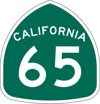
State Route 65 is a north-south state highway in the U.S. state of California. It is composed of two segments in the Central Valley. The southern segment begins at SR 99, near Bakersfield and terminates at SR 198 near Exeter. It also serves the communities of Oildale, Ducor, Terra Bella, Porterville, Strathmore, and Lindsay. The northern segment begins at Interstate 80 in Roseville and terminates at SR 70 at Olivehurst. It also serves the communities of Rocklin, Lincoln, and Wheatland.
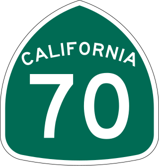
State Route 70 is a state highway in the U.S. state of California, connecting SR 99 north of Sacramento with U.S. Route 395 near Beckwourth Pass via the Feather River Canyon. Through the Feather River Canyon, from SR 149 to US 395, SR 70 is the Feather River Scenic Byway, a Forest Service Byway that parallels the ex-Western Pacific Railroad's Feather River Route.
State Route 185 is a state highway in the San Francisco Bay Area of the U.S. state of California. It runs along sections of Mission Boulevard in Hayward, East 14th Street in San Leandro and International Boulevard in Oakland. At its south end, SR 185 connects with State Routes 92 and 238 in Hayward. At the north end of SR 185 at International Boulevard and 42nd Avenue, the short State Route 77 heads southwest to Interstate 880.
State Route 115 is a state highway in the U.S. state of California. It runs in Imperial County from Interstate 8 (I-8) southeast of Holtville to SR 111 in Calipatria. The routing was added to the state highway system in 1933, and was constructed by 1934; SR 115 was officially designated in the 1964 state highway renumbering.
State Route 244 is an unsigned state highway in the U.S. state of California located northeast of Sacramento. It serves as a short freeway connection between the Interstate 80/Interstate 80 Business junction and Auburn Boulevard. SR 244 was first added to the state highway system in 1959 as Legislative Route 288, and was renumbered as SR 244 in the 1964 renumbering. Portions of this route have been removed from the system as recently as 1994.
U.S. Route 50 (US 50) is a transcontinental United States Numbered Highway, stretching from West Sacramento, California, in the west to Ocean City, Maryland, in the east. The California portion of US 50 runs east from Interstate 80 (I-80) in West Sacramento to the Nevada state line in South Lake Tahoe. A portion in Sacramento also has the unsigned designation of Interstate 305. The western half of the highway in California is a four-or-more-lane divided highway, mostly built to freeway standards, and known as the El Dorado Freeway outside of downtown Sacramento. US 50 continues as an undivided highway with one eastbound lane and two westbound lanes until the route reaches the canyon of the South Fork American River at Riverton. The remainder of the highway, which climbs along and out of the canyon, then over the Sierra Nevada at Echo Summit and into the Lake Tahoe Basin, is primarily a two-lane road.
U.S. Route 95 (US 95) is a United States Numbered Highway, stretching from the Mexican border in San Luis, Arizona to the Canadian border near Eastport, Idaho. The California portion of US 95 traverses through the far eastern edges of both Riverside and San Bernardino counties. US 95 serves Blythe and Needles and junctions with SR 62 at Vidal Junction.
↑ Federal Highway Administration (March 25, 2015). National Highway System: Sacramento, CA(PDF) (Map). Scale not given. Washington, DC: Federal Highway Administration. Retrieved August 20, 2017.
↑ Natzke, Stefan; Neathery, Mike & Adderly, Kevin (June 20, 2012). "What is the National Highway System?". National Highway System. Washington, DC: Federal Highway Administration. Retrieved July 1, 2012.
↑ Ben Blow, California Highways: A Descriptive Record of Road Development by the State and by Such Counties as Have Paved Highways, 1920 (Archive.org or Google Books), pp. 101-102, 206, 285
↑ Sacramento Bee, Face-lift on Capitol Mall menu, February 5, 2006, p. B1: "City leaders have said something should be done to spruce up the concourse. But until January, the state Department of Transportation controlled it as a state highway. Control now has passed to the city, and city staff members say Sacramento should do something to make the mall more inviting for pedestrians and visitors."
↑ California Transportation Commission, Minutes, July 13–14, 2005, p. 13
↑ California State Assembly. " Session of the Legislature". Session of the Legislature. Statutes of California. State of California. Ch. 421.
1 2 California Department of Transportation. "State Truck Route List". Sacramento: California Department of Transportation. Archived from the original(XLS file) on September 5, 2015. Retrieved June 30, 2015.
This page is based on this Wikipedia article Text is available under the CC BY-SA 4.0 license; additional terms may apply. Images, videos and audio are available under their respective licenses.


