State Route 118 is a state highway in the U.S. state of California that runs west to east through Ventura and Los Angeles counties. It travels from State Route 126 at the eastern edge of Ventura immediately northwest of Saticoy, then through Saticoy, in Ventura County east to Interstate 210 near Lake View Terrace in Los Angeles. SR 118 crosses the Santa Susana Pass and the northern rim of the San Fernando Valley along its route.

State Route 3 is a state highway in the U.S. state of California that serves Trinity and Siskiyou counties. It runs from SR 36 north along the shore of Trinity Lake, Fort Jones and Etna. The route then approaches Yreka, intersecting with Interstate 5 (I-5), and turns east to Montague. The road was numbered SR 3 in 1964, and most of it has been part of the state highway system since 1933.
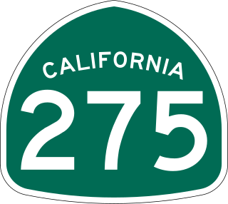
State Route 275 is an unsigned state highway connecting West Sacramento, California and Downtown Sacramento. Since 1996, the highway has been legally defined to be the length of the Tower Bridge crossing the Sacramento River. Prior to that year, SR 275 was also known as the West Sacramento Freeway, and was a short spur connecting Interstate 80 Business / U.S. Route 50 in West Sacramento, and the Tower Bridge. SR 275 also extended east into Sacramento along the Capitol Mall from the bridge to 9th Street, just west of the California State Capitol. West Sacramento completed a project to replace the freeway with a pedestrian-friendly street initially named Tower Bridge Gateway. The street was renamed Cabaldon Parkway in honor of former West Sacramento mayor Christopher Cabaldon.

State Route 154 is a state highway in the U.S. state of California that runs from Los Olivos to Santa Barbara, crossing the San Marcos Pass in the Santa Ynez Mountains. Before U.S. Route 101 was built through the Gaviota Pass, SR 154 was the main throughway to Santa Barbara and the tri city area including use as a stagecoach route in early years. After being replaced by US 101 as the primary route between the Santa Ynez Valley and Santa Barbara, SR 154 now serves as a scenic bypass.

State Route 189 is a state highway in the U.S. state of California that runs through the San Bernardino Mountains in San Bernardino County. The route travels from State Route 18 near Crestline to State Route 173 in Lake Arrowhead, serving Twin Peaks and Blue Jay along its way.

State Route 66 is a state highway in the U.S. state of California that runs along a section of old U.S. Route 66 in Los Angeles and San Bernardino counties. It goes from State Route 210 in La Verne east to Interstate 215 in San Bernardino, passing through Claremont, Upland, Rancho Cucamonga, Fontana and Rialto along Foothill Boulevard. In San Bernardino, it is the part of Fifth Street west of H Street.

State Route 142, also known as Carbon Canyon Road for most of its length, is a state highway in the U.S. state of California that connects Brea in Orange County with Chino Hills in San Bernardino County. The eastern portion of the route is known as Chino Hills Parkway.
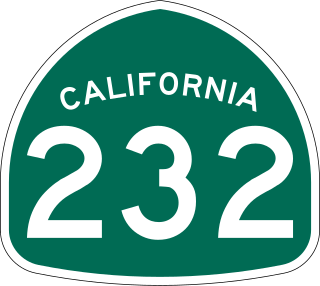
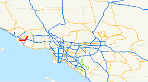
State Route 232 is a state highway in the U.S. state of California that runs along Vineyard Avenue in Ventura County, serving as a connector between US 101 in Oxnard and SR 118 near Saticoy.
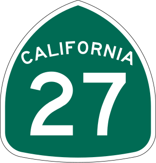
State Route 27, commonly known by its street name Topanga Canyon Boulevard, is a state highway in the U.S. state of California that runs from the Pacific Coast Highway at Topanga State Beach near Pacific Palisades, through the Topanga Canyon in Topanga, and continuing through Woodland Hills, Canoga Park, West Hills, and Chatsworth to the Ronald Reagan Freeway.
State Route 246 is a state highway in the U.S. state of California that runs from Lompoc east to Solvang and Santa Ynez, cutting through the Santa Ynez Valley and the Santa Barbara Wine Country. Its western terminus is at the western city limits of Lompoc, and its eastern terminus is at State Route 154 near Santa Ynez.
State Route 224 was a state highway in the U.S. state of California that served as a spur route in Santa Barbara County from U.S. Route 101 in Carpinteria to Carpinteria State Beach. The route existed from 1964 to 1996.
State Route 371 is a state highway in Riverside County, California, serving as a 20.75-mile (33.39 km) connector from SR 79 near Aguanga to SR 74 near Anza. The highway crosses through the private community of Lake Riverside, as well as Cahuilla and the Cahuilla Indian Reservation. It is the primary road running through Anza but mostly serves rural areas.

State Route 62 is a state highway in the U.S. state of California that cuts across the Little San Bernardino Mountains in Riverside and San Bernardino counties. Its western terminus is at Interstate 10 in unincorporated Riverside County outside the borders of Whitewater and Palm Springs. Its eastern terminus is at the Arizona state line just east of Parker, Arizona. The highway passes through the city of Twentynine Palms and along the northern boundary of the Joshua Tree National Park.

State Route 195 was a state highway in the U.S. state of California, branching westward from SR 111 to SR 86 near the town of Mecca and the Salton Sea. The route formerly extended east to Interstate 10 (I-10) near Joshua Tree National Park as a longer route extending to Blythe and points further east. After the main route was shifted north, the older route remained as an alternate known as Box Canyon Road. The route was designated in the 1964 state highway renumbering, although the Box Canyon Road portion was removed as a state highway in 1972. Following the construction of the SR 86 expressway, SR 195 was curtailed in 2009, and removed entirely in 2014.

State Route 115 is a state highway in the U.S. state of California. It runs in Imperial County from Interstate 8 (I-8) southeast of Holtville to SR 111 in Calipatria. The routing was added to the state highway system in 1933, and was constructed by 1934; SR 115 was officially designated in the 1964 state highway renumbering.

State Route 127 is a state highway in the U.S. state of California that connects Interstate 15 in Baker to Nevada State Route 373 at the Nevada state line, passing near the eastern boundary of Death Valley National Park. The entire length of the highway closely follows the central portion of the former Tonopah and Tidewater Railroad and loosely follows the Amargosa River.

State Route 266 (SR 266) is a state highway in the U.S. state of California. The route traverses Fish Lake Valley, which is part in California and part in Nevada. The route connects two Nevada state routes that traverse the Nevada portion of the valley, SR 264 and SR 266. The only connection from SR 266 to the rest of California's road network is via SR 168 in the community of Oasis. Prior to 1986 the southern and northern halves of modern SR 266 had separate numerical designations. The southern portion of the highway, along with modern SR 168, dates to the auto trail era, forming part of the Midland Trail.

State Route 244 is an unsigned state highway in the U.S. state of California located northeast of Sacramento. It serves as a short freeway connection between the Interstate 80/Interstate 80 Business junction and Auburn Boulevard. SR 244 was first added to the state highway system in 1959 as Legislative Route 288, and was renumbered as SR 244 in the 1964 renumbering. Portions of this route have been removed from the system as recently as 1994.

State Route 174 is a state highway in the U.S. state of California. The two-lane 13-mile (21 km) highway in the western Sierra Nevada, added to the state highway system in 1933, connects Interstate 80 in Colfax with SR 20/SR 49 in Grass Valley, crossing the Bear River next to a 1924 concrete arch bridge. The majority of the route is eligible for the State Scenic Highway System, but local residents have blocked its designation due to property right concerns.

State Route 187 is a state highway in the U.S. state of California that runs along Venice Boulevard in Los Angeles from Lincoln Boulevard in Venice to Interstate 10 in the South Robertson district.