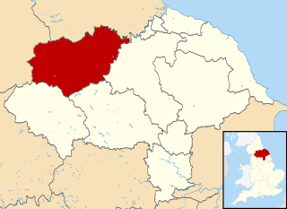
Richmondshire was a local government district of North Yorkshire, England, from 1974 to 2023. It covered a large northern area of the Yorkshire Dales including Swaledale and Arkengarthdale, Wensleydale and Coverdale, with the prominent Scot's Dyke and Scotch Corner along the centre. Teesdale lay to the north. With a total area of 1,319 km2, it was larger than seven of the English ceremonial counties.

Swaledale is a valley in North Yorkshire, England. It is one of the Yorkshire Dales, which are part of the Pennines, and within the Yorkshire Dales National Park. It is named after the River Swale, which runs through it. Swaledale is the most northerly of the major dales.
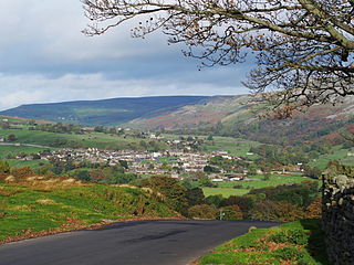
Reeth is a village 11 miles (18 km) west of Richmond in North Yorkshire, England, in the civil parish of Reeth, Fremington and Healaugh. Historically part of the North Riding of Yorkshire, it is the principal settlement of upper Swaledale.
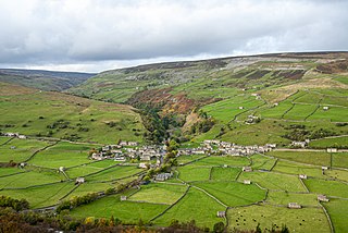
Gunnerside is a village in North Yorkshire, England. It is situated in Swaledale, on the B6270 road, 3 miles (5 km) east of Muker and 6 miles (10 km) west of Grinton. The village lies between the River Swale and its tributary, Gunnerside Beck, and is within the Yorkshire Dales National Park.

Arkengarthdale is a dale, or valley, on the east side of the Pennines in North Yorkshire, England. Running roughly north-west to south-east, it is the valley of the Arkle Beck, and is the northernmost of the Yorkshire Dales. It is a subsidiary dale to Swaledale, which it joins at Reeth. The history of the dale, its people, and farming, lead mining, and local crafts is displayed and documented in the Swaledale Museum in Reeth.

Bishopdale is a dale in the Yorkshire Dales National Park in North Yorkshire, England. The dale is a side dale on the south side of Wensleydale, and extends for some 6 miles (10 km) south west from Aysgarth. Bishopdale is also the name of a civil parish, which includes only the sparsely populated upper reaches of the dale, from the head of the dale as far downstream as Howesyke and Howgill Gill.

Fremington Edge is a 3-mile (5 km) long wall of crags and scree slopes that is situated to the north of the village of Reeth in Swaledale in the Yorkshire Dales National Park, England. Fremington Edge forms the south-eastern edge of Arkengarthdale, extending to the point where the dale meets Swaledale. Throughout its full length the Edge stays above the height of 1,300 feet (400 m) and reaches a highest point of 1,552 feet (473 m) at the northern end of the escarpment.

Grinton is a small village and civil parish in the Yorkshire Dales, North Yorkshire, England. Close to Reeth and Fremington, it lies 9 miles (15 km) west of Richmond on the B6270 road.

Appersett is a hamlet in the Yorkshire Dales in the Richmondshire district of North Yorkshire, England one mile (1.6 km) west of Hawes. It lies on the A684 road and an unclassified road runs alongside Widdale Beck to connect with the B6255 road between Hawes and Ingleton.
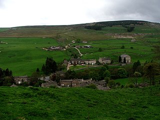
Langthwaite is one of the few villages in Arkengarthdale, North Yorkshire, England. It is 3.5 miles (5.6 km) north of Reeth and sits 870 feet (270 m) above sea level. It is the main settlement in the dale and is one of the most northerly settlements in the whole of Yorkshire Dales National Park. Langthwaite is one of two places in the dale that have houses clustered together closely in a traditional village set up; the rest of the settlements in the dale are populated by scattered buildings.
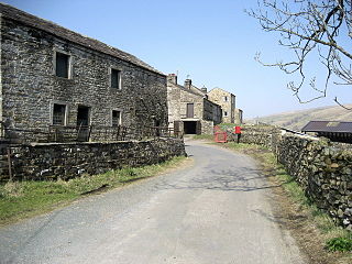
West Stonesdale is a hamlet in the Yorkshire Dales, North Yorkshire, England. The secluded village is near Keld to the south, Tan Hill to the north and is both 10 miles (16 km) from Grinton and Askrigg. The small valley that cuts south from Tan Hill to West Stonesdale is also known as West Stonesdale and carries Stonesdale Beck 4 miles (7 km) south to the River Swale. A road heads north from the B6270 through West Stonesdale to Tan Hill. Where the road diverges from the B6270 is the site of Currack Force, a waterfall on Stonesdale Beck which drops 23 feet (7 m) before entering the Swale.

Healaugh is a small village in the civil parish of Reeth, Fremington and Healaugh, in Swaledale in the Yorkshire Dales. It is in the Richmondshire district of North Yorkshire, England and lies about 1 mile west of Reeth.
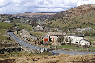
Arkle Town is a hamlet in Arkengarthdale in the Richmondshire district of North Yorkshire, England. It is situated 0.4 miles (0.64 km) to the south of Langthwaite and 2.7 miles (4.3 km) north-west of Reeth.

Booze is a hamlet in Arkengarthdale, in the Richmondshire district of North Yorkshire, England. It is about 1 mile (1.6 km) east of Langthwaite. There are 11 households in the hamlet. There is a riding school nearby.
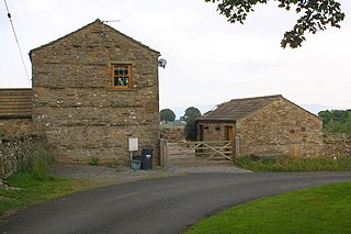
Newbiggin is a hamlet very close to Askrigg, North Yorkshire, England. Another Newbiggin is only about 7 miles (11 km) away. The hamlet consists of eight dwellings and other smaller buildings such as barns, just to the east of Askrigg at a height of 888 feet (270.6 m) above sea level.

Arkle Beck is the stream running through the valley of Arkengarthdale in the Yorkshire Dales, England. It is a tributary of the River Swale, which it joins just past Reeth at Grinton Bridge. The beck itself has several tributaries which include:

Birks Fell is a hill in the Yorkshire Dales, near to Hubberholme in North Yorkshire, England. It is classed as a Marilyn. Birks Fell only became an official Marilyn in 2006 as it was resurveyed and discovered to be 610 metres (2,001 ft) and not 608 metres (1,995 ft) as previously thought. Books from the late 19th and early 20th centuries list the hill as being 2,001 feet (610 m) and it is thought that in the conversion to metric, the hill lost some height. This raises it above neighbouring Horse Head Moor, making it the Marilyn in place of Horse Head Moor.

The Church of St Andrew, Grinton, is the parish church for the village of Grinton in North Yorkshire, England. The grade I listed structure has also been called The Cathedral of the Dales, and as the only parish church in Upper Swaledale, it was at the end of the Swaledale Corpse Way, where those who had died in the upper valley, were brought for burial. Grinton never developed past village status, but its noted crossing point of the River Swale afforded it more importance than other settlements.

The Church of St Mary the Virgin is an Anglican church in the Upper Swaledale village of Muker, in North Yorkshire, England. It is one of four churches in the ecclesiastical Parish of Swaledale with Arkengarthdale. The church was constructed in 1580, but previous to this, a chapel-of-ease had stood on the site which came under the Church of St Andrew in Grinton. Until the consecration of St Mary's, baptisms, weddings and funerals, had to be conducted at the church in Grinton. The Church of St Mary the Virgin, is noted for being a rare example of a house of worship being built during the Elizabethan era.

In July 2019, parts of the Yorkshire Dales, in North Yorkshire, England, were subjected to above average rainfall for the time of year. The flash-flooding that followed affected many communities destroying bridges, sweeping roads away, causing landslips on railway lines and resulting in at least one public event being cancelled. The flooding even inundated the fire station in the town of Leyburn, in Wensleydale, whilst the crew were out helping those in need. The recovery took many weeks and months, with immediate help by the rescue services being bolstered by British Army personnel who assisted with the clean up.


