Canadian Land and Emigration Company

Last updated

The Canadian Land and Emigration Company was an English company formed in 1861 to promote the sale of lands in the Province of Canada, most of which would later form the Municipality of Dysart et al in Haliburton County.

Contents

History

Formation

In 1859, the Crown Lands Department in the Province of Canada [lower-alpha 1] advertised a block of land for sale, comprising the townships of Dysart, Dudley, Harcourt, Gilford, Harburn, Bruton, Havelock, Eyre, Clyde, and Longford. The purpose was to promote rapid settlement of the newly created townships in the district through private enterprise.

The company, whose first chairman was Thomas Chandler Haliburton, [lower-alpha 2] was formed in April 1861 under the British Joint Stock Companies Act 1856 , [2] and acquired the above lands later that year, through the intermediary of an association formed by Richard Bethell, Samuel Gurney and George Lyall. [lower-alpha 3] [3] Among its investors (who were approached by John Beverley Robinson to participate in the venture) [4] were Sir Francis Bond Head, [lower-alpha 4] Henry Kingscote [lower-alpha 5] and Hugh Edmondstone Montgomerie. [lower-alpha 6] [6] Special legislation was passed by the Legislative Assembly of the Province of Canada in 1865 to facilitate the company's operations in the Province. [7]

Lengthy negotiations were carried on between the company, and the Department of Crown Lands concerning the selection of townships and the terms of sale. The department agreed to pay for the survey of the outlines of the townships, but the company had to pay for the survey within the townships and their subdivision into lots.

Of the ten townships purchased by the company, Longford was located in the County of Victoria, while the others were then a part of Peterborough County. These, along with other townships of Peterborough County, Victoria County and Nipissing District, were incorporated as the Municipality of Haliburton in 1874, which later became the Provisional County of Haliburton.

Although the company wanted to appoint Edward Madan Miles as the surveyor for these townships, [8] the Crown Lands Department preferred Brookes Wright Gossage, [8] who, with other surveyors under his direction, began work in the townships of Dysart and Longford. At first, Gossage was in partnership with John Stoughton Dennis and later with Vernon Bayley Wadsworth. As many as sixty or seventy men were employed on the project at one time, and large sums of money were required for wages and provisions. When the survey was completed it showed 403,125 acres (1,631 km2) in the ten townships of which 41,000 acres (166 km2) was deducted as being swamp, leaving 362,125 acres (1,465 km2) to be paid for at 50 cents per acre. Miles was later appointed to re-examine the surveys, and determined that the acreage fit for settlement was far below that estimated by Gossage, [8] but the latter's figures were accepted by the department. However, later settlers' experience proved the accuracy of Miles' report. [8]

Challenges

From the outset the company had difficulty in selling the lands. The distance of the townships from the settled parts of the province, the absence of good roads, [lower-alpha 7] the rough nature of the country, the Civil War in the United States, the Fenian raids on the border, the Long Depression of 18731879, and rival attractions of Western Canada, all combined to discourage sales.

From 1863 to 1870, a large number of emigrants came to settle in the region. By 1871, the company had sold 16,650 acres (67 km2) to settlers and a number of town lots to various purchasers. Most of the company's profits were realized from the sale of timber. In 1872, the company built a road between the villages of Kennaway and Haliburton, and contributed to the cost of the connection of a telegraph line to Haliburton. In 1877, the company aided the construction of the Victoria Railway from Kinmount to Haliburton with the hopes of increasing settlement in the townships.

By 1883, the Province of Ontario had begun to open up neighbouring townships in Haliburton and Muskoka with offers of free land grants, [lower-alpha 8] and the company found settlers were even more reluctant to purchase Company lands. The company was unable to cope with this competition. As a result, it was decided to offer for sale its complete holdings and undertakings in Canada. On April 11, 1883, the company appointed W.H. Lockhart Gordon [lower-alpha 9] and James Moore Irwin [lower-alpha 10] to be its commissioners of affairs in the area. [lower-alpha 11] [11]

Decline and dissolution

The company was involved in disputes with the Municipality of Dysart relating to valuations of its real and personal property, which led to a settlement in 1885 that was subsequently ratified by the Legislative Assembly of Ontario in 1887. [13]

The company initiated winding-up proceedings in 1888, [14] and was reincorporated by letters patent in Ontario as the Canadian Land and Immigration Company of Haliburton Limited in 1889. From 1890 to 1897 little activity took place. Sales of land and timber cutting rights had practically ceased. In 1895, Irwin declared bankruptcy and the bank (most likely the Canadian Bank of Commerce) took possession of his rights and interests in Haliburton, which included his shares in the new Company. In 1922, the company sold Bruton Township to the Hydro-Electric Power Commission of Ontario for $225,000, [15] and proceeds from the sale allowed the company to buy back from the bank the timber cutting rights previously licensed to Irwin. In 1933, the company sold Clyde Township back to the Province for $25,000. [16]

During the Great Depression, lumbering activities ceased once again, and financial difficulties resulted in liens being placed against the company's lands in Dysart. [17] However, as more roads were constructed, the region began to develop as a tourist and vacation area, and land sales began to increase. At the outbreak of World War II, lumbering activities intensified, and carried on into the post-war years. By the end of 1946, all of the land originally purchased by the company had been sold. The company wound up its affairs, surrendered its charter, and ceased to exist.

Further reading

Notes

  1. at that time directed by Matthew Scott VanKoughnet [1]
  2. whose name was given to the first village to be established within the Company's lands and later to the County of Haliburton.
  3. Member of Parliament (MP) for Whitehaven 1857-1865, and son of George Lyall Sr.
  4. initially proposed as chairman, until he withdrew in favour of Haliburton [5]
  5. also a director of the South Australian Company
  6. a ship insurance broker, and later a Chairman of the Company [5]
  7. the Peterson Road, which ran through the Company's townships, was being taken over by underbrush [9]
  8. following the passage of The Free Grants and Homestead Act in 1868 [10]
  9. a barrister in Toronto [11]
  10. brother-in-law and cousin of Mossom Martin Boyd [12]
  11. Irwin had been involved in lumbering in the area from 1877.

Related Research Articles

<span class="mw-page-title-main">Upper Canada</span> Former British colony in North America

The Province of Upper Canada was a part of British Canada established in 1791 by the Kingdom of Great Britain, to govern the central third of the lands in British North America, formerly part of the Province of Quebec since 1763. Upper Canada included all of modern-day Southern Ontario and all those areas of Northern Ontario in the Pays d'en Haut which had formed part of New France, essentially the watersheds of the Ottawa River or Lakes Huron and Superior, excluding any lands within the watershed of Hudson Bay. The "upper" prefix in the name reflects its geographic position along the Great Lakes, mostly above the headwaters of the Saint Lawrence River, contrasted with Lower Canada to the northeast.

<span class="mw-page-title-main">Victoria County, Ontario</span>

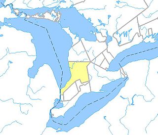
The County of Victoria, or Victoria County, was a county in the Canadian province of Ontario. It was formed in 1854 as The United Counties of Peterborough and Victoria, and separated from Peterborough in 1863. In 2001, the county was dissolved and reformed as the city of Kawartha Lakes. Though first opened to settlement in 1821, the area that was encompassed by Victoria County has a history of Indian occupation, first by the Hurons.

<span class="mw-page-title-main">Peterborough County</span> County in Ontario, Canada

Peterborough County is located in Southern Ontario, Canada. The county seat is Peterborough, which is independent of the county.

<span class="mw-page-title-main">Kawartha Lakes</span> City in Ontario, Canada

The City of Kawartha Lakes is a unitary municipality in Central Ontario, Canada. It is a municipality legally structured as a single-tier city; however, Kawartha Lakes is the size of a typical Ontario county and is mostly rural. It is the second largest single-tier municipality in Ontario by land area.

<span class="mw-page-title-main">Haliburton County</span> County in Ontario, Canada

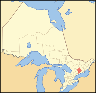
Haliburton is a county of Ontario, Canada, known as a tourist and cottage area in Central Ontario for its scenery and for its resident artists. Minden Hills is the county seat. Haliburton County and the village of Haliburton are named after Thomas Chandler Haliburton, author, statesman, and the first chairman of the Canadian Land and Emigration Company.

<span class="mw-page-title-main">District Municipality of Muskoka</span> Regional municipality in Ontario, Canada

The District Municipality of Muskoka, more generally referred to as the District of Muskoka or Muskoka, is a regional municipality in Central Ontario, Canada. Muskoka extends from Georgian Bay in the west, to the northern tip of Lake Couchiching in the south, to the western border of Algonquin Provincial Park in the east. A two-hour drive north of Toronto, Muskoka spans 6,475 km2 (2,500 sq mi). Muskoka has some 1,600 lakes, making it a popular cottaging destination.

Anthony Van Egmond was purportedly a Dutch Napoleonic War veteran. He became one of the first settlers and business people in the Huron Tract in present-day southwestern Ontario Canada. Van Egmond became an early contractor employed by the Canada Company to construct the original 74-kilometre (46 mi) road into the new settlement, allowing the entry of settlers for the purchase of company lands and further economic development. He eventually became a supporter of William Lyon Mackenzie and led a force of armed rebels in their unsuccessful skirmish at Montgomery's Tavern near Toronto on 7 December 1837, during the Upper Canada Rebellion.

<span class="mw-page-title-main">Ramara</span> Township in Ontario, Canada

Ramara is a lower-tier township municipality in Simcoe County, Ontario, Canada.

<span class="mw-page-title-main">Haliburton Forest</span> Privately owned forest in Ontario, Canada

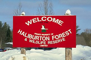
Haliburton Forest & Wild Life Reserve Ltd. is a privately owned 300-square-kilometre (120 sq mi) forest in Haliburton County, Ontario. Abutting Algonquin Provincial Park, Haliburton Forest is a "multi-use forest", with the Haliburton Forest Wolf Centre, a canopy walk, and a freshwater tour submarine as popular points of interest. Haliburton Forest forestry operations were certified by the international Forest Stewardship Council in Canada. Haliburton Forest supports ecosystem-based research projects, primarily conducted by the University of Toronto's Faculty of Forestry, and operates year-round recreation, tourism and education programs.

Ontario County was the name of two historic counties in the Canadian province of Ontario.

Halton County is a former county in the Canadian province of Ontario, with an area of 228,181 acres (923.42 km2). It is also one of the oldest counties in Canada.

<span class="mw-page-title-main">Kennisis Lake</span> Body of water

Kennisis Lake is the 2nd largest lake in the Haliburton Highlands with a surface area of over 1,640 hectares in the area of Ontario just south west of Algonquin Provincial Park. From end to end, the lake is approximately 23 kilometres (14 mi) long. There is a smaller counterpart, named Little Kennisis Lake.

<span class="mw-page-title-main">Dysart et al, Ontario</span> United township in Ontario, Canada

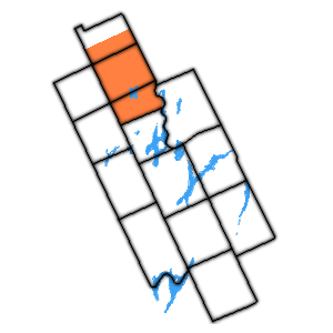
The United Townships of Dysart, Dudley, Harcourt, Guilford, Harburn, Bruton, Havelock, Eyre and Clyde, commonly known as the Municipality of Dysart et al, is a municipality in Haliburton County in Central Ontario, Canada. The original townships were of the Canadian Land and Emigration Company.

<span class="mw-page-title-main">Laxton, Digby and Longford Township</span> Former township in southern Ontario, Canada

The united Townships of Laxton, Digby and Longford were a municipality in the northern part of what is now Kawartha Lakes in the Canadian province of Ontario.

<span class="mw-page-title-main">Verulam Township</span> Former township in southern Ontario, Canada

The Township of Verulam was a rural municipality within the former Victoria County, now the city of Kawartha Lakes. It was bounded on the north by the geographic township of Somerville, the south by the geographic township of Emily, the west by the geographic township of Fenelon, and the east by the County of Peterborough. For the purposes of government, land surveying and reference, it is now properly referred to as the "Geographic Township of Verulam".

<span class="mw-page-title-main">South-West Oxford</span> Township in Ontario, Canada

South-West Oxford is a township in the Canadian province of Ontario, located within Oxford County. The township had a population of 7,664 in the 2016 Canadian census. A predominantly rural municipality, South-West Oxford was formed in 1975 through the amalgamation of Dereham and West Oxford townships and the village of Beachville.

Mossom Boyd was an Anglo-Irish entrepreneur who developed and operated a large lumber business on the Trent river system in Ontario, Canada.

<span class="mw-page-title-main">Gull River (Balsam Lake)</span> River in Haliburton County, Ontario, Canada

The Gull River is a river in Algonquin Highlands and Dysart et al, Haliburton County and the single-tier municipality of Kawartha Lakes in south-central Ontario, Canada. It is in the Trent River and Lake Ontario drainage basins, and flows from southern Algonquin Provincial Park to Balsam Lake on the Trent–Severn Waterway.

<span class="mw-page-title-main">Huron Tract</span>

The Huron Tract Purchase also known as the Huron Block, registered as Crown Treaty Number 29, is a large area of land in southwestern Ontario bordering on Lake Huron to the west and Lake Erie to the east. The area spans the counties of Huron, Perth, Middlesex and present day Lambton County, Ontario in the province of Ontario.

The Queen's Bush was an area of what is now Southwestern, Ontario, between Waterloo County, Ontario and Lake Huron that was set aside as clergy reserves by the colonial government. It is known as the location of communities established by Black settlers, many formerly enslaved in the United States, in what would become Canada. Established in 1820 and known as the Queen's Bush Settlement, the community grew to more than 2,000. In the early 1840s, the land on which they lived was surveyed for future sale. Following the survey, many of the Black residents were unable to pay for the land and migrated out of Queen's Bush.

References

  1. Emmerson 2015, p. 30.
  2. 1865 Act, Preamble
  3. "Crown Lands and Lumber Limits". Ottawa Citizen . Ottawa. May 28, 1861. p. 2.
  4. Emmerson 2015, p. 8.
  5. 1 2 Emmerson 2015, p. 11.
  6. Emmerson 2015, pp. 8–11.
  7. An Act respecting the Canadian Land and Emigration Company (Limited), to facilitate proof of its incorporation for the execution of instruments and for other purposes , S.Prov.C. 1865, c. 40
  8. 1 2 3 4 Murray 1976.
  9. McDougall, William (1863). Report of the Commissioner of Crown Lands of Canada for the Year 1862. Quebec: Hunter, Rose & Co. p. 92.
  10. The Free Grants and Homestead Act of 1868 , S.O. 1868, c. 8
  11. 1 2 Emmerson 2015, p. 348.
  12. Turner 1998.
  13. An Act to legalize and confirm an agreement entered into by and between the Municipality of Dysart and the Canadian Land and Emigration Company (Limited) , S.O. 1887, c. 49
  14. "No. 25835". The London Gazette . 6 July 1888. p. 3713.
  15. Fifteenth Annual Report. Toronto: Hydro-Electric Power Commission of Ontario. 1922. p. 273.
  16. "Can't collect taxes, teachers go unpaid". Toronto Daily Star . January 16, 1933. p. 42.
  17. The Municipality of Dysart Act, 1937 , S.O. 1937, c. 87

Sources