Canoe, Iowa

Last updated

Canoe, Iowa
USA Iowa location map.svg
Red pog.svg
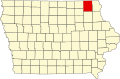
Canoe, Iowa
Location within the state of Iowa
Usa edcp location map.svg
Red pog.svg
Canoe, Iowa
Canoe, Iowa (the United States)
Coordinates: 43°21′03″N91°39′15″W / 43.35083°N 91.65417°W / 43.35083; -91.65417
Country United States
State Iowa
County Winneshiek
Elevation
958 ft (292 m)
Time zone UTC-6 (Central (CST))
  Summer (DST) UTC-5 (CDT)
GNIS feature ID465557

Canoe is an unincorporated community in northeastern Winneshiek County, Iowa, United States. [1]

History

A post office was established in August 1857, and remained in operation off and on until being discontinued in December 1905. [2] [3] Canoe's population was 15 in 1925. [4] The population was also 15 in 1940. [5]

Related Research Articles

<span class="mw-page-title-main">Dorchester, Iowa</span> Unincorporated community in Iowa, United States

Dorchester is an unincorporated community in northwestern Allamakee County, Iowa, United States. It lies along local roads just off Iowa Highway 76, north of the city of Waukon, the county seat of Allamakee County. Its elevation is 738 feet (225 m). The town was originally settled by Harvey Bell and Edmund Bell, and was named after Dorchester, England. Although Dorchester is unincorporated, it has a post office, with the ZIP code of 52140, which opened on 21 May 1857. Dorchester is located in Waterloo Township.

Dewar is an unincorporated town in eastern Black Hawk County, Iowa, United States. It lies northeast of the city of Waterloo, the county seat of Black Hawk County. Its elevation is 889 feet (271 m). Although Dewar is unincorporated, it has a post office with the ZIP code of 50623, which opened on 25 October 1887.

<span class="mw-page-title-main">Cedar, Iowa</span> Unincorporated community in Iowa, United States

Cedar is an unincorporated community in southeastern Mahaska County, Iowa, United States. It lies along Iowa Highway 23 southeast of the city of Oskaloosa, the county seat of Mahaska County.

Killduff is an unincorporated community in southeastern Jasper County, Iowa, United States. It lies along local roads southeast of the city of Newton, the county seat of Jasper County.

Conroy is an unincorporated community and census-designated place (CDP) in central Iowa County, Iowa, United States. It lies along local roads southeast of the city of Marengo, the county seat of Iowa County. Its elevation is 879 feet (268 m). Conroy has a post office with the ZIP Code of 52220, which opened on 5 January 1885. As of the 2010 census the population was 259.

Prole is an unincorporated rural village in northwestern Warren County, Iowa, United States. It lies along Iowa Highway 28 northwest of the city of Indianola, the county seat of Warren County. Its elevation is 978 feet (298 m). Prole has a post office, with the ZIP code of 50229,

Pilot Grove is an unincorporated community in northern Lee County, Iowa, United States. It lies along local roads northwest of the city of Fort Madison, the county seat of Lee County. Its elevation is 643 feet (196 m).

Almont is an unincorporated community in Elk River Township, Clinton County, in the U.S. state of Iowa.

Carnforth is an unincorporated community in Poweshiek County, in the U.S. state of Iowa.

Crocker is an unincorporated community in Polk County, Iowa, United States.

Lawn Hill is an unincorporated community in Hardin County, in the U.S. state of Iowa.

Malone is an unincorporated community in Clinton County, in the U.S. state of Iowa.

Nashville is an unincorporated community in Jackson County, in the U.S. state of Iowa.

<span class="mw-page-title-main">Petersville, Iowa</span> Unincorporated community in Iowa, United States

Petersville is an unincorporated community in Clinton County, in the U.S. state of Iowa.

Carnes is an unincorporated rural small hamlet in Sioux County, in the U.S. state of Iowa. Presently, the hamlet consists of a pizza restaurant.

Lakewood is a ghost town in Lyon County, in the U.S. state of Iowa.

Boyd is an unincorporated community in southeastern New Hampton Township in Chickasaw County, in the U.S. state of Iowa.

<span class="mw-page-title-main">Festina, Iowa</span> Unincorporated community in Iowa, United States

Festina is an unincorporated community in Winneshiek County, Iowa, United States.

Chequest was an unincorporated community in Davis County, Iowa, United States. Its elevation is 722 feet (287 m). It was on County Road V42 near Chequest Creek.

Village Creek is an unincorporated community in Allamakee County, Iowa, United States.

References

  1. U.S. Geological Survey Geographic Names Information System: Canoe, Iowa
  2. U.S. Geological Survey Geographic Names Information System: Canoe Post Office (historical)
  3. Melvin G Hill. "Winneshiek County Iowa". iowaghosttowns.com. Retrieved July 5, 2016.
  4. Premier Atlas of the World: Containing Maps of All Countries of the World, with the Most Recent Boundary Decisions, and Maps of All the States,territories, and Possessions of the United States with Population Figures from the Latest Official Census Reports, Also Data of Interest Concerning International and Domestic Political Questions. Rand McNally & Company. 1925. p. 190.
  5. The Attorneys List. United States Fidelity and Guaranty Company, Attorney List Department. 1940. p. 295.