Related Research Articles

Les Authieux-Papion is a former commune in the Calvados department in the Normandy region of north-western France. On 1 January 2017, it was merged into the new commune Mézidon Vallée d'Auge.

Méry-Corbon is a former commune in the Calvados department in the Normandy region in northwestern France. On 1 January 2017, it was merged into the new commune Méry-Bissières-en-Auge.

Le Mesnil-Mauger is a commune in the Calvados department in the Normandy region in northwestern France. On 1 January 2017, it was merged into the new commune Mézidon Vallée d'Auge.

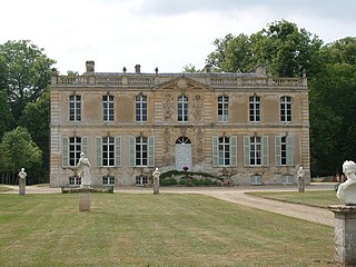
Mézidon-Canon is a former commune in the Calvados department in the Normandy region in northwestern France. On 9 September 1972, Mézidon merged with Canon to create Mézidon-Canon. On 1 January 2017, it was merged into the new commune Mézidon Vallée d'Auge.

Saint-Julien-le-Faucon is a former commune in the Calvados department in the Normandy region in northwestern France. On 1 January 2017, it was merged into the new commune Mézidon Vallée d'Auge.
The Canton of Beuzeville is a canton of the département of Eure, in France. At the French canton reorganisation which came into effect in March 2015, the canton was expanded from 16 to 62 communes :

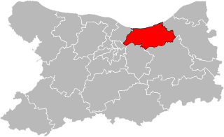
The canton of Trévières is an administrative division of the Calvados département, in northwestern France. Its chief town is Trévières. Its borders were modified at the French canton reorganisation which came into effect in March 2015

The arrondissement of Caen is an arrondissement of France in the Calvados department in the Normandy region. It has 201 communes. Its population is 384,540 (2016), and its area is 1,595.7 km2 (616.1 sq mi).

The arrondissement of Lisieux is an arrondissement of France in the Calvados department in the Normandy region. It has 160 communes. Its population is 162,678 (2016), and its area is 1,756.2 km2 (678.1 sq mi).

The arrondissement of Vire is an arrondissement of France in the Calvados department in the Normandy region. It has 44 communes. Its population is 72,565 (2016), and its area is 1,205.9 km2 (465.6 sq mi).
The Canton of Rue is a canton situated in the department of the Somme and in the Hauts-de-France region of northern France.
The Canton of Gournay-en-Bray is a canton situated in the Seine-Maritime département and in the Normandy region of northern France.
The Canton of Neufchâtel-en-Bray is a canton situated in the Seine-Maritime département and in the Normandy region of north-western France.
The Canton of Saint-Valery-en-Caux is a canton situated in the Seine-Maritime département and in the Normandy region of northern France.
The Canton of Yvetot is a canton situated in the Seine-Maritime département and in the Normandy region of northern France.
The Communauté de communes de la Vallée d'Auge is a former communauté de communes in the Calvados département and in the Normandy région of France. It was merged into the new Communauté d'agglomération Lisieux Normandie in January 2017.

The canton of Aunay-sur-Odon is an administrative division of the Calvados department, northwestern France. Its borders were modified at the French canton reorganisation which came into effect in March 2015. Its seat is in Les Monts d'Aunay.

The canton of Cabourg is an administrative division of the Calvados department, northwestern France. Its borders were modified at the French canton reorganisation which came into effect in March 2015. Its seat is in Cabourg.

The canton of Pont-l'Évêque is an administrative division of the Calvados department, northwestern France. Its borders were modified at the French canton reorganisation which came into effect in March 2015. Its seat is in Pont-l'Évêque.
Communauté d'agglomération Lisieux Normandie is the communauté d'agglomération, an intercommunal structure, centred on the town of Lisieux. It is located in the Calvados department, in the Normandy region, northwestern France. It was created in January 2017 by the merger of the former communautés de communes Lintercom Lisieux - Pays d'Auge - Normandie, Vallée d'Auge, Trois Rivières, Pays de Livarot and Pays de l'Orbiquet. It was expanded with six communes from the former communautés de communes de Cambremer in January 2018. Its population was 77,871 in 2015. Its seat is in Lisieux.
References
- ↑ "Téléchargement du fichier d'ensemble des populations légales en 2018". INSEE. 28 December 2020.
- ↑ Décret n° 2014-160 du 17 février 2014 portant délimitation des cantons dans le département du Calvados
- ↑ Populations légales 2013: Téléchargement du fichier d'ensemble, INSEE
- ↑ Téléchargement du fichier d'ensemble des populations légales en 2018, INSEE