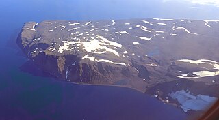
Tasiilap Karra or Cape Gustav Holm is a headland in eastern Greenland, Sermersooq municipality.

Cape Hope is a headland in the Scoresby Sound, east Greenland, Sermersooq municipality.

Sermersooq is a municipality in Greenland, formed on 1 January 2009 from five earlier, smaller municipalities. Its administrative seat is the city of Nuuk, the capital of Greenland, and it is the most populous municipality in the country, with 23,123 inhabitants as of January 2020.
Cape Atholl, also known as Kangaarasuk, is a headland in Northwest Greenland, Avannaata municipality.
Sokongen is an island in the Sermersooq municipality, in eastern Greenland.

Cape Brewster is a headland in the Greenland Sea, east Greenland, Sermersooq municipality.
Cape Nansen is a headland in the Greenland Sea, east Greenland, Sermersooq municipality. This cape is named after Fridtjof Nansen. Cape Nansen is an important geographical landmark.
Cape J.A.D. Jensen is a headland in the North Atlantic Ocean, east Greenland, Sermersooq municipality. This cape is named after J. A. D. Jensen, an officer of the Danish Navy and Arctic explorer.
Cape Cort Adelaer, also known as Cape Adelaer, is a headland in the North Atlantic Ocean, southeast Greenland, Sermersooq municipality. This cape is named after Norwegian seaman Cort Adeler (1622–1675) who distinguished himself for services rendered to the Royal Dano-Norwegian Navy.

Odinland, also Odinsland in the Defense Mapping Agency Greenland Navigation charts, is a peninsula in the King Frederick VI Coast, southeastern Greenland. It is a part of the Sermersooq municipality.

Cape Bridgman is a headland in the Wandel Sea, Arctic Ocean, northeast Greenland.
Cape Robertson, also known as Tuloriok, is a headland in Northwest Greenland, Avannaata municipality.
Cape Discord, also known as Kangeq, is a headland in the North Atlantic Ocean, southeast Greenland, Kujalleq municipality.

Cape Cannon is a headland in the Lincoln Sea, Arctic Ocean, North Greenland. Administratively it is part of the Northeast Greenland National Park.
Fleming Fjord is a fjord in King Christian X Land, eastern Greenland.
Cape Møsting is a headland in the North Atlantic Ocean, southeast Greenland, Kujalleq municipality.

Cape Moltke is a headland in the North Atlantic Ocean, southeast Greenland, Kujalleq municipality.

Cape Harald Moltke is a headland in Peary Land, North Greenland. Administratively it is part of the Northeast Greenland National Park.
Cape Brown is a headland in the Greenland Sea, east Greenland, Sermersooq municipality.
Cape Simpson is a headland in the Greenland Sea, Northeast Greenland. Administratively it is part of the Northeast Greenland National Park.


