
Interstate 95 (I-95) is the main north–south Interstate Highway on the East Coast of the United States, running from U.S. Route 1 (US 1) in Miami, Florida, north to the Houlton–Woodstock Border Crossing between Maine and the Canadian province of New Brunswick. The highway largely parallels the Atlantic coast and US 1, except for the portion between Savannah, Georgia, and Washington, D.C., and the portion between Portland and Houlton in Maine, both of which follow a more direct inland route.

The New Jersey Turnpike (NJTP) is a system of controlled-access toll roads in the U.S. state of New Jersey. The turnpike is maintained by the New Jersey Turnpike Authority. The 117.2-mile (188.6 km) mainline's southern terminus is at the Delaware Memorial Bridge on I-295 in Pennsville. Its northern terminus is at an interchange with US 46 in Ridgefield Park. Construction of the mainline, from concept to completion, took a total of 22 months between 1950 and 1951. It was opened to traffic on November 5, 1951, between its southern terminus and exit 10.

The Pulaski Skyway is a four-lane bridge-causeway in the northeastern part of the U.S. state of New Jersey, carrying a freeway designated U.S. Route 1/9 (US 1/9) for most of its length. The structure has a total length of 3.502 miles (5.636 km). Its longest bridge spans 550 feet (168 m). Traveling between Newark and Jersey City, the roadway crosses the Passaic and Hackensack rivers, Kearny Point, the peninsula between them, and the New Jersey Meadowlands.

U.S. Route 74 (US 74) is an east–west United States highway that runs for 515 miles (829 km) from Chattanooga, Tennessee to Wrightsville Beach, North Carolina. Primarily in North Carolina, it serves as an important highway from the mountains to the sea, connecting the cities of Asheville, Charlotte and Wilmington. It is known as Andrew Jackson Highway throughout most of North Carolina.
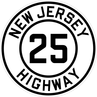
Route 25 was a major state highway in New Jersey, United States prior to the 1953 renumbering, running from the Benjamin Franklin Bridge in Camden to the Holland Tunnel in Jersey City. The number was retired in the renumbering, as the whole road was followed by various U.S. Routes: US 30 coming off the bridge in Camden, US 130 from the Camden area north to near New Brunswick, US 1 to Tonnele Circle in Jersey City, and US 1 Business to the Holland Tunnel.
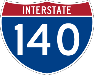
Interstate 140 (I-140) and North Carolina Highway 140 (NC 140) is a 25.4-mile (40.9 km) auxiliary Interstate Highway and state highway in the U.S. state of North Carolina. Officially designated the John Jay Burney Jr. Freeway, it serves as a bypass of Wilmington. The western terminus of the highway is at U.S. Route 17 (US 17) near Winnabow. It heads north in western Leland before turning to the east north of an interchange with U.S. Route 74 (US 74)/U.S. Route 76 (US 76). I-140 crosses the Cape Fear River north of Navassa and the Northeast Cape Fear River northwest of Wrightsboro. I-140 ends at Interstate 40 (I-40), and the route number changes to NC 140. NC 140 continues to the east, ending at US 17 in Kirkland.

Interstate 540 (I-540) and North Carolina Highway 540 (NC 540) are part of a partially completed beltway around the city of Raleigh in the US state of North Carolina, forming the Raleigh Outer Loop. When complete, the route will completely encircle the city, meeting its parent route of I-40 in two locations.

Route 92 was a 6.7-mile (10.8 km) proposed branch of the New Jersey Turnpike that would have run from west to east, beginning at U.S. Route 1 just north of Ridge Road in South Brunswick Township, east along Route 32, to Exit 8A in Monroe Township. Route 92 was also assigned in the 1953 renumbering and by the late 1950s it was named the Princeton–Hightstown Bypass, a freeway planned to connect the Somerset Freeway in Montgomery Township, with Route 33 in East Windsor Township. In 1987, the planned Route 92 was truncated to only run east from U.S. Route 1 near Kingston. New plans were announced in 1994, this time running to US 1 near Princeton. After public hearings found opposition was still strong, the planned route was truncated to a much shorter bypass of Hightstown only and numbered Route 133. Construction on the road, the first project awarded under New Jersey's modified Design-build program, began on September 20, 1996 and was opened November 30, 1999.

South Carolina Highway 31 (SC 31), also known as the Carolina Bays Parkway, is a 28.097-mile (45.218 km) six-lane, limited-access highway that parallels the Intracoastal Waterway around Myrtle Beach. The first phase opened on December 17, 2002, completing a 22-mile (35 km) link between U.S. Route 501 (US 501) and SC 9. The second phase opened in March 2005, running from US 501 southwest to S.C. Highway 544. The third phase opened on November 7, 2019, extending to SC 707. While usually referred to only as the Carolina Bays Parkway, the highway is also dedicated the John B. Singleton Parkway in memory of John B. Singleton, a former Myrtle Beach City Council member and police commissioner.

The Pennsylvania Turnpike/Interstate 95 Interchange Project is an ongoing road construction project to build an interchange between Interstate 95 (I-95) and the Pennsylvania Turnpike in Bristol Township, Bucks County, Pennsylvania, in the United States. The $553 million first stage is complete: a pair of flyover ramps–one connecting I-95 northbound with the eastbound turnpike and the other connecting the westbound turnpike with I-95 southbound—that opened in 2018, with some cleanups to connecting roads completed in 2021. Construction of the remaining ramps is expected to begin when funding is available.

The Cape Fear Memorial Bridge is a steel vertical-lift bridge in North Carolina. It carries US 17/US 76/US 421 across the Cape Fear River between Brunswick County and New Hanover County. It also carried U.S. Route 74 until that designation was shifted to the Isabel S. Holmes Bridge. It has a lift span that can be raised 135 feet (41 m). The lift span is 408 feet (124 m) long.
The Garden Parkway was a proposed limited access toll road that was to be built in the U.S. state of North Carolina. The route would have passed through portions of Gaston and Mecklenburg counties.

U.S. Route 1 (US 1) is a U.S. Route which parallels the East Coast of the United States, running from Key West, Florida, in the south to Fort Kent, Maine, at the Canadian border in the north. Of the entire length of the route, 66.06 miles (106.31 km) of it runs through New Jersey. It enters the state from Pennsylvania on the Trenton–Morrisville Toll Bridge over the Delaware River in the state capital of Trenton, running through the city on the Trenton Freeway. From here, US 1 continues northeast as a surface divided highway through suburban areas, heading into Middlesex County and passing through New Brunswick and Edison. US 1 merges with US 9 in Woodbridge, and the two routes continue through northern New Jersey as US 1/9 to the George Washington Bridge over the Hudson River in Fort Lee. At this point, the road continues into New York City along with Interstate 95.
The North Carolina Turnpike Authority was created in 2002 to speed the implementation of needed transportation improvements by funding some projects with tolls. Governed by a nine-member authority board, it is located within the Department of Transportation and under the direct supervision of the Secretary of Transportation. The authority has the power to study, plan, develop and undertake preliminary design work on up to eleven turnpike projects. At the conclusion of these actives, the authority is authorized to design, establish, purchase, construct, operate and maintain toll highways and bridges. The authority is also authorized to designate one or more lanes of any highway, or portion thereof, into a high-occupancy toll lanes or other type of managed lanes; provided that such designation does not reduce the number of existing non-toll general purpose lanes.

U.S. Route 421 (US 421) is part of the United States Numbered Highway System that runs from Fort Fisher, North Carolina to Michigan City, Indiana. In the U.S. state of North Carolina, US 421 travels 328 miles (528 km) from its southern terminus at Fort Fisher to the Tennessee state line near the community of Zionville, North Carolina. US 421 traverses the state from east to west travelling from the coastal plains to Appalachian Mountains. It provides an important connection between the cities of Wilmington, Sanford, Greensboro, Winston-Salem, and Boone. Despite being signed as north–south, much of the routing of US 421 in North Carolina runs in an east–west direction, particularly between Greensboro and the Tennessee state line. Portions of US 421 have been upgraded to freeway standards including the majority of its routing between Sanford and North Wilkesboro.

U.S. Highway 76 (US 76) is a U.S. Highway running from Chattanooga, Tennessee to Wrightsville Beach, North Carolina. In North Carolina the highway runs for 80.4 miles (129.4 km) in the southeastern region of the state. US 76 enters the state from South Carolina south of Fair Bluff in Columbus County. Travelling in an eastward direction, US 76 meets US 74 in Chadbourn. The two highways run concurrently for 50.4 miles (81.1 km) between Chadbourn and Wilmington. US 76 runs concurrently with US 17 along much of its Wilmington routing, until once again meeting US 74. US 76 and US 74 run concurrently for 1.4 miles (2.3 km) until reaching Wrightsville Beach. US 76 reaches its eastern terminus on the south side of Wrightsville Beach, at an intersection with Water Street.
The Triangle Expressway (TriEx) is the first modern toll road built in North Carolina, and one of the first toll roads in the United States built to use only electronic toll collection instead of toll booths. The overall freeway consists of three segments called the Triangle Parkway, the Western Wake Expressway, and the Southern Wake Expressway, totalling up to 32.4 miles (52.1 km) long. The six-lane Triangle Parkway extends Interstate 885 (I-885) 3.5 miles (5.6 km) via North Carolina Highway 885 (NC 885) in Durham County to meet North Carolina Highway 540 (NC 540) in Morrisville in Wake County. The Western Wake Expressway extends 12.4 miles (20.0 km) long, extending NC 540 to meet NC 55 in Apex. The Southern Wake Expressway extends 16.5 miles (26.6 km) long, extending NC 540 to meet I-40 and I-42 southeast of Garner.
The Mid-Currituck Bridge is a proposed 7-mile (11 km) long two-lane toll bridge that will span across Currituck Sound, connecting US 158 and NC 12. Its purpose is to alleviate summer traffic congestion and to improve both emergency response and evacuation time. Long a topic of study and debate, the bridge could be built in the 2020s-2030s.
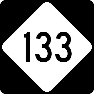
North Carolina Highway 133 (NC 133) is a primary state highway in the U.S. state of North Carolina. It traverses 46.6 miles (75.0 km) from Oak Island Drive in Oak Island to NC 210 in Bells Crossroads. The route serves communities such as Southport, Belville, Leland, Wilmington, and Castle Hayne. Additionally, NC 133 serves as an entry point for Military Ocean Terminal Sunny Point located to its east. Much of NC 133 runs parallel to the Cape Fear River and Brunswick River between Southport and Belville. West of Wilmington, NC 133 runs concurrently with U.S. Route 17 (US 17), US 74, and US 76. The road follows another concurrency along US 74 and US 421, west of Downtown Wilmington, and crosses into New Hanover County on the Isabel Holmes Bridge. North of Wilmington, NC 133 exits to the north, serving several suburban communities north of Wilmington. NC 133 runs concurrently with US 117 through Castle Hayne, before bearing northwest toward Bells Crossroads.
