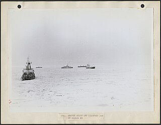
Utqiagvik, formerly known as Barrow, is the borough seat and largest city of the North Slope Borough in the U.S. state of Alaska. Located north of the Arctic Circle, it is one of the northernmost cities and towns in the world and the northernmost in the United States, with nearby Point Barrow as the country's northernmost point.

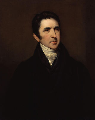
Sir John Barrow, 1st Baronet, was an English geographer, linguist, writer and civil servant best known for serving as the Second Secretary to the Admiralty from 1804 until 1845.

Cape Spear is a headland located on the Avalon Peninsula of Newfoundland near St. John's in the Canadian province of Newfoundland and Labrador. At a longitude of 52°37' W, it is the easternmost point in Canada and North America, excluding Greenland.
Beechey Island is an island located in the Arctic Archipelago of Nunavut, Canada, in Wellington Channel. It is separated from the southwest corner of Devon Island by Barrow Strait. Other features include Wellington Channel, Erebus Harbour, and Terror Bay.
John Barrow may refer to:
The Barrow Point or Mutumui language, called Eibole, is a recently extinct Australian Aboriginal language. According to Wurm and Hattori (1981), there was one speaker left at the time.
John B. Barrow was an American college and professional football player who was an offensive and defensive tackle in the Canadian Football League (CFL) for fourteen seasons in the 1950s, 1960s and 1970s. Barrow played college football for the University of Florida, and was recognized as an All-American. Thereafter, he played professionally for the Hamilton Tiger-Cats of the CFL, and was later inducted into the Canadian Football Hall of Fame.

Murchison Promontory, a cape (promontory) in the northern Canadian Arctic, is the northernmost mainland point of the Americas and of Canada. Located 1,087 nautical miles from the North Pole, it is 64 km (40 mi) farther north than Point Barrow, Alaska, the northernmost point of all U.S. territory.

Barrow Strait is a shipping waterway in Northern Canada's territory of Nunavut. Forming part of the Parry Channel, the strait separates several large islands including Cornwallis Island and Devon Island to the north, from Prince of Wales Island, Somerset Island, and Prince Leopold Island to the south.
Fairholme Island is a member of the Queen Elizabeth Islands and the Arctic Archipelago in the territory of Nunavut. It is an irregularly shaped island located in the Penny Strait, between John Barrow Island and the entrance to Barrow Harbour, Devon Island. Sir John Barrow Monument is to the southeast.
John Barrow Island is a member of the Queen Elizabeth Islands and the Arctic Archipelago in the territory of Nunavut. It is an elongated island located midway in the Penny Strait between Bathurst Island and Devon Island.
Hyde Parker Island is a member of the Queen Elizabeth Islands and the Arctic Archipelago in the territory of Nunavut. It is an irregularly shaped island located in the Penny Strait, between Bathurst Island and Devon Island. John Barrow Island lies directly to the north, while Sir John Barrow Monument is to the east.
Captain Henry Parkyns Hoppner was an officer of the Royal Navy, Arctic explorer, draughtsman and artist. His career included two ill-fated voyages culminating in the loss of HMS Alceste in 1816 and HMS Fury in 1825.

Thomas Simpson was a Scottish Arctic explorer, Hudson's Bay Company fur trader, and cousin of Company Governor Sir George Simpson. He helped chart the northern coasts of Canada. He died by violence near the Turtle River while traveling through the wilderness in what is now the U.S. state of North Dakota but was then part of the Territory of Iowa. The circumstances of his final hours—in which he allegedly killed himself after gunning down two companions—have long been a subject of controversy.
Peter Warren Dease was a Canadian fur trader and Arctic explorer.

Cape Barrow is a cape which separates Coronation Gulf from Bathurst Inlet in Nunavut, Canada. It is named in honour of the Arctic explorer Sir John Barrow, 1st Baronet, and is referred to as Haninnek by the local Inuit.
Cape Pembroke is an uninhabited headland at the northeastern tip of Coats Island in northern Hudson Bay within the Kivalliq Region of Nunavut, Canada.

Radstock Bay is a waterway located in the Qikiqtaaluk Region, Nunavut, Canada. It lies off the southern coast of Devon Island in the eastern high Arctic. Like Maxwell Bay to the east, it is an arm of Lancaster Sound and Barrow Strait.
The Mutumui were an indigenous Australian people of northern Queensland.
Cape Barrow may refer to:


