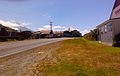
Cardiff, New Zealand

Last updated

Cardiff
Cardiff, New Zealand, looking north.jpg
View of Cardiff, with Mount Taranaki in the background
NZ-Taranaki plain map.png
Disc Plain red.svg
Cardiff
Coordinates: 39°21′38″S174°13′52″E / 39.36056°S 174.23111°E / -39.36056; 174.23111
Country New Zealand
Region Taranaki
District Stratford District

Cardiff is a settlement in inland Taranaki, in the western North Island of New Zealand. It is located five kilometres southwest of Stratford close to Egmont National Park.

Contents

Further reading

General historical works

  • Mander, Owen (1986). Cardiff School and district centennial, 1886-1986. Stratford, [N.Z.]: The School ; Stratford Press Print.

Business history

  • Marchant, Claude A. (1951). Cardiff Co-operative Dairy Factory Company Limited diamond jubilee, 1891 - 1951. New Plymouth, [N.Z.]: Taranaki Daily News.

People

Schools

  • Mander, Owen (1986). Cardiff School and district centennial, 1886-1986. Stratford, [N.Z.]: The School ; Stratford Press Print.

Coordinates: 39°22′S174°14′E / 39.367°S 174.233°E / -39.367; 174.233


Related Research Articles

Inglewood, New Zealand Place in Taranaki, New Zealand

Inglewood is a town in the Taranaki Region of New Zealand's North Island. It is 16 kilometres (10 mi) southeast of New Plymouth on State Highway 3, close to Mount Taranaki, and sits 200 metres (660 ft) above sea level. The town services a mainly dairy farming region.

Eltham, New Zealand Place in Taranaki, New Zealand

Eltham is a small inland town in South Taranaki, New Zealand, located 50 kilometres (31 mi) south of the city of New Plymouth and southeast of the volcanic cone of Mount Taranaki/Egmont. Stratford is 11 kilometres (6.8 mi) north, Kaponga 13 km west, and Hāwera is 19 km (12 mi) south. State Highway 3 runs through the town.

Ōkato Small town in Taranaki, New Zealand

Ōkato is a small town in rural Taranaki, New Zealand. It is situated about 25 minutes drive around the coast from New Plymouth on State Highway 45. Oakura is 12 km to the north-east, and Warea is 9 km to the south-west. The place offers popular rocky surfing spots around coastal beaches. The town was established as a military settlement in the 1860s.

Ngaere Place in Taranaki, New Zealand

Ngaere is a village situated on State Highway 3, 4 kilometres (2.5 mi) south of Stratford, New Zealand. The name "Ngaere" literally means "swamp" in English, and before settlement, the area was covered by a vast and ancient wetland.

David Ernest Walter was a New Zealand politician and journalist. He was the first mayor of Stratford District Council (1989–1998) and also served as chairman of both of the Taranaki Regional Council (2001–2007) and the Stratford County Council (1983–1989).

Lepperton is a small village in North Taranaki, New Zealand. It is approximately 6 km (3.7 mi) inland from Waitara township, 5 km (3.1 mi) west of the Waitara River, and 1 km (0.62 mi) east of State Highway 3A, which connects Inglewood to Waitara.

Midhirst is a small village in Taranaki, New Zealand, approximately 4 km north of Stratford, on State Highway 3. Inglewood is 17 km (11 mi) north of Midhirst, and New Plymouth is 35 km (22 mi) to the northwest.

Tahora, Manawatū-Whanganui Place in Manawatū-Whanganui region, New Zealand

Tahora is a small settlement located in the Manawatū-Whanganui Region in the North Island of New Zealand along the Stratford–Okahukura railway line and State Highway 43 between Stratford and Taumarunui. It was the location of an annual folk music festival for 30 years. Tahora is located in the Stratford District.

Mokoia Place in Taranaki, New Zealand

Mokoia is a small settlement in south Taranaki, in the western North Island of New Zealand. It is located on State Highway 3, 10 kilometres (6.2 mi) to the east of Hāwera and about 17 km northwest of Patea.

Ōakura Place in Taranaki, New Zealand

Ōakura is a small township in New Plymouth District, Taranaki, in the western North Island of New Zealand. It is located on State Highway 45, 15 kilometres south-west of New Plymouth. Ōkato is 12 km further south-west. The Oakura River flows past the town and into the North Taranaki Bight. To the south is the Kaitake Range, part of Egmont National Park.

Moturoa Suburb of New Plymouth in New Zealand

Moturoa is a coastal suburb of New Plymouth, in the western North Island of New Zealand. It is located to the west of the city centre, bordering Port Taranaki and The Sugar Loaf Islands. One of the islands, Moturoa, the largest, shares its name with the suburb.

Alton, New Zealand Place in Taranaki, New Zealand

Alton is a small rural community in south Taranaki, in the western North Island of New Zealand. It is located between the towns of Hāwera and Patea.

Te Popo Place in Taranaki, New Zealand

Te Popo is a settlement in inland Taranaki, in the western North Island of New Zealand. It is located ten kilometres northeast of Stratford.

Waipuku is a settlement in inland Taranaki, in the western North Island of New Zealand. It is located between Stratford and Inglewood on State Highway 3.

Onaero Place in Taranaki, New Zealand

Onaero is a settlement in northern Taranaki, in the North Island of New Zealand. It is located on State Highway 3 close to the shore of the North Taranaki Bight, 15 kilometres (9.3 mi) east of Waitara. Onaero was the site of the No. 2 Company Redoubt, a British military installation created during the Second Taranaki War by soldiers from the Tikorangi Redoubt in 1865, however it was abandoned several months later.

Tongapōrutu Place in Taranaki, New Zealand

Tongapōrutu is a settlement in northern Taranaki, in the North Island of New Zealand. It is located on State Highway 3 at the mouth of the Tongaporutu River, 15 kilometres south of Mokau. Tongapōrutu is well known in New Zealand for its 'Three Sisters' rock formations and its Māori petroglyphs carved into cave rock walls. However, both the Māori rock carvings and the 'Three Sisters formations are constantly being eroded by the Tasman Sea.

Awakino is a settlement in the south of Waitomo District, in the North Island of New Zealand. It is located on State Highway 3 at the mouth of the Awakino River, five kilometres north of Mokau. It is 79 km southwest of Te Kuiti, and 98 km northeast of New Plymouth.

Uruti is a locality in northern Taranaki, in the North Island of New Zealand. It is located on State Highway 3, north-east of Mimi and south-west of Ahititi. The Uruti Stream meets the Mimi River at this point. The river flows past the settlement into the North Taranaki Bight.

Brooklands, New Plymouth Suburb of New Plymouth in New Zealand

Brooklands is a suburb of New Plymouth, in the Taranaki region of the western North Island of New Zealand. It is located on the southern edge of the city and east of Vogeltown. The area is named after Brooklands farm, established in 1842.

Puke Ariki Museum, Public library in New Plymouth

Puke Ariki is a combined museum and library at New Plymouth, New Zealand which opened in June 2003. It is an amalgamation of the New Plymouth Public Library and the Taranaki Museum. Its name, Māori for "hill of chiefs", is taken from the Māori village that formerly occupied the site.