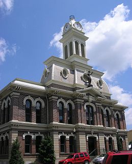
Scott is a county located in the U.S. state of Kentucky. As of the 2010 census, the population was 47,173. Its county seat is Georgetown.

Hopkins County is a county located in the western part of the U.S. state of Kentucky. As of the 2010 census, the population was 46,920. Its county seat is Madisonville. The county was formed in 1806 and named for General Samuel Hopkins, an officer in both the American Revolutionary War and War of 1812, and later a Kentucky legislator and U.S. Congressman.

Hickman County is a county located in the U.S. state of Kentucky. As of the 2010 census, the population was 4,902, making it the third-least populous county in Kentucky. Its county seat is Clinton. The county was formed in 1821. It is the least densely populated county in the state and is a prohibition or dry county.

Russellville is a home rule-class city in Logan County, Kentucky, in the United States. It is the seat of its county. The population was 6,947 at the time of the 2010 U.S. Census.

The Battle of Helena was a land battle of the American Civil War fought on July 4, 1863, at Helena, Arkansas. The battle was a Confederate attempt to relieve pressure on the besieged city of Vicksburg. The victory secured eastern Arkansas for the United States.

In the context of the American Civil War (1861–65), the border states were slave states that did not declare a secession from the Union and did not join the Confederacy. To their north they bordered free states of the Union and to their south they bordered Confederate slave states. Of the 34 U.S. states in 1861, nineteen were free states and fifteen were slave states. Two slave states never declared a secession or adopted an ordinance: Delaware and Maryland. Four others did not declare secession until after the Battle of Fort Sumter and were briefly considered to be border states: Arkansas, North Carolina, Tennessee and Virginia—after this, they were less frequently called "border states". Also included as a border state during the war is West Virginia, which was formed from 50 counties of Virginia and became a new state in the Union in 1863.

The third USS Lexington was a timberclad gunboat in the United States Navy during the American Civil War.

Roger Weightman Hanson was a brigadier general in the Confederate States Army during the American Civil War. The commander of the famed "Orphan Brigade," he was mortally wounded at the Battle of Murfreesboro. He was nicknamed "Old Flintlock."

Louisville in the American Civil War was a major stronghold of Union forces, which kept Kentucky firmly in the Union. It was the center of planning, supplies, recruiting and transportation for numerous campaigns, especially in the Western Theater. By the end of the war, Louisville had not been attacked once, although skirmishes and battles, including the battles of Perryville and Corydon, took place nearby.

The Battle of Baton Rouge was a ground and naval battle in the American Civil War fought in East Baton Rouge Parish, Louisiana, on August 5, 1862. The Union victory halted Confederate attempts to recapture the capital city of Louisiana.

During the American Civil War (1861-1865), Maryland, a slave state, was one of the border states, straddling the South and North. Because of its strategic location, bordering the national capital city of Washington D.C. with its District of Columbia since 1790, and the strong desire of the opposing factions within the state to sway public opinion towards their respective causes, Maryland played an important role in the American Civil War (1861-1865). Newly elected 16th President Abraham Lincoln, suspended the constitutional right of habeas corpus in Maryland; and he dismissed the U.S. Supreme Court's "Ex parte Merryman" decision concerning freeing John Merryman, a prominent Southern sympathizer from Baltimore County arrested by the military and held in Fort McHenry. The Chief Justice, but not in a decision with the other justices, had held that the suspension was unconstitutional and would leave lasting civil and legal scars. The decision was filed in the U.S. Circuit Court for Maryland by Chief Justice Roger Brooke Taney, a Marylander from Frederick and sometimes in Baltimore and former protege of seventh President Andrew Jackson who had appointed him two decades earlier.

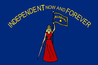
The State of Alabama was central to the Civil War, with the secession convention at Montgomery, birthplace of the Confederacy, inviting other states to form a Southern Republic, during January–March 1861, and develop constitutions to legally run their own affairs. The 1861 Alabama Constitution granted citizenship to current U.S. residents, but prohibited import duties (tariffs) on foreign goods, limited a standing military, and as a final issue, opposed emancipation by any nation, but urged protection of African slaves, with trial by jury, and reserved the power to regulate or prohibit the African slave trade. The secession convention invited all slaveholding states to secede, but only 7 Cotton States of the Lower South formed the Confederacy with Alabama, while the majority of slave states were in the Union and voted to make U.S. slavery permanent by passing the Corwin Amendment, signed by President Buchanan and backed by President Lincoln on March 4, 1861.

During the American Civil War, Arkansas was a Confederate state, though it had initially voted to remain in the Union. Following the capture of Fort Sumter in April 1861, Abraham Lincoln called for troops from every Union state to put down the rebellion, and Arkansas and several other states seceded. For the rest of the war, Arkansas played a major role in controlling the vital Mississippi River and neighboring states, including Tennessee and Missouri.

Hylan Benton Lyon was a career officer in the United States Army until the start of the American Civil War, when he resigned rather than fight against the South. As a Confederate brigadier general, he led a daring cavalry raid into Kentucky in December 1864, in which his troops burned seven county courthouses which were being used as barracks by the Union Army.

USS St. Clair (1862) was a steamer purchased by the Union Navy during the American Civil War.

Indiana, a state in the Midwest, played an important role in supporting the Union during the American Civil War. Despite anti-war activity within the state, and southern Indiana's ancestral ties to the South, Indiana was a strong supporter of the Union. Indiana contributed approximately 210,000 Union soldiers, sailors, and marines. Indiana's soldiers served in 308 military engagements during the war; the majority of them in the western theater, between the Mississippi River and the Appalachian Mountains. Indiana's war-related deaths reached 25,028. Its state government provided funds to purchase equipment, food, and supplies for troops in the field. Indiana, an agriculturally rich state containing the fifth-highest population in the Union, was critical to the North's success due to its geographical location, large population, and agricultural production. Indiana residents, also known as Hoosiers, supplied the Union with manpower for the war effort, a railroad network and access to the Ohio River and the Great Lakes, and agricultural products such as grain and livestock. The state experienced two minor raids by Confederate forces, and one major raid in 1863, which caused a brief panic in southern portions of the state and its capital city, Indianapolis.

The Thompson and Powell Martyrs Monument is a memorial to two Confederate soldiers in St. Joseph, Kentucky. It is on the National Register of Historic Places (NRHP), one of only three NRHP locations in Daviess County, Kentucky that is not in Owensboro, Kentucky.

The Confederate Monument of Morganfield, Kentucky is a monument to Confederate soldiers from surrounding Union County, Kentucky, of which Morganfield is the county seat. It is in the northernmost corner of the City Cemetery/Odd Fellows Cemetery just outside downtown Morganfield. During the War "Union" County was mostly a Confederate-sympathizing county. The county produced 657 soldiers for the Confederacy, but only 187 for the Union, although 131 African-Americans joined the Union forces in 1864. In July 1862, Union forces at Caseyville, Kentucky threatened to arrest everyone in the town of treason, eventually freeing all but nineteen citizens. A skirmish in Morganfield on September 1, 1862, resulted in a Confederate victory.
Kentucky Route 1508 is a state highway located in northwestern Kentucky. The route starts at KY 109, west of Sturgis. It travels westward to unincorporated area of Caseyville, and turns north near the Ohio River. KY 1508 then travels through the community of Dekoven, before ending at KY 109, northwest of its southern terminus. The route was designated around 1967, after the KY 130 designation was removed from the section in Caseyville, which was connected to the community since 1939.


