Castelnovo di Sotto

Last updated
Castelnovo di Sotto
Comune
Comune di Castelnovo di Sotto
Italy provincial location map 2015.svg
Red pog.svg
Castelnovo di Sotto
Location of Castelnovo di Sotto in Italy
Coordinates: 44°49′N10°34′E / 44.817°N 10.567°E / 44.817; 10.567 Coordinates: 44°49′N10°34′E / 44.817°N 10.567°E / 44.817; 10.567
Country Italy
Region Emilia-Romagna
Province Reggio Emilia (RE)
Frazioni Meletole, Villa Cogruzzo, Case Melli
Government
  Mayor Maurizio Bottazzi
Area
  Total 34.6 km2 (13.4 sq mi)
Population (31 December 2016) [1]
  Total 8,493
  Density 250/km2 (640/sq mi)
Demonym(s) Castelnovesi
Time zone CET (UTC+1)
  Summer (DST) CEST (UTC+2)
Postal code42024
Dialing code 0522
Patron saint St. Andrew the Apostle
Saint day November 30

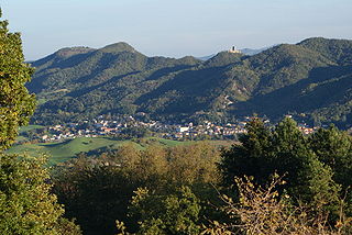
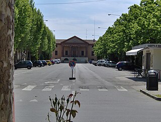
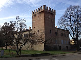
Castelnovo di Sotto (Reggiano: Castelnōv) is a comune (municipality) in the Province of Reggio Emilia in the Italian region Emilia-Romagna, located about 70 kilometres (43 mi) northwest of Bologna and about 14 kilometres (9 mi) northwest of Reggio Emilia.

<i>Comune</i> third-level administrative divisions of the Italian Republic

The comune is a basic administrative division in Italy, roughly equivalent to a township or municipality.

Province of Reggio Emilia Province of Italy

The Province of Reggio Emilia is one of the nine provinces of the Italian Region of Emilia-Romagna. The capital city, which is the most densely populated comune in the province, is Reggio Emilia.

Italy republic in Southern Europe

Italy, officially the Italian Republic, is a country in Southern and Western Europe. Located in the middle of the Mediterranean Sea, Italy shares open land borders with France, Switzerland, Austria, Slovenia and the enclaved microstates San Marino and Vatican City. Italy covers an area of 301,340 km2 (116,350 sq mi) and has a largely temperate seasonal and Mediterranean climate. With around 61 million inhabitants, it is the fourth-most populous EU member state and the most populous country in Southern Europe.

Castelnovo di Sotto borders the following municipalities: Boretto, Cadelbosco di Sopra, Campegine, Gattatico, Gualtieri, Poviglio.

Boretto Comune in Emilia-Romagna, Italy

Boretto is a comune (municipality) in the Province of Reggio Emilia in the Italian region Emilia-Romagna, located about 80 kilometres (50 mi) northwest of Bologna and about 25 kilometres (16 mi) northwest of Reggio Emilia. As of 31 December 2016, it had a population of 5,293 and an area of 19.2 square kilometres (7.4 sq mi).

Cadelbosco di Sopra Comune in Emilia-Romagna, Italy

Cadelbosco di Sopra is a town and comune in the province of Reggio Emilia in Emilia-Romagna, Italy.

Campegine Comune in Emilia-Romagna, Italy

Campegine is a comune (municipality) in the Province of Reggio Emilia in the Italian region Emilia-Romagna, located about 70 kilometres (43 mi) northwest of Bologna and about 12 kilometres (7 mi) northwest of Reggio Emilia.

It is home of one of the most ancient carnivals in Italy, dating from the 16th century.

Carnival festive season which occurs immediately before Lent

Carnival is a Western Christian and Greek Orthodox festive season that occurs before the liturgical season of Lent. The main events typically occur during February or early March, during the period historically known as Shrovetide. Carnival typically involves public celebrations, including events such as parades, public street parties and other entertainments, combining some elements of a circus. Elaborate costumes and masks allow people to set aside their everyday individuality and experience a heightened sense of social unity. Participants often indulge in excessive consumption of alcohol, meat, and other foods that will be forgone during upcoming Lent. Traditionally, butter, milk, and other animal products were not consumed "excessively", rather, their stock was fully consumed as to reduce waste. Pancakes, donuts, and other desserts were prepared and eaten for a final time. During Lent, animal products are no longer eaten, and individuals have the ability to give up a certain object or activity of desire.

Demographic evolution

Castelnovo di Sotto

Related Research Articles

Castelnovo ne Monti Comune in Emilia-Romagna, Italy

Castelnovo Monti is a town and comune in the province of Reggio Emilia, central Italy.

Bibbiano Comune in Emilia-Romagna, Italy

Bibbiano is a comune (municipality) in the Province of Reggio Emilia in the Italian region Emilia-Romagna, located about 70 kilometres (43 mi) northwest of Bologna and about 14 kilometres (9 mi) southwest of Reggio Emilia.

Carpineti Comune in Emilia-Romagna, Italy

Carpineti is a comune (municipality) in the Province of Reggio Emilia in the Italian region Emilia-Romagna, located about 70 kilometres (43 mi) west of Bologna and about 30 kilometres (19 mi) southwest of Reggio Emilia.

Casina Comune in Emilia-Romagna, Italy

Casina is a comune (municipality) in the Province of Reggio Emilia in the Italian region Emilia-Romagna, located about 70 kilometres west of Bologna and about 25 km (16 mi) southwest of Reggio Emilia.

Fabbrico Comune in Emilia-Romagna, Italy

Fabbrico is a comune (municipality) in the Province of Reggio Emilia in the Italian region Emilia-Romagna, located about 60 kilometres (37 mi) northwest of Bologna and about 25 kilometres (16 mi) northeast of Reggio Emilia.

Gattatico Comune in Emilia-Romagna, Italy

Gattatico is a comune (municipality) in the Province of Reggio Emilia in the Italian region Emilia-Romagna, located about 80 kilometres (50 mi) northwest of Bologna and about 15 kilometres (9 mi) northwest of Reggio Emilia.

Gualtieri Comune in Emilia-Romagna, Italy

Gualtieri is a comune (municipality) in the Province of Reggio Emilia in the Italian region Emilia-Romagna, located about 70 kilometres (43 mi) northwest of Bologna and about 25 kilometres (16 mi) north of Reggio Emilia on the right bank of the Po River. Historically, it suffered numerous floods, the last occurring in 1951.

Poviglio Comune in Emilia-Romagna, Italy

Poviglio is a comune (municipality) in the Province of Reggio Emilia in the Italian region Emilia-Romagna, located about 70 kilometres (43 mi) northwest of Bologna and about 20 kilometres (12 mi) northwest of Reggio Emilia.

Rio Saliceto Comune in Emilia-Romagna, Italy

Rio Saliceto is a comune (municipality) in the Province of Reggio Emilia in the Italian region Emilia-Romagna, located about 60 kilometres (37 mi) northwest of Bologna and about 20 kilometres (12 mi) northeast of Reggio Emilia.

Rolo, Emilia-Romagna Comune in Emilia-Romagna, Italy

Rolo is a comune (municipality) in the Province of Reggio Emilia in the Italian region Emilia-Romagna, located about 60 kilometres (37 mi) northwest of Bologna and about 25 kilometres (16 mi) northeast of Reggio Emilia.

San Martino in Rio Comune in Emilia-Romagna, Italy

San Martino in Rio is a comune (municipality) in the Province of Reggio Emilia in the Italian region Emilia-Romagna, located about 50 kilometres (31 mi) northwest of Bologna and about 12 kilometres (7 mi) northeast of Reggio Emilia.

SantIlario dEnza Comune in Emilia-Romagna, Italy

Sant'Ilario d'Enza is a comune (municipality) in the Province of Reggio Emilia in the Italian region Emilia-Romagna, located about 80 kilometres (50 mi) northwest of Bologna and about 15 kilometres (9 mi) northwest of Reggio Emilia.

Vetto Comune in Emilia-Romagna, Italy

Vetto is a comune (municipality) in the Province of Reggio Emilia in the Italian region Emilia-Romagna, located about 80 kilometres (50 mi) west of Bologna and about 35 kilometres (22 mi) southwest of Reggio Emilia.

Castelnovo del Friuli Comune in Friuli-Venezia Giulia, Italy

Castelnovo del Friuli is a comune (municipality) in the Province of Pordenone in the Italian region Friuli-Venezia Giulia, located about 90 kilometres (56 mi) northwest of Trieste and about 30 kilometres (19 mi) northeast of Pordenone.

Clauzetto Comune in Friuli-Venezia Giulia, Italy

Clauzetto is a comune (municipality) in the Province of Pordenone in the Italian region Friuli-Venezia Giulia, located about 100 kilometres (62 mi) northwest of Trieste and about 35 kilometres (22 mi) northeast of Pordenone.

Tramonti di Sotto Comune in Friuli-Venezia Giulia, Italy

Tramonti di Sotto is a comune (municipality) in the Province of Pordenone, in the Italian region of Friuli-Venezia Giulia. It is located about 110 kilometres (68 mi) northwest of Trieste and about 35 kilometres (22 mi) northeast of Pordenone. As of 31 December 2004, it had a population of 444 and an area of 84.6 square kilometres (32.7 sq mi).

Travesio Comune in Friuli-Venezia Giulia, Italy

Travesio is a comune (municipality) in the Province of Pordenone in the Italian region Friuli-Venezia Giulia, located about 100 kilometres (62 mi) northwest of Trieste and about 30 kilometres (19 mi) northeast of Pordenone. As of 31 December 2004, it had a population of 1,816 and an area of 28.8 square kilometres (11.1 sq mi).

Vito dAsio Comune in Friuli-Venezia Giulia, Italy

Vito d'Asio is a comune (municipality) in the Province of Pordenone in the Italian region Friuli-Venezia Giulia, located about 90 kilometres (56 mi) northwest of Trieste and about 35 kilometres (22 mi) northeast of Pordenone.

References

  1. All demographics and other statistics: Italian statistical institute Istat.