Vetto | |
---|---|
Comune | |
Comune di Vetto | |
Coordinates: 44°29′N10°20′E / 44.483°N 10.333°E Coordinates: 44°29′N10°20′E / 44.483°N 10.333°E | |
Country | Italy |
Region | Emilia-Romagna |
Province | Reggio Emilia (RE) |
Frazioni | Atticola, Brolo, Buvolo, Caiolla, Cantoniera, Casalecchio, Casella, Casone, Castellaro, Castellina, Cesola, Cola, Costa, Costaborga, Crovara, Ferma, Gottano Sopra, Gottano Sotto, Groppo, Legoreccio, Mavore, Maiola, Moziollo, Piagnolo, Pineto, Predella, Rodogno, Roncolo, Rosano, Scalucchia, Sole Sopra, Sole Sotto, Spigone, Strada, Teggia, Tizzolo, Vidiceto |
Government | |
• Mayor | Fabio Ruffini |
Area | |
• Total | 53.37 km2 (20.61 sq mi) |
Elevation | 447 m (1,467 ft) |
Population (31 December 2017) [1] | |
• Total | 1,852 |
• Density | 35/km2 (90/sq mi) |
Demonym(s) | Vettesi |
Time zone | CET (UTC+1) |
• Summer (DST) | CEST (UTC+2) |
Postal code | 42020 |
Dialing code | 0522 |
Patron saint | St. Lawrence |
Saint day | 10 August |
Website | Official website |
Vetto (Reggiano: Vèt) is a comune (municipality) in the Province of Reggio Emilia in the Italian region Emilia-Romagna, located about 80 kilometres (50 mi) west of Bologna and about 35 kilometres (22 mi) southwest of Reggio Emilia.
The comune is a basic administrative division in Italy, roughly equivalent to a township or municipality.
The Province of Reggio Emilia is one of the nine provinces of the Italian Region of Emilia-Romagna. The capital city, which is the most densely populated comune in the province, is Reggio Emilia.
Italy, officially the Italian Republic, is a country in Southern Europe. Located in the middle of the Mediterranean Sea, Italy shares open land borders with France, Switzerland, Austria, Slovenia and the enclaved microstates San Marino and Vatican City. Italy covers an area of 301,340 km2 (116,350 sq mi) and has a largely temperate seasonal and Mediterranean climate. With around 61 million inhabitants, it is the fourth-most populous EU member state and the most populous country in Southern Europe.
Vetto borders the following municipalities: Castelnovo ne' Monti, Canossa, Neviano degli Arduini, Palanzano, Ventasso.
Castelnovo Monti is a town and comune in the province of Reggio Emilia, central Italy.
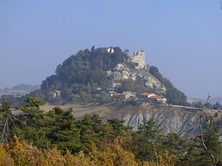
Canossa is a comune and castle town in the Province of Reggio Emilia, Emilia-Romagna, northern Italy. It is the site where Holy Roman Emperor Henry IV did penance in 1077, standing three days bare-headed in the snow, in order to reverse his excommunication by Pope Gregory VII. The Walk to Canossa is sometimes used as a symbol of the changing relationship between the medieval Church and State.
Neviano degli Arduini is a comune (municipality) in the Province of Parma in the Italian region Emilia-Romagna, located about 80 kilometres (50 mi) west of Bologna and about 25 kilometres (16 mi) south of Parma.
Palanzano is a comune (municipality) in the Province of Parma in the Italian region Emilia-Romagna, located about 90 kilometres (56 mi) west of Bologna and about 40 kilometres (25 mi) south of Parma. Palanzano borders the following municipalities: Corniglio, Monchio delle Corti, Neviano degli Arduini, Tizzano Val Parma, Ventasso, Vetto.
Baiso is a comune (municipality) in the Province of Reggio Emilia in the Italian region Emilia-Romagna, located about 60 kilometres (37 mi) west of Bologna and about 20 kilometres (12 mi) south of Reggio Emilia.
Bibbiano is a comune (municipality) in the Province of Reggio Emilia in the Italian region Emilia-Romagna, located about 70 kilometres (43 mi) northwest of Bologna and about 14 kilometres (9 mi) southwest of Reggio Emilia.
Boretto is a comune (municipality) in the Province of Reggio Emilia in the Italian region Emilia-Romagna, located about 80 kilometres (50 mi) northwest of Bologna and about 25 kilometres (16 mi) northwest of Reggio Emilia. As of 31 December 2016, it had a population of 5,293 and an area of 19.2 square kilometres (7.4 sq mi).
Campagnola Emilia is a comune (municipality) in the Province of Reggio Emilia in the Italian region Emilia-Romagna, located about 60 kilometres (37 mi) northwest of Bologna and about 20 kilometres (12 mi) northeast of Reggio Emilia.
Campegine is a comune (municipality) in the Province of Reggio Emilia in the Italian region Emilia-Romagna, located about 70 kilometres (43 mi) northwest of Bologna and about 12 kilometres (7 mi) northwest of Reggio Emilia.
Casalgrande is a comune (municipality) in the Province of Reggio Emilia in the Italian region Emilia-Romagna, located about 50 kilometres (31 mi) west of Bologna and about 15 kilometres (9 mi) southeast of Reggio Emilia. As of 8 January 2017, it had a population of 19,215 and an area of 37.7 square kilometres (14.6 sq mi).
Castellarano is a comune (municipality) in the Province of Reggio Emilia in the Italian region Emilia-Romagna, located about 45 kilometres (28 mi) west of Bologna and about 20 kilometres (12 mi) southeast of Reggio Emilia.
Castelnovo di Sotto is a comune (municipality) in the Province of Reggio Emilia in the Italian region Emilia-Romagna, located about 70 kilometres (43 mi) northwest of Bologna and about 14 kilometres (9 mi) northwest of Reggio Emilia.
Cavriago is a comune (municipality) in the Province of Reggio Emilia in the Italian region Emilia-Romagna, located about 70 kilometres northwest of Bologna and about 8 km (5 mi) west of Reggio Emilia.
Fabbrico is a comune (municipality) in the Province of Reggio Emilia in the Italian region Emilia-Romagna, located about 60 kilometres (37 mi) northwest of Bologna and about 25 kilometres (16 mi) northeast of Reggio Emilia.
Gattatico is a comune (municipality) in the Province of Reggio Emilia in the Italian region Emilia-Romagna, located about 80 kilometres (50 mi) northwest of Bologna and about 15 kilometres (9 mi) northwest of Reggio Emilia.
Poviglio is a comune (municipality) in the Province of Reggio Emilia in the Italian region Emilia-Romagna, located about 70 kilometres (43 mi) northwest of Bologna and about 20 kilometres (12 mi) northwest of Reggio Emilia.
Quattro Castella is a comune (municipality) in the Province of Reggio Emilia in the Italian region Emilia-Romagna, located about 70 kilometres (43 mi) west of Bologna and about 15 kilometres (9 mi) southwest of Reggio Emilia.
Rio Saliceto is a comune (municipality) in the Province of Reggio Emilia in the Italian region Emilia-Romagna, located about 60 kilometres (37 mi) northwest of Bologna and about 20 kilometres (12 mi) northeast of Reggio Emilia.
Rolo is a comune (municipality) in the Province of Reggio Emilia in the Italian region Emilia-Romagna, located about 60 kilometres (37 mi) northwest of Bologna and about 25 kilometres (16 mi) northeast of Reggio Emilia.
San Martino in Rio is a comune (municipality) in the Province of Reggio Emilia in the Italian region Emilia-Romagna, located about 50 kilometres (31 mi) northwest of Bologna and about 12 kilometres (7 mi) northeast of Reggio Emilia.
Sant'Ilario d'Enza is a comune (municipality) in the Province of Reggio Emilia in the Italian region Emilia-Romagna, located about 80 kilometres (50 mi) northwest of Bologna and about 15 kilometres (9 mi) northwest of Reggio Emilia.
Toano is a comune (municipality) in the Province of Reggio Emilia in the Italian region Emilia-Romagna, located about 60 kilometres (37 mi) west of Bologna and about 35 kilometres (22 mi) south of Reggio Emilia.
Vezzano sul Crostolo is a comune (municipality) in the Province of Reggio Emilia in the Italian region Emilia-Romagna, located about 60 kilometres (37 mi) west of Bologna and about 13 kilometres (8 mi) southwest of Reggio Emilia.
This article on a location in Emilia–Romagna is a stub. You can help Wikipedia by expanding it. |