
Baiso is a comune (municipality) in the Province of Reggio Emilia in the Italian region Emilia-Romagna, located about 60 kilometres (37 mi) west of Bologna and about 20 kilometres (12 mi) south of Reggio Emilia.

Bibbiano is a comune (municipality) in the Province of Reggio Emilia in the Italian region Emilia-Romagna, located about 70 kilometres (43 mi) northwest of Bologna and about 14 kilometres (9 mi) southwest of Reggio Emilia.

Campegine is a comune (municipality) in the Province of Reggio Emilia in the Italian region Emilia-Romagna, located about 70 kilometres (43 mi) northwest of Bologna and about 12 kilometres (7 mi) northwest of Reggio Emilia.
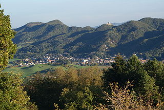
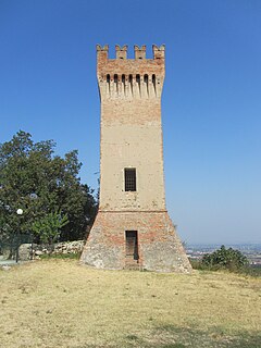
Carpineti is a comune (municipality) in the Province of Reggio Emilia in the Italian region Emilia-Romagna, located about 70 kilometres (43 mi) west of Bologna and about 30 kilometres (19 mi) southwest of Reggio Emilia.
Casalgrande is a comune (municipality) in the Province of Reggio Emilia in the Italian region Emilia-Romagna, located about 50 kilometres (31 mi) west of Bologna and about 15 kilometres (9 mi) southeast of Reggio Emilia. As of 8 January 2017, it had a population of 19,215 and an area of 37.7 square kilometres (14.6 sq mi).
Casina is a comune (municipality) in the Province of Reggio Emilia in the Italian region Emilia-Romagna, located about 70 kilometres west of Bologna and about 25 km (16 mi) southwest of Reggio Emilia.

Castellarano is a comune (municipality) in the Province of Reggio Emilia in the Italian region Emilia-Romagna, located about 45 kilometres (28 mi) west of Bologna and about 20 kilometres (12 mi) southeast of Reggio Emilia.
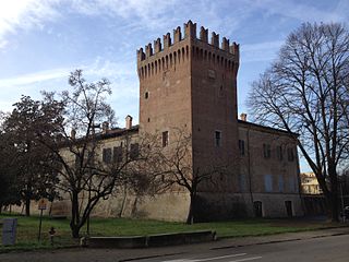
Castelnovo di Sotto is a comune (municipality) in the Province of Reggio Emilia in the Italian region Emilia-Romagna, located about 70 kilometres (43 mi) northwest of Bologna and about 14 kilometres (9 mi) northwest of Reggio Emilia.

Cavriago is a comune (municipality) in the Province of Reggio Emilia in the Italian region Emilia-Romagna, located about 70 kilometres northwest of Bologna and about 8 km (5 mi) west of Reggio Emilia.

Fabbrico is a comune (municipality) in the Province of Reggio Emilia in the Italian region Emilia-Romagna, located about 60 kilometres (37 mi) northwest of Bologna and about 25 kilometres (16 mi) northeast of Reggio Emilia.

Gattatico is a comune (municipality) in the Province of Reggio Emilia in the Italian region Emilia-Romagna, located about 80 kilometres (50 mi) northwest of Bologna and about 15 kilometres (9 mi) northwest of Reggio Emilia.

Poviglio is a comune (municipality) in the Province of Reggio Emilia in the Italian region Emilia-Romagna, located about 70 kilometres (43 mi) northwest of Bologna and about 20 kilometres (12 mi) northwest of Reggio Emilia.
Rio Saliceto is a comune (municipality) in the Province of Reggio Emilia in the Italian region Emilia-Romagna, located about 60 kilometres (37 mi) northwest of Bologna and about 20 kilometres (12 mi) northeast of Reggio Emilia.
Rolo is a comune (municipality) in the Province of Reggio Emilia in the Italian region Emilia-Romagna, located about 60 kilometres (37 mi) northwest of Bologna and about 25 kilometres (16 mi) northeast of Reggio Emilia.
San Martino in Rio is a comune (municipality) in the Province of Reggio Emilia in the Italian region Emilia-Romagna, located about 50 kilometres (31 mi) northwest of Bologna and about 12 kilometres (7 mi) northeast of Reggio Emilia.
Sant'Ilario d'Enza is a comune (municipality) in the Province of Reggio Emilia in the Italian region Emilia-Romagna, located about 80 kilometres (50 mi) northwest of Bologna and about 15 kilometres (9 mi) northwest of Reggio Emilia.
Toano is a comune (municipality) in the Province of Reggio Emilia in the Italian region Emilia-Romagna, located about 60 kilometres (37 mi) west of Bologna and about 35 kilometres (22 mi) south of Reggio Emilia.
Vetto is a comune (municipality) in the Province of Reggio Emilia in the Italian region Emilia-Romagna, located about 80 kilometres (50 mi) west of Bologna and about 35 kilometres (22 mi) southwest of Reggio Emilia.

Vezzano sul Crostolo is a comune (municipality) in the Province of Reggio Emilia in the Italian region Emilia-Romagna, located about 60 kilometres (37 mi) west of Bologna and about 13 kilometres (8 mi) southwest of Reggio Emilia.

Villa Collemandina is a comune (municipality) in the Province of Lucca in the Italian region Tuscany, located about 80 kilometres (50 mi) northwest of Florence and about 35 kilometres (22 mi) north of Lucca.


