Center Township, Starke County, Indiana

Last updated

Center Township
Map highlighting Center Township, Starke County, Indiana.svg
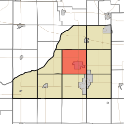
Location in Starke County
Coordinates: 41°18′11″N86°38′20″W / 41.30306°N 86.63889°W / 41.30306; -86.63889
Country Flag of the United States (23px).png  United States
State Flag of Indiana.svg  Indiana
County Starke
Government
  Type Indiana township
Area
  Total
36.34 sq mi (94.1 km2)
  Land36.34 sq mi (94.1 km2)
  Water0 sq mi (0 km2)  0%
Elevation
[1]
696 ft (212 m)
Population
 (2020) [2]
  Total
6,131
  Density171.4/sq mi (66.2/km2)
Time zone UTC-6 (Central (CST))
  Summer (DST) UTC-5 (CDT)
ZIP code
46534
Area code 574
GNIS feature ID 453193

Center Township is one of nine townships in Starke County, in the U.S. state of Indiana. [3] As of the 2020 census, its population was 6,131 (down from 6,229 at 2010 [4] ) and it contained 2,371 housing units.

Contents

Geography

According to the 2010 census, the township has a total area of 36.34 square miles (94.1 km2), all land. [4]

Cities, towns, villages

Unincorporated towns

(This list is based on USGS data and may include former settlements.)

Adjacent townships

Cemeteries

The township contains these three cemeteries: Crown Hill, Oak Grove and Oak Park.

Major highways

Airports and landing strips

Landmarks

School districts

Political districts

References

  1. "US Board on Geographic Names". United States Geological Survey. October 25, 2007. Retrieved May 9, 2017.
  2. "Census Bureau profile: Center Township, Starke County, Indiana". United States Census Bureau. May 2023. Retrieved April 4, 2024.
  3. "Center Township". Geographic Names Information System . United States Geological Survey, United States Department of the Interior . Retrieved July 5, 2009.
  4. 1 2 "Population, Housing Units, Area, and Density: 2010 - County -- County Subdivision and Place -- 2010 Census Summary File 1". United States Census. Archived from the original on February 12, 2020. Retrieved May 10, 2013.