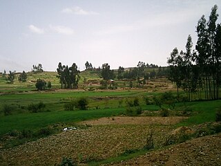
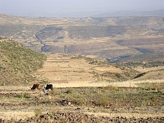
Chalacot is mentioned in a charter written in 1794, when Emperor Tekle Giyorgis made a grant to Meqdese Selassie Church in the village; the document mentions seven properties.[6]RasWolde Selassie made Chalacot his capital, and received Henry Salt there in 1810. The Ras built a palace in the village, as well as houses for his wives and the church Chelekot Selassie, which Philips Briggs described as an "architecturally impressive example of the circular tikul styles of paintings" and "covered in beautiful 19th-century paintings".[7] When Wolde Selassie died in Chalacot (1816), his nephew Walda Rufa'el sacked it.[8]
The town had recovered its former prosperity by the 1840s when Ferret and Galiner visited it; they described it as "one of the principal towns" of Ethiopia, with a population of 3,000 living in well-constructed houses and well-kept gardens.[9] However, a little more than a generation later Chalacot had declined; Guglielmo Massaia found only 200 houses with about 1,000 inhabitants and in the 1880s Augustus B. Wylde reported he counted only 80 houses there. The town suffered further losses during the First Italo–Ethiopian War according to Richard Pankhurst, who included Chalacot in a list of northern Ethiopian towns affected by the "disturbed conditions of the times."[10]
Chelekot is the birthplace of Ras Araya Dimtsu, the chief crown councillor to Emperor Yohannes IV of Ethiopia from 1867 to 1889. Ras Araya held significant influence as the governor of Tigray and Akale Guzay. He lost his life at the Battle of Metema in March 1889 while fighting against the Mahdists of Sudan, alongside Emperor Yohannes. Notably, Ras Araya was Emperor Yohannes's maternal uncle. Another noteworthy figure from Chelekot is Emperor Yohannes's mother, Amate Silas Dimtsu, who was born there. Her father, Dejazmach Dimtsu Debbab of Enderta, served as a hereditary chief of Enderta in the 1820s and 1830s.
Chelekot also serves as the burial place of Empress Tiruwork Wube, the granddaughter of Ras Wolde Selassie and the widow of Emperor Tewodros II. During his journey to the Battle of Adwa, Emperor Menelik II visited the churches in Chelekot. As a gesture of gratitude for his victory over the Italians, he bestowed his robes of state upon the Church of the Holy Trinity (Mekdese Selassie), where they are still prominently displayed.
↑ Bosellini, A.; Russo, A.; Fantozzi, P.; Assefa, G.; Tadesse, S. (1997). "The Mesozoic succession of the Mekelle Outlier (Tigrai Province, Ethiopia)". Mem. Sci. Geol. 49: 95–116.
↑ Tefera, M.; Chernet, T.; Haro, W. Geological Map of Ethiopia (1:2,000,000). Addis Ababa, Ethiopia: Ethiopian Institute of Geological Survey.
↑ Moeyersons, J. and colleagues (2006). "Age and backfill/overfill stratigraphy of two tufa dams, Tigray Highlands, Ethiopia: Evidence for Late Pleistocene and Holocene wet conditions". Palaeogeography, Palaeoclimatology, Palaeoecology. 230 (1–2): 162–178. doi:10.1016/j.palaeo.2005.07.013.
↑ Philip Briggs, Ethiopia: the Bradt Travel Guide, third edition (London: Bradt, 2002), p. 269
↑ Richard K.P. Pankhurst, History of Ethiopian Towns: From the Middle Ages to the Early Nineteenth Century (Wiesbaden: Franz Steiner Verlag, 1982), vol. 1 pp. 207f
↑ Richard Pankhurst, Economic History of Ethiopia (Addis Ababa: Haile Sellasie I University, 1968), pp. 691f
Related Research Articles
Atsbi is a town in Tigray, Ethiopia. Located in the Misraqawi (Eastern) Zone of the Tigray Region, about 50 kilometers northeast of Qwiha, this town has a latitude and longitude of 13°52′N39°44′E with an elevation of 2630 meters above sea level. It is the administrative center of Atsbi Wenberta woreda.
Enderta or Inderta is a former historical province of Ethiopia; it is located in the eastern edge of the Tigray highlands. Enderta is bordered on the west by Tembien, on the south and southwest by Lasta and Wag, on the east by denkel, and on the north by Agame and Adwa. Mekelle was formerly the capital of the province. Enderta's local administration of Denkel/Afar up to the edges of Aseb under its jurisdiction seems to have been highly, interlinked with the operation of the salt trade and its taxation system; the entire tasks of salt caravan organization being the responsibility of the bäalgada, title assumed by the governor of Endärta, since at least the Medieval period.
Dergajen was a woreda in Enderta Province, in Tigray Region, Ethiopia. Its administrative center was Kwiha; now is a tabia (municipality) located 19 kilometers east of Kwiha, Ethiopia. The administrative center of the tabia is located in the village of Aragure. A weekly market is organized in Aragure. According to the 2007 census, 9524 people were living in the tabia, which results in a population density of 68 inhabitants per square kilometer.
Mika’el Abiy is a tabia or municipality in the Dogu’a Tembien district of the Tigray Region of Ethiopia. The tabia centre is in Megesta village, located approximately 7 km to the southeast of the woreda town Hagere Selam.
Melfa is a tabiya or municipality in the Dogu'a Tembien district of the Tigray Region of Ethiopia and ancient capital of Tembien. The tabia centre is Melfa village itself, located approximately 3 km to the west of the woreda town Hagere Selam.
Amanit is a tabia or municipality in the Dogu'a Tembien district of the Tigray Region of Ethiopia. The tabia centre is Addi Qeshofo village, located approximately 15 km to the southeast of the woreda town Hagere Selam.
Debre Nazret is a tabia or municipality in the Inderta district of the Tigray Region of Ethiopia. It belonged to Dogu'a Tembien up to January 2020. The tabia centre is in Togogwa town, located approximately 19 km to the east-southeast of Hagere Selam and 25 km to the west of Mekelle.
Addilal is a tabia or municipality in the Dogu'a Tembien district of the Tigray Region of Ethiopia. The tabia centre is in Addilal village, located approximately 19 km (12 mi) to the east of the woreda town Hagere Selam.
Aregen is a tabia or municipality in the Dogu'a Tembien district of the Tigray Region of Ethiopia. The tabia centre is in Addi Gotet village, located approximately 11 km (6.8 mi) to the west-southwest of the woreda town Hagere Selam.
Menachek is a tabia or municipality in the Tanqua Millash district of the Tigray Region of Ethiopia. The tabia centre is in Addi Bayro village. Until January 2020 it belonged to the Dogu'a Tembien district.
Inda Sillasie is a tabia or municipality in the Dogu'a Tembien district of the Tigray Region of Ethiopia. The tabia centre is in Migichi village, located approximately 13 km to the south-southeast of the woreda town Hagere Selam.
Simret is a municipality in the Tanqua Millash district of the Tigray Region, Ethiopia, which comprises the longest cave of Tigray in Zeyi, as well as Ras Alula’s birthplace in Mennewe. The municipality centre is in Dengolo village. Until January 2020, Simret belonged to the Dogu'a Tembien district.
Selam is a tabia or municipality in the Dogu'a Tembien district of the Tigray Region of Ethiopia. The tabia centre is in Addi Werho village, located approximately 3 km to the northeast of the woreda town Hagere Selam.
Lim’at is a tabia in the Dogu'a Tembien district of the Tigray Region of Ethiopia. The tabia centre is in Maygwa village, located approximately 8 km to the southwest of the woreda town Hagere Selam.
Ayninbirkekin is a tabia or municipality in the Dogu'a Tembien district of the Tigray Region of Ethiopia. Literal meaning of Ayninbirkekin in Tigrinya is "We will not bend". The tabia centre is in Halah village, located approximately 8 km to the east of the woreda town Hagere Selam. Main town is Ala'isa, situated on the ridge overseeing the Giba valley.
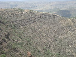
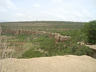
The soils of the Kilte Awula’ilo woreda (district) in Tigray, Ethiopia reflect its longstanding agricultural history, highly seasonal rainfall regime, relatively low temperatures, the presence of a wide depression at the foot of the Atsbi horst and steep slopes. Outstanding features in the soilscape are the wide ancient fluvial deposits, the soils of the granite batholith, cuestas and fertile lands behind tufa dams.
The soils of the Atsbi Wenberta woreda (district) in Tigray (Ethiopia) reflect its longstanding agricultural history, highly seasonal rainfall regime and relatively low temperatures. The northern part of the district is on the high uplifted Atsbi Horst, whereas the southern part is dominated by the Des’a forest on Antalo Limestone. In between there is the fluvial landscape of Hayqi Meshal. Particularities in the southern part of the district are soil catenas on intervening plains behind tufa dams and in a polje.
The soils of the Inderta woreda (district) in Tigray (Ethiopia) reflect its longstanding agricultural history, highly seasonal rainfall regime, relatively low temperatures, overall dominance of limestone and dolerite lithologies and steep slopes. Outstanding features in the soilscape are wide plains with Vertisols.
The soils of the Tanqwa Abergele woreda (district) in Tigray (Ethiopia) reflect its longstanding agricultural history, highly seasonal rainfall regime, relatively high temperatures, overall dominance of Precambrian metamorphic rocks and steep slopes.
The soils of the Dogu’a Tembien woreda (district) in Tigray (Ethiopia) reflect its longstanding agricultural history, highly seasonal rainfall regime, relatively low temperatures, an extremely great variety in lithology and steep slopes. Outstanding features in the soilscape are the fertile highland Vertisols and Phaeozems in forests.
This page is based on this Wikipedia article Text is available under the CC BY-SA 4.0 license; additional terms may apply. Images, videos and audio are available under their respective licenses.