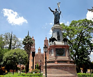
Dolores Hidalgo is the name of a city and the surrounding municipality in the north-central part of the Mexican state of Guanajuato.
Escuinapa de Hidalgo is a city in Escuinapa Municipality of the same name, located at the extreme southern end of the Mexican state of Sinaloa. Its geographical coordinates are 22°28′0″N105°26′17″W. At the census of 2005 the city had a population of 28,789 inhabitants, while the municipality reported 49,655 inhabitants. According to the Mexican Government, Escuinapa will have near 500,000 inhabitants in 2025 for the mega touristic center that are building near the town, and will be finished in 2025; with this information we can know Escuinapa de Hidalgo will be the second or third city more important in Sinaloa, also will be between the second and fourth place according population by municipality, maybe over Ahome and behind Mazatlán. The municipality has an area of 1633.22 km² and includes the towns of Isla del Bosque and Teacapan, in addition to many smaller localities.

Tarandacuao is a Mexican city located in the lowlands of the state of Guanajuato. The municipality has an area of 117.39 square kilometres, and is bordered to the north and east by Jerécuaro, to the south by the state of Michoacán, and to the west by Acámbaro. The municipality had 11,583 inhabitants according to the 2005 census. Outlying communities found in Tarandacuao include La Purísima, San Juan De Dios, San José de Hidalgo, San Antonio, El Tocuz, San felipe and La Virgen.
Chocamán is a settlement in Veracruz, Mexico. It is located about 146 km south of the Veracruz state capital Xalapa. It has an area of 41.13 km2. It is located at 19°01′N97°02′W.
Coxquihui is a municipality in Veracruz, Mexico. It is located in montane central zone of the state, about 95 km from state capital Xalapa. It has a surface of 86.37 km2. It is located at 20°11′N97°35′W.
Zozocolco de Hidalgo is a municipality located in northwest

Acatzingo Municipality is a municipality in Puebla in south-eastern Mexico.

Cuetzalan del Progreso Municipality is a municipality in Puebla in south-eastern Mexico.

Chichiquila Municipality is a municipality in Puebla in south-eastern Mexico.
Hueytlalpan (municipality) is a town and municipality in Puebla in south-eastern Mexico.
Atlequizayan (municipality) is a town and municipality in Puebla in south-eastern Mexico.
Jonotla Municipality is a municipality in Puebla in south-eastern Mexico.
Nauzontla (municipality) is a town and municipality in Puebla in south-eastern Mexico.
Tepatlaxco de Hidalgo (municipality) is a town and municipality in Puebla in south-eastern Mexico.
Tepexi de Rodríguez (municipality) is a town and municipality in Puebla in south-eastern Mexico.
Tzicatlacoyan (municipality) is a town and municipality in Puebla in south-eastern Mexico.

Tlaxiaco District is located in the south of the Mixteca Region of the State of Oaxaca, Mexico. The main city is the Heroic City of Tlaxiaco
Atatláhuca–San Miguel Mixtec is a diverse Mixtec language of Oaxaca.

El Chico National Park is a protected area in the State of Hidalgo, Mexico. It is one of the oldest protected areas in Mexico, as its foundation dates to 1898 when the then president of the republic, General Porfirio Díaz, by decree, created "Monte Vedado del Mineral del Chico". Since this date, the ancient conifer forests have been protected from the deforestation suffered in other parts of the country. Another decree followed in 1915 and still another by Presidential Agreement on 13 September 1922, which declared Monte Vedado to be cataloged as a forest reservation.

XHÑUC-FM is a community radio station on 88.1 FM in Chalcatongo de Hidalgo, Oaxaca, Mexico. It is known as La Favorita and owned by the civil association Ñucuaha, A.C.
